

Orlando weather: Warm temps and sunshine before weekend rain
Orlando Weather Forecast: 80s and rain chances this weekend
FOX 35 Storm Team Senior Meteorologist Noah Bergren is tracking showers and storms for early next week into central Florida.
ORLANDO, Fla. - Mostly clear skies are expected through the evening, with overnight temperatures dipping into the mid-50s, warmer than recent nights.
Cloud cover will increase Wednesday and Thursday as a weak front moves across the Florida Peninsula.

A few brief sprinkles or light showers are possible Wednesday afternoon, though no significant rainfall is expected.

Looking Ahead:
Sunny and warmer conditions return Friday and Saturday, with highs near 80 degrees Friday and in the low 80s Saturday. Both days are forecast to remain dry. Gusty winds and temperatures in the low to mid-80s are expected Sunday ahead of another approaching cold front across central Florida.
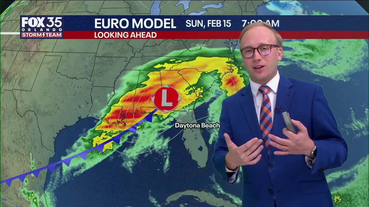
Forecast confidence remains limited on whether rain could affect Sunday’s Daytona 500. Weather models are split on timing, with most suggesting rain holds off until after the race. Some guidance, including the GFS model, delays showers until after midnight Monday.
Rainy Daytona 500 weekend?
A cold front will pass across Florida late next weekend. This front will come with some rain showers for central Florida, and maybe some thunderstorms in Georgia and the Florida Panhandle. It has rained two years in a row on race day, and odds are in our favor we should catch a break this year.
It has never rained to the point of impacting the race three years in a row, and we are hoping this will not be the first time that happens.
Models vary, but the consensus is for any rain shower potential to arrive after the race is done. Some models, like the American, GFS model bring in rain showers after midnihgt on Sunday and into Monday — which means the Raceday is a great day.
The forecast timing of shower arrival is tricky because the weather system that will cause this is still out over the Pacific Ocean, and is a long way away from Florida. Confidence will continue to increase as we get closer in when any rain showers will arrive.
Key historical examples of rain impacts:
- 1965 and 1966 — Both races were shortened by rain (the only back-to-back shortened Daytona 500s). 1965 ended after 133 laps; 1966 after 198 laps. This is the longest streak of direct rain shortening, but only two years.
- 2003 and 2009 — Both were rain-shortened (2003 to 109 laps; 2009 to 152 laps), but not consecutive.
- 2012 — First-ever postponement to Monday due to rain.
- 2020 — Started on Sunday but postponed to Monday due to rain.
- 2021 — Major rain delay (over 5 hours), finished after midnight.
- 2024 — Postponed to Monday due to steady rain.
- 2025 — Significant rain delay after just ~11-20 laps (long red flag).

Another cold front on the way
A cold front is set to move into the Sunshine State, but exactly when and how strong it will be is still uncertain.
Since we're still nearly a week away, there are many details that have yet to come into focus.
Timing is one of the most important factors, and it's too soon to say whether rain will impact the race.
Regardless, it looks to be a windy and warm day with gusts of 30 mph+ and temperatures climbing into the upper 70s and low 80s.
Stay tuned over the coming days as we're able to analyze more and better data to fine-tune the forecast details.
The Source: This story was written with information from the FOX 35 Storm Team.