

Orlando weather: Tracking afternoon showers, thunderstorms
Strong thunderstorms are moving across Central Florida, prompting severe thunderstorm warnings.
Severe thunderstorm warnings are issued when
Live weather radar: Track Orlando storms

Heat advisories issued as heat index soars into triple digits
What to expect:
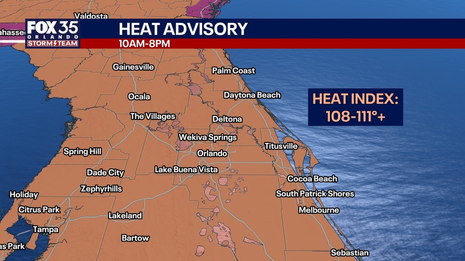
A Heat Advisory is in effect for nearly all of Central Florida today from 10 a.m. to 8 p.m., Aug. 14. This is due to heat indices (feels-like temperatures) that will be soaring to a range of around 108-111°+ once we factor in elevated humidity levels.
Actual air temperatures will still be above normal as afternoon highs reach the mid 90s.
Meteorologist Tip: If you have to spend extended time outdoors, especially doing physical activity between the hours of 11 a.m. to 4 p.m. make sure you take lots of breaks and drink water. It's important to listen to your body too and watch out for light-headedness or nausea as it can be a sign of heat exhaustion.
Rain forecast: Scattered showers and thunderstorms this afternoon
Timeline:
Scattered downpours and storms will return this afternoon. Plan for a 50% chance of downpours and storms this afternoon, mainly between the hours of 2 p.m. to 8 p.m.
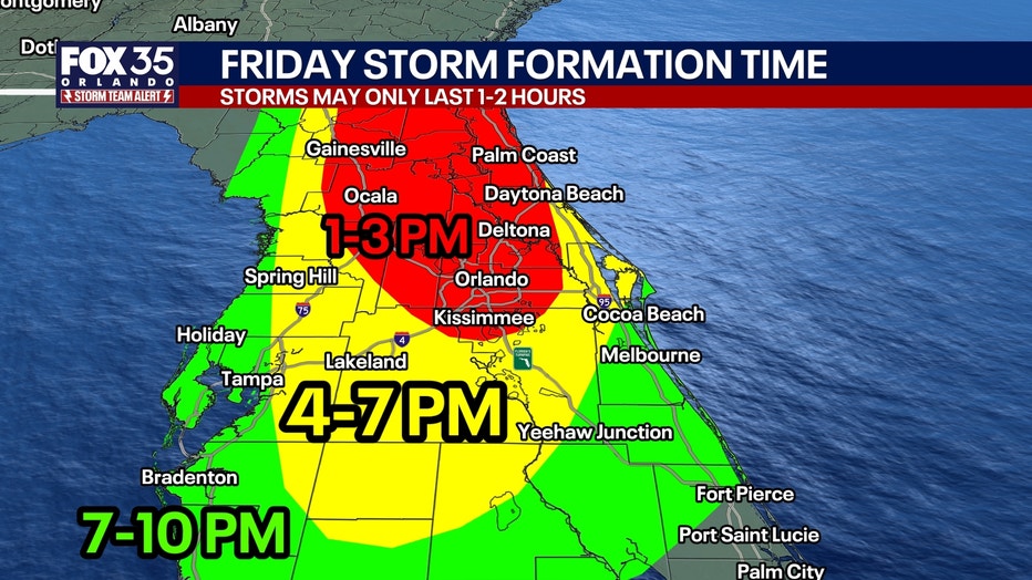
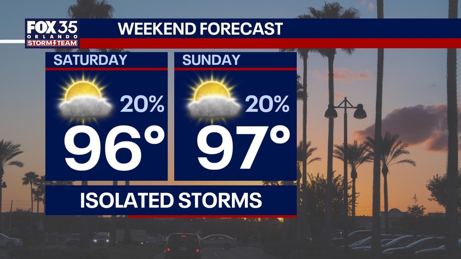
This will be a more typical set-up for this time of year too, with the sea-breeze helping enhance storms inland. A few isolated strong storms will be possible, with heavy rain, gusty winds, and frequent lightning possible. This weekend will feature slightly lower storm chances at 20%, which is much more isolated.
Weekend heat stretches into next week
Our stretch of above-average highs will persist for what looks to be the next several days. Highs will be cranking up well into the mid 90s through the weekend and into next week. Some spots next week could approach the upper 90s. Once we factor in our humidity levels, it will feel closer to the low 100s. Stay cool and hydrated, and listen to your body for when you need to take breaks!
Tracking the Tropics
There are two areas of potential tropical development in the Atlantic.
INVEST 92L - Southern Atlantic: There's an 30% chance of development over the next two days and over the next seven days for an area of low pressure that's formed across the southern Atlantic. This is lower than previous days because the system has encountered drier air and wind shear, and will continue to do so in the coming days. So the chances of Tropical Storm Dolly forming from this particular system are becoming less likely as it moves towards the Caribbean.
INVEST 94L - Eastern Atlantic: A vigorous tropical wave has rolled off the western coast of Africa and into the far eastern Atlantic forming an area of low pressure. Development chances are at 30% chance over the next two days and a 50% chance of development over the next seven days. This system could move into a better environment next week, with data hinting at further development into next week. The next name on the list is Dolly. We'll be watching it.
The Source: Information in this story was gathered from FOX 35's Jessica Dobson.