

Orlando weather: Rain forecast, rainfall estimates, flooding concerns
Orlando Weather Forecast: Tracking showers and heavy rain Wednesday
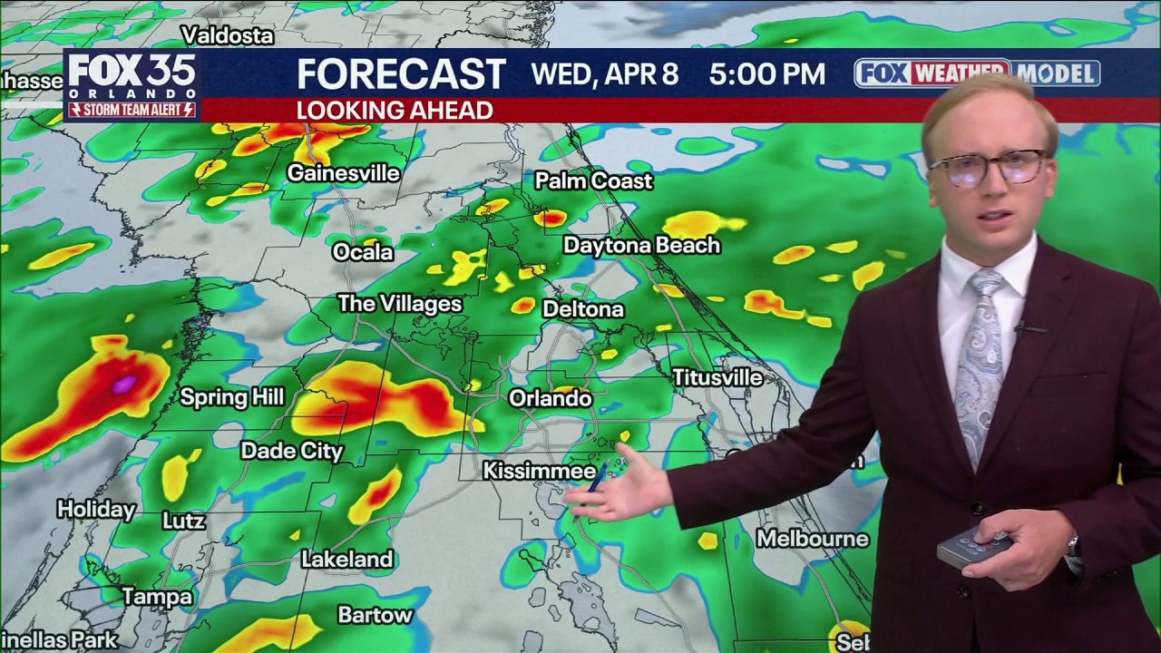
More rain is expected for Central Florida this week. FOX 35 Storm Team Senior Meteorologist Noah Bergren takes a look at the forecast.
ORLANDO, Fla. - Steady rain and a few thunderstorms will be possible throughout today.
There will be brief periods of dry time, but the best chances of the heaviest rain looks to take place starting late morning, lasting through midday and into the early afternoon.
Data suggests there will be a bit of a break in the action or a lull as we head into this evening. Before today is all said and done, areas could pick up an additional 2-4" of rain.
Flood Watch issued for Florida's coastal cities
A flood watch has been issued for parts of Brevard County, Indian River, Martin, Saint Lucie, and Volusia counties due to the potential for flooding in rivers, creeks, streams, and low-lying areas due to rain runoff.
Between 1-3" of rain is possible through Wednesday night, forecasters said. Some local areas could see rain totals up to 7" due to slow-moving bands of rain.

Wind advisory: Gusts up to 50 mph tonight
A wind advisory has been issued until 8 a.m on Wednesday for Orlando and the surrounding areas. Sustained winds are expected to be between 15–25 mph with gusts up to 50 mph.
Those winds are strong enough to blow around unsecured objects. Forecasters said the winds could cause some tree limbs to break and could result in some power outages.
The strongest winds will be along the Atlantic coast.

High Surf Advisory
In place from 5 p.m. Tuesday until 8 p.m. Thursday for Brevard, Volusia, and Flagler counties. As onshore winds increase, dangerously rough surf is likely. Large breaking waves will be as high as 8–12 feet.
There's a high risk of strong rip currents as well. Entering the water is strongly discouraged, even for strong swimmers. The rough surf may also lead to areas of minor beach and dune erosion.

How much rain could we see this week?
According to forecast models, those along the Atlantic coast could see several inches of rain. Those in the Orlando area could see 2" inches of rain, while those near The Villages and Ocala will likely see under 2" of rain.

The Source: This story was written with information from the FOX 35 Storm Team.