

Orlando weather: Storm chances rise later this week, weekend could be soggy

Orlando Weather Forecast PM: June 24, 2025
FOX 35 Storm Team Meteorologist Noah Bergren is tracking rising storm chances for later this week.
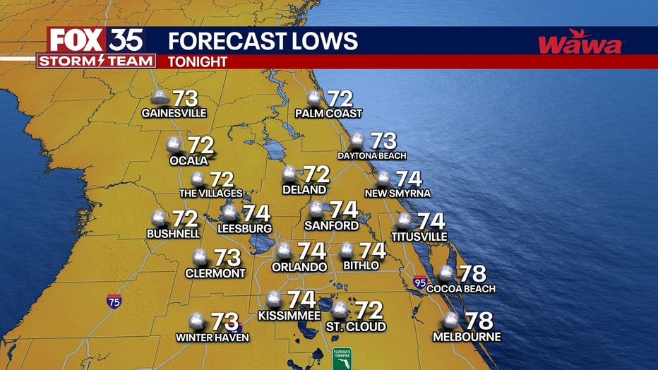
What will the weather look like tonight?
What to expect:
ORLANDO, Fla. - A few isolated t-showers on the I-75 corridor, but other than that, it is mostly dry for the majority of the Orlando area. Temperatures fall into the mid 70s.
What will the weather look like tomorrow?
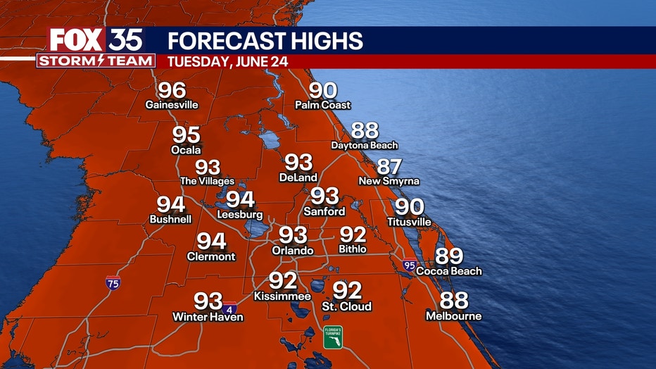
What to expect:
Hot again on Wednesday with highs in the mid 90s.
A higher coverage of afternoon and evening storms, but mainly on the west coast of the state.
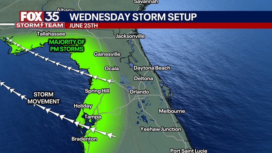
A few may clip Sumter, Lake, and Marion counties, but doubtful much beyond that.
What will the weather look like the rest of the week/weekend?
Looking ahead:
A higher chance of showers and storms for central Florida Thursday and Friday.
On Thursday, storms will track to the west. On Friday, storms will track to the east. On both days, downpours, very vivid lightning, little hail, and gusty winds are possible.
This weekend will feature numerous afternoon and evening showers and storms across central Florida. Rain chances around 70-80%.
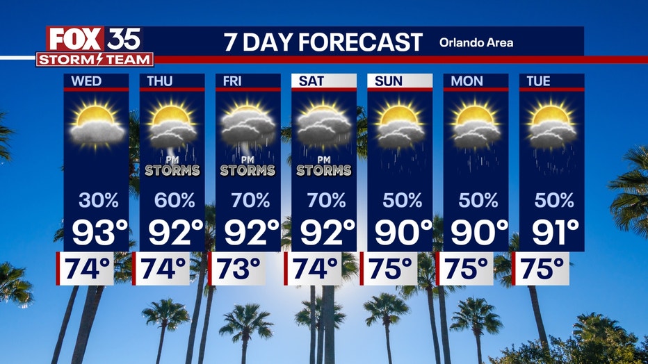
Next week, rain chances get tricky to nail down as there will be an odd and complicated weather pattern over the southeast U.S.
Too early to tell how hot or rainy it could be on the 4th of July in Orlando yet. We'll see how it looks as we get closer.
Tracking the Tropics
Dig deeper:
Tropically speaking, Andrea will fall apart tonight or tomorrow. It would impact nobody and was a questionable "flash in the pan" kinda storm.
Overall, things remain very quiet in the Atlantic for the foreseeable future.
Orlando 7-Day Weather Forecast

FOX 35 Storm Tracker Radar
Track live when storms move across your area using the FOX 35 Storm Tracker Radar below.

More radar maps from FOX 35 Storm Tracker Radar
- Brevard County
- Flagler County
- Lake County
- Marion County
- Osceola County
- Orange County
- Polk County
- Seminole County
- Sumter County
- Volusia County
- U.S./National Radar
STAY CONNECTED WITH FOX 35 ORLANDO:
- Download the FOX Local app for breaking news alerts, the latest news headlines
- Download the FOX 35 Storm Team Weather app for weather alerts & radar
- Sign up for FOX 35's daily newsletter for the latest morning headlines
- FOX Local: Stream FOX 35 newscasts, FOX 35 News+, Central Florida Eats on your smart TV
The Source: This story was written based on information shared by the FOX 35 Storm Team on June 24, 2025.