

Orlando weather: Heat builds into weekend as storm chances drop
ORLANDO, Fla. - Looking ahead to the weekend, the forecast calls for significant heat and limited rain.
What will the weather look like today?
What to expect:
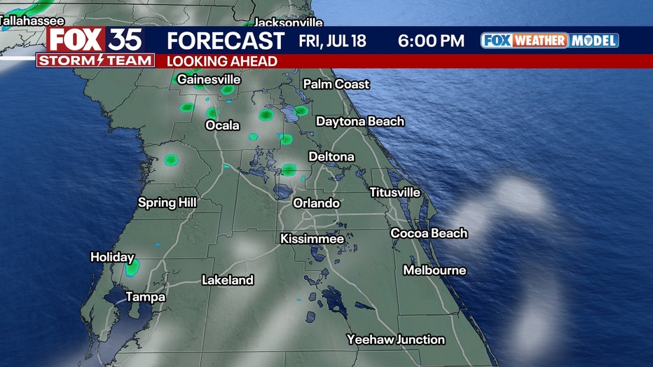
A few isolated thunderstorms are possible Thursday evening as storms move northwest through Central Florida, but conditions are expected to turn calmer overnight with temperatures settling into the mid-70s under humid skies.
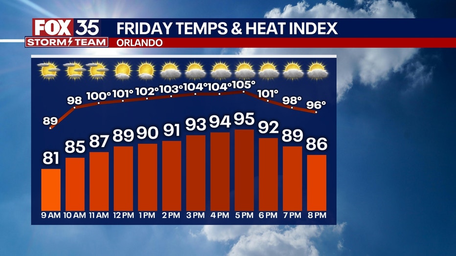
On Friday, a much drier air mass is expected to move into the region, reducing cloud cover and limiting rain chances. Highs will reach the mid-90s, with heat index values climbing into the 100 to 105-degree range.
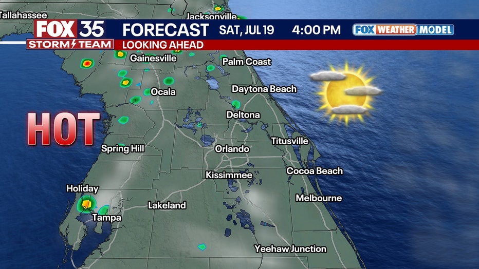
What will the weather look like this weekend?
Looking ahead:
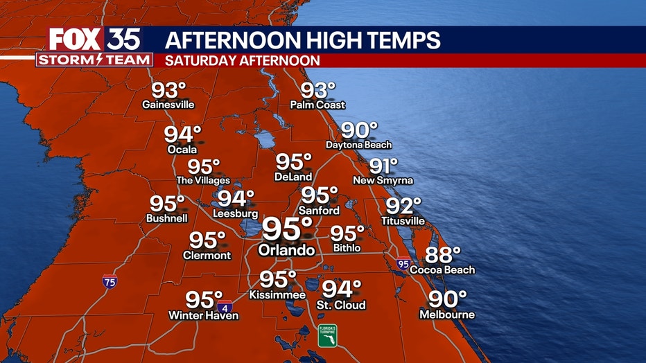
Temperatures will be sweltering this weekend.
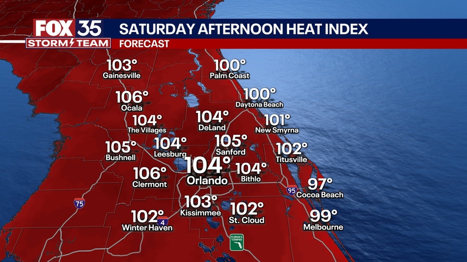
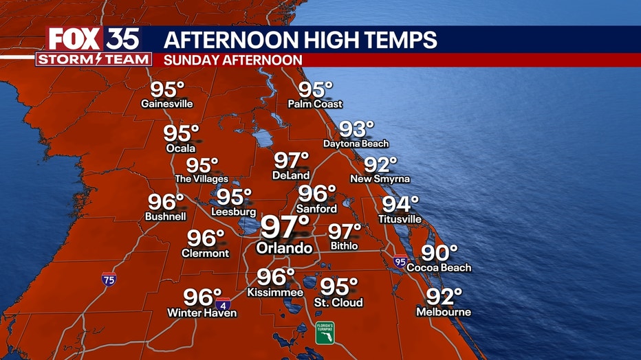
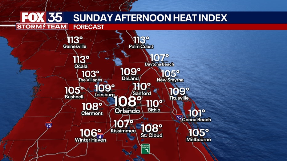
Temperatures are expected to soar on Saturday into the mid-90s Sunday, with the heat index hovering at or above 100 degrees in parts of Central Florida — levels considered dangerous.
Saturday’s rain chances drop to just 10%, while Sunday brings a slight increase to 30% by the afternoon.
Sunday temperatures will be even hotter than Saturday with highs in the upper 90s and the heat index possibly exceeding 110 degrees.
There will be a dramatic shift early next week, as a surge of tropical moisture returns to the area. Rain and storm chances will sharply rise Monday through Wednesday, with daily afternoon downpours likely.
Tracking the Tropics
The remnants of Invest 93L will look to bring more heavy rain our way into early next week.
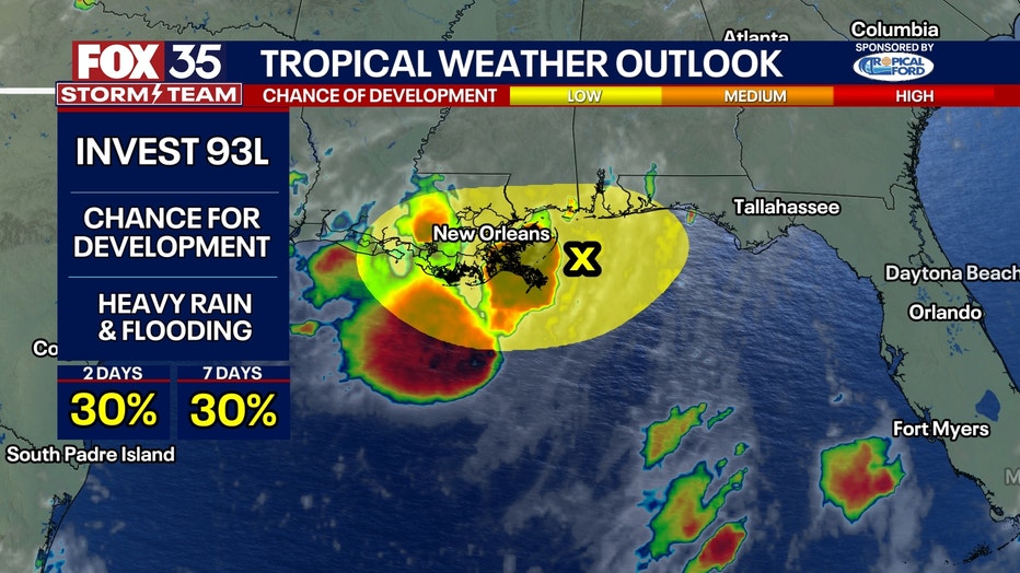
The system will move inland near the Louisiana coast, before being picked up and moving eastward where it could loop around and swing back down into Florida.
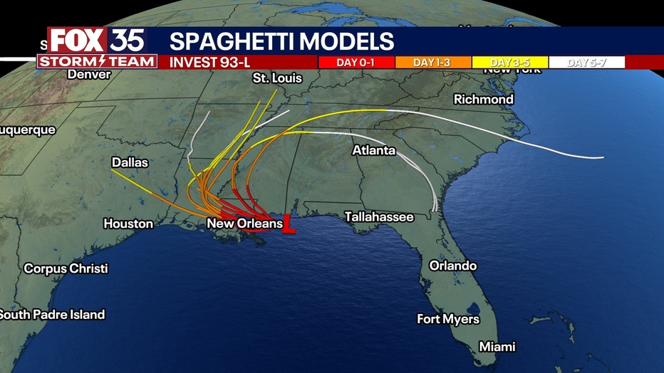
This would bring another slug of deep tropical moisture our way for the first half of next week.
What does this mean for Florida?
Repeated rounds of heavy rainfall are growing more likely.
This could lead to additional inches of rainfall over areas in Central Florida that are already fairly water-logged. There are still some questions as to where exactly the heaviest rain will set up, so be sure to stay close to the forecast for more.
Orlando 7-Day Weather Forecast

FOX 35 Storm Tracker Radar and Live Weather Cameras
Track live when storms move across your area using the FOX 35 Storm Tracker Radar below. You can also watch as heavy rain moves across Central Florida on our Live Weather Cameras' page here.

More radar maps from FOX 35 Storm Tracker Radar
- Brevard County
- Flagler County
- Lake County
- Marion County
- Osceola County
- Orange County
- Polk County
- Seminole County
- Sumter County
- Volusia County
- U.S./National Radar
The Source: This story was written based off information shared by the FOX 35 Storm Team on July 17, 2025.