

Orlando weather: Heat continues as storm chances rise, tropics become active
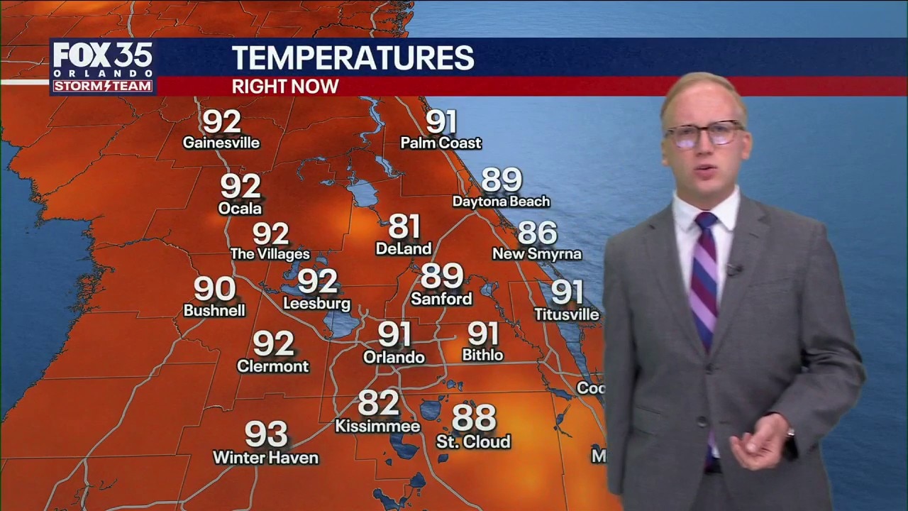
Orlando Weather Forecast: Tracking storms and heat
Scattered showers and storms are around this evening and more storms are expected for Friday afternoon and evening. FOX 35 Storm Team Senior Meteorologist Noah Bergren is tracking hotter weather next week.
ORLANDO, Fla. - Central Florida’s hot and dry year continues, with temperatures expected to reach 95 degrees or higher and the summer rainy season remaining lackluster.
A heat advisory was issued Thursday, and additional advisories could be issued in the coming days as afternoon heat index values climb as high as 111 degrees.
Scattered afternoon storms
What to expect:
Rain and storm chances will move closer to seasonal levels by Friday, though they are expected to remain below what is typical for this time of year.
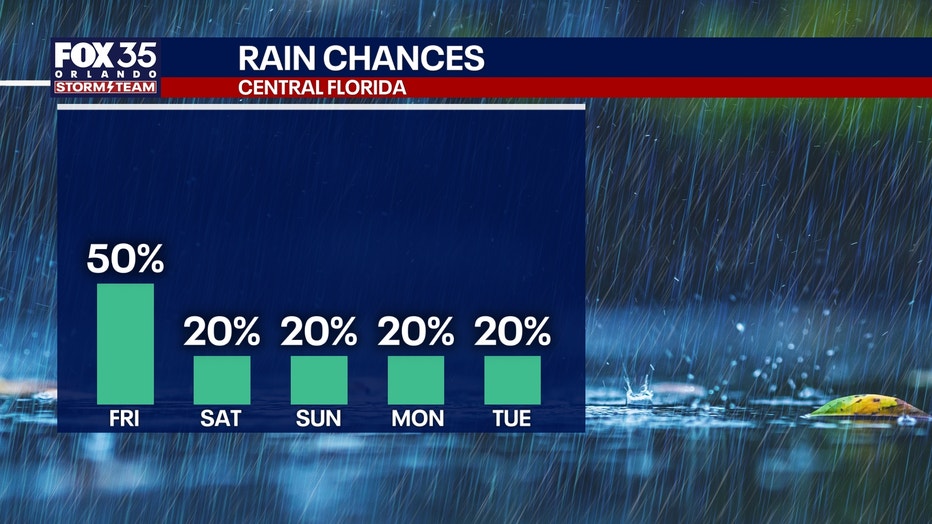
There is a 40% to 50% chance of showers and thunderstorms Friday, primarily between 2 and 8 p.m. A more typical summertime sea-breeze pattern is expected to develop.
A few storms could become strong, bringing heavy rain, gusty winds and frequent lightning.
The heat is here to stay
What to expect:
Our stretch of above-average highs will persist for what looks to be the next several days.
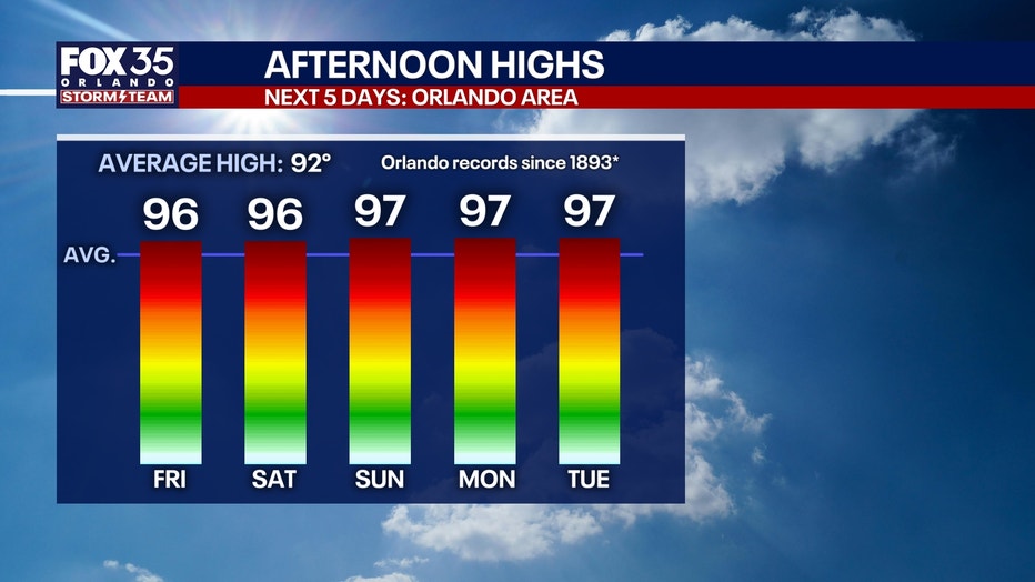
Highs will be cranking up well into the mid 90s on Friday, through the weekend, and into next week.
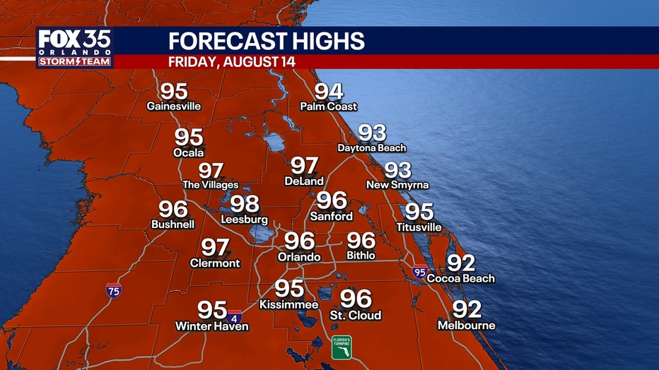
Once we factor in our humidity levels, it will feel closer to the low 100s. Additional heat advisories are likely in the coming days.
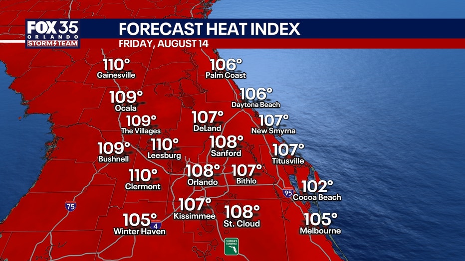
People spending extended periods outdoors should take precautions.
Safety tips to remember:
- Avoid intense physical activity during the hottest part of the day, 11 a.m. - 4 p.m.
- Drink plenty of water and sports drinks
- Find shade, air conditioning, and take breaks as needed
Rain forecast: Scattered storms this afternoon
Timeline:
The FOX 35 Storm Team is tracking the potential for scattered showers and thunderstorms this afternoon, a little closer to normal for Florida summer.
There is a 40%-50% chance of downpours across the area, mainly between the hours of 2 p.m. - 8 p.m.
Some of those storms could be strong with heavy rain, gusty winds, and frequent lightning.
Tracking the Tropics
Several systems are being monitored across the Atlantic and Pacific basins.
Invest 92L could briefly develop into a tropical depression this weekend, though conditions are expected to become less favorable as the system moves toward the eastern Caribbean.
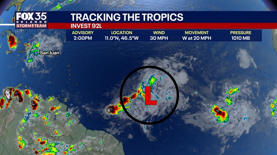
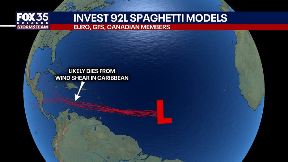
Invest 94L, a tropical wave farther east, has a somewhat better chance of developing into a tropical storm early next week as it tracks north of the Caribbean islands. The next named storm would be Dolly.
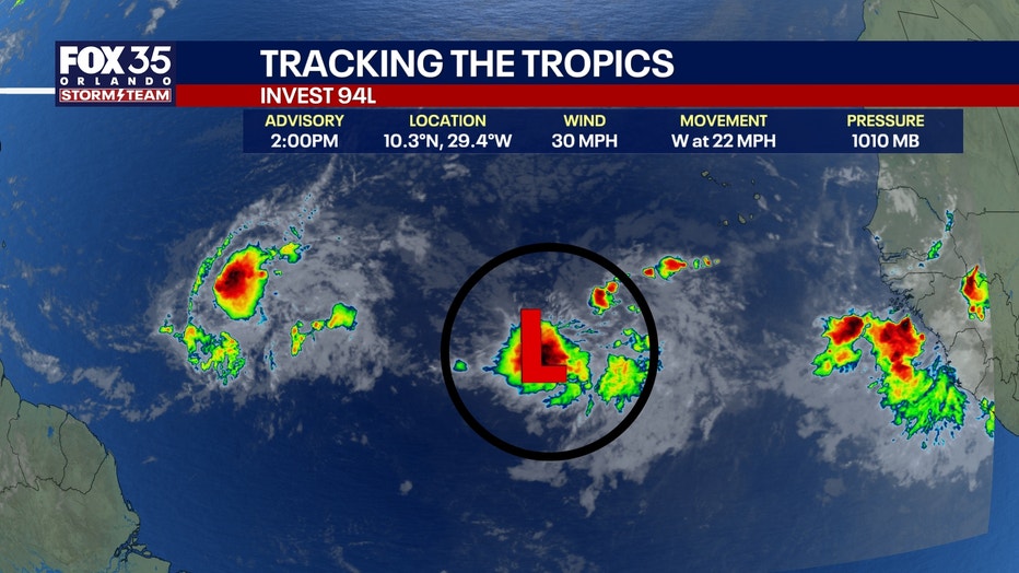
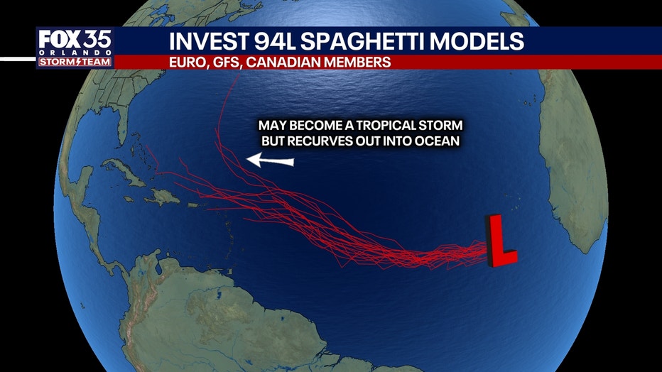
There's plenty of wind shear and dry air that will help limit development, so the chances of Tropical Storm Dolly forming are low as it moves towards the Caribbean.
In the Central Pacific, Tropical Storm Lala could threaten Hawaii’s Big Island with a rare direct landfall this weekend. Hurricane watches are in effect.
Threats to Florida?
No immediate impacts on Florida or the United States, according to the FOX 35 Storm Team.
The Source: The information is from the FOX 35 Storm Team and the National Hurricane Center.