

Orlando weather: Central Florida heat continues as scattered storms bring limited relief
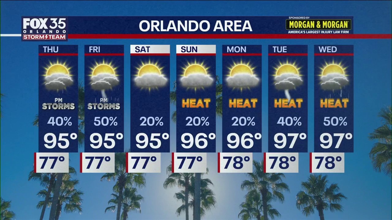
Orlando PM Weather Forecast: Stretch of excessive heat
Central Florida will stay hot, with highs in the mid-90s and heat index values reaching 104 to 111 degrees through early next week.
ORLANDO, Fla. - Another stretch of intense heat is expected across Central Florida, with temperatures remaining in the mid-90s and heat index values ranging from about 104 to 111 degrees each day through early next week, with little change in humidity. Afternoon high temperatures are forecast to remain at or above 95 degrees for the foreseeable future.
The persistent heat could help make the summer of 2026 one of the hottest on record, though where it ultimately ranks will depend on temperatures through the rest of August.
Storm chances increase
What To Expect:
Scattered thunderstorms could provide some temporary relief from the heat. The best chances for storms this week are expected Thursday and Friday, particularly during the afternoon.
Most parts of Central Florida were expected to remain relatively dry Wednesday evening, with only isolated showers in areas including DeLand and Pierson.
Little relief from the heat
Our stretch of above-average highs will persist for what looks to be the next several days. Highs will be cranking up well into the mid 90s through the weekend and into next week.
Once we factor in our humidity levels, it will feel closer to the low 100s. Stay cool and hydrated, and listen to your body for when you need to take breaks!
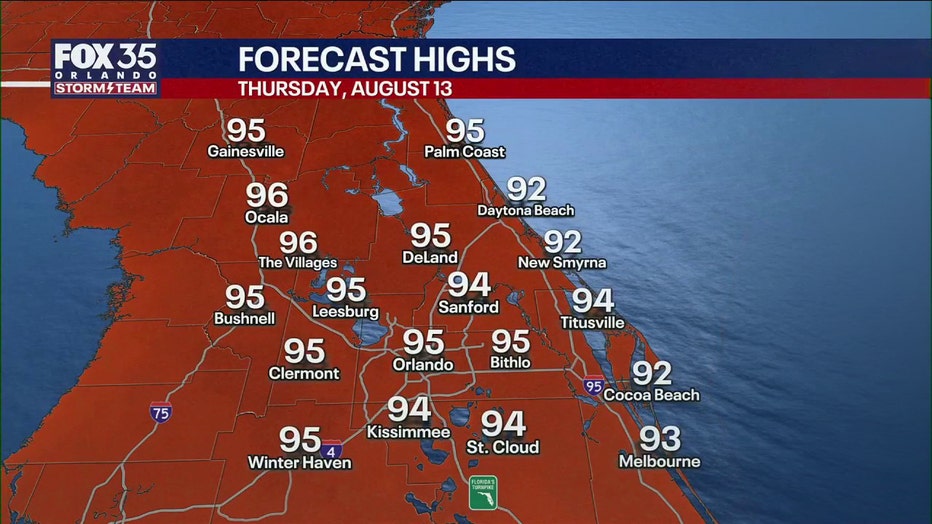
Thursday is expected to begin mostly sunny and dry before scattered afternoon storms develop. Rain chances Thursday and Friday could be higher than what Central Florida has experienced earlier in the week.
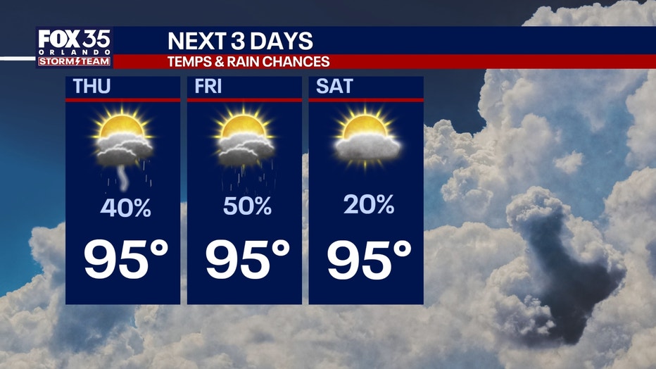
The heat isn't going anywhere. Temperatures are expected to reach about 95 degrees Saturday and 96 degrees Sunday, with highs potentially approaching 97 degrees by Tuesday.
Tracking the Tropics
Tropical Storm Cristobal formed in the open waters of the North Atlantic Ocean on Wednesday morning about 1,050 miles east-northeast of Bermuda, according to the National Hurricane Center (NHC). Cristobal strengthened from Invest 93L and is moving farther into the Atlantic and poses no threat to land.
Forecasters are also tracking two tropical waves in the Central and Eastern Atlantic.
INVEST 92L - Central Atlantic: An area of showers and thunderstorms in the Central Atlantic has a high chance of becoming a tropical depression within the next two days as it moves generally westward. This system was about 950 miles west-southwest of the Cabo Verde Islands on Wednesday evening. Conditions are expected to favor development over the next couple of days as it moves west to west-northwest across the Atlantic. The NHC says there is an 80% chance for development over the next seven days.
INVEST 94L - Eastern Atlantic: A vigorous tropical wave has rolled off the western coast of Africa and into the far eastern Atlantic. Chances of development are at 20% over the next two days and 50% over the next seven days. It could move into a better environment for development next week. We'll be watching it.
For Florida and the Gulf, the current pattern is expected to remain relatively steady through Saturday before changing somewhat Sunday. The outlook provided does not indicate any immediate Florida impacts from either waves.
The Source: The information in this story was provided by the FOX 35 Storm Team.