

Orlando weather: Afternoon storms to bring heavy rain, vivid lightning and gusty winds
ORLANDO, Fla. - The rest of Thursday afternoon and early evening will be occupied by clouds, as storms move through the Central Florida area. The storms are expected to spark up between 2-8 p.m.
Here's a look at what to expect from the weather tonight, as well as a look ahead to the weekend and heading into next week.
What will the weather look like tonight?
What To Expect:
Clouds will increase through the rest of the afternoon, and storms will spark up between 2-8 p.m.
CLICK TO DOWNLOAD THE FOX LOCAL APP
The main threats from the afternoon storms are periods of heavy rain, vivid lightning and gusty winds, with the additional possibility of small hail in stronger storms.
The storms are expected to quiet down after sunset, leaving partly cloudy skies later tonight.
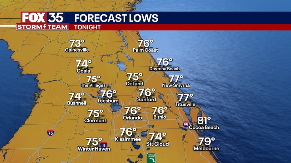
Temperatures will fall into the mid-70s and stay mild for the early Friday morning commute.
What will the weather look like tomorrow?
What's next:
The chances of rain will be much more scattered for the start of the weekend. We will see partly cloudy skies, as well as a few pop-up storms and isolated showers, tomorrow afternoon.
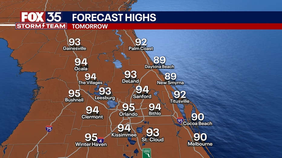
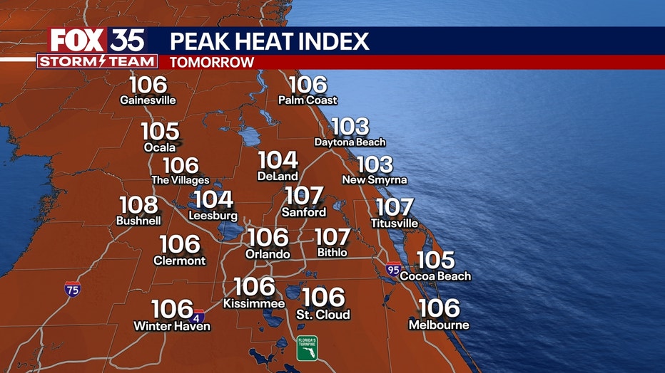
However, the big story heading into the weekend is the heat. Temperatures will sizzle back into the mid-90s, but the humidity will really make things feel hot, with heat indexes reaching levels well into the triple digits.
Overnight lows will still stay mild, with lows in the mid-70s with humid and muggy conditions.
What will the weather look like next week?
Looking Ahead:
Rain chances will remain low for the weekend as dry air pushes into the region.
However, these will likely be the hottest temperatures we've felt so far this summer. Temperatures will sizzle back into the mid-90s. Early next week, the humidity will really make things feel hot, with heat indexes reaching levels as high as 110 degrees. Heat advisories will most likely be issued for this weekend and possibly early parts of next week.
SIGN-UP FOR FOX 35'S BREAKING NEWS, DAILY NEWS NEWSLETTERS
Stay cool, stay hydrated and listen to your body! Heat exhaustion can set in quickly, so take it easy.
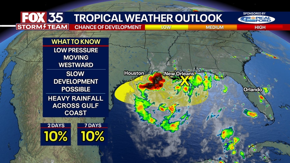
Tracking the tropics
Dig deeper:
There will be zero impact on Florida, but the moisture that originally came from the chance of tropical development two weeks ago was once again pushed through the Sunshine State, bringing us the rain we saw during this past week.
Regardless of formation, this will bring once again lots of heavy rainfall to the Gulf Coast of Texas and Louisiana.
There is a 10% chance of development over the next 48 hours and a 10% chance of development within the next seven days.
The Source: This story was written based on information shared by the FOX 35 Storm Team on July 24, 2025.