

Toasty and sunny ahead of potentially strong storms in Central Florida mid-week

Weather Forecast: March 28, 2022
FOX 35 Storm Team Meteorologist Brittany Lockley has the latest on the weather in Central Florida.
ORLANDO, Fla. - The trend of great weekend weather has moved into the start of the new workweek.
If you're in town for Spring Break and perhaps visiting Central Florida's beaches or theme parks, you just can't go wrong!
Humidity is still relatively low with an outdoor comfort index around 7 out of 10.
DOWNLOAD: FOX 35 NEWS APP | FOX 35 STORM TEAM WEATHER APP
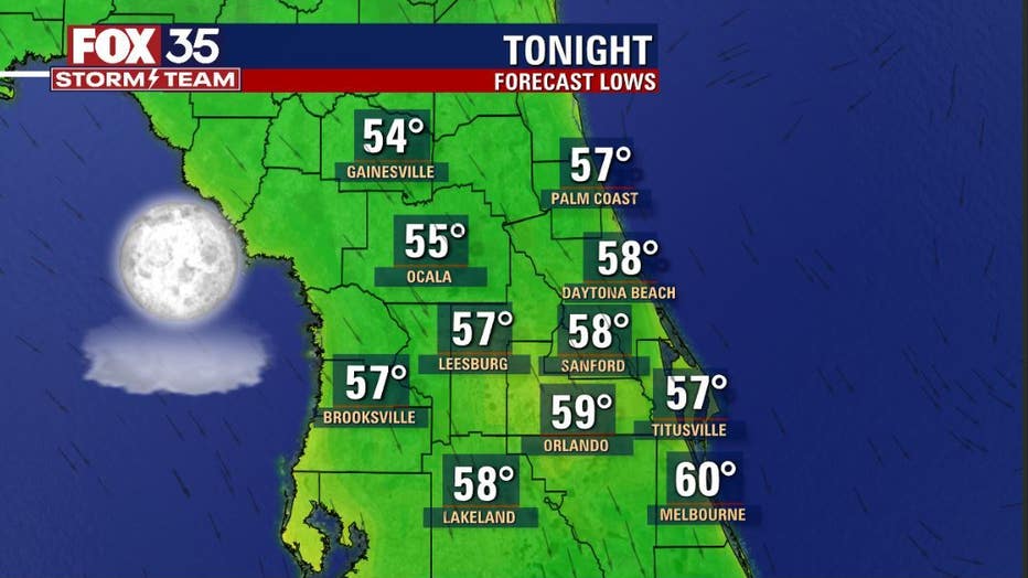
Tonight, there could be a few areas of patchy fog. Otherwise, it'll remain cool, dry and quiet.
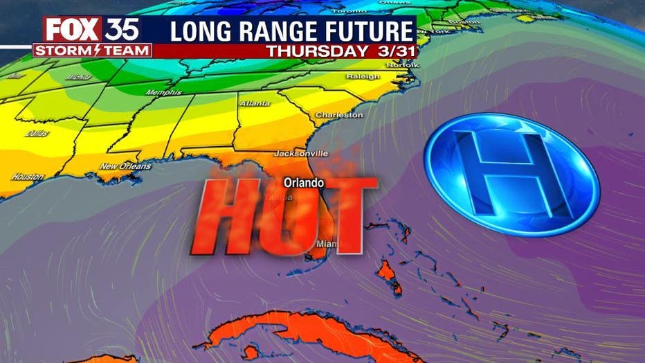
High pressure will move out into the Atlantic around midweek with winds wrapping around to the south in response. The southerly flow will warm things up in a big way with area highs inland heading for the 90-degree mark. It's during this time that a front draws closer to the area.
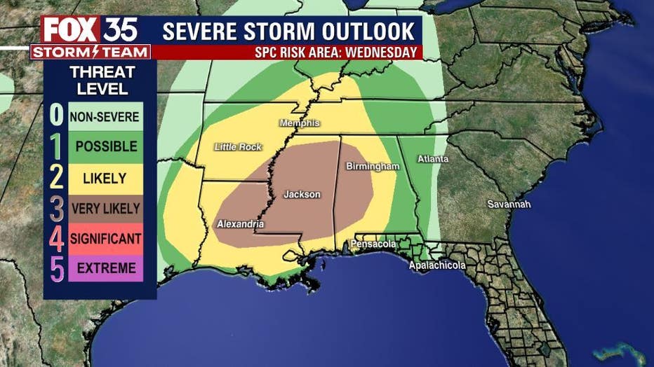
The front will spawn some potentially strong storms over the Gulf south on Wednesday with some of the storms expanding into Florida by Thursday.
Storms risk will be rising locally by the end of this week so stay tuned for any FOX 35 STORM ALERT DAYS that could be issued then."
Get the latest on Orlando weather, the Florida forecast, and interactive radar.
Click here for the latest Central Florida news, Florida stories, and local headlines.