

Orlando weather: Stormy start to week followed by hot, dry weekend

Orlando Weather Forecast PM: July 21, 2025
FOX 35 Storm Team Senior Meteorologist Noah Bergren is tracking lots of showers and storms on the way for Tuesday and Wednesday.
ORLANDO, Fla. - Central Florida is in for a stormy start to the week, but much hotter and drier weather is on the way by the weekend.
What will the weather look like tonight?
We can expect a few thunderstorms through mid-evening Monday. One or two of these storms are expected to be strong.
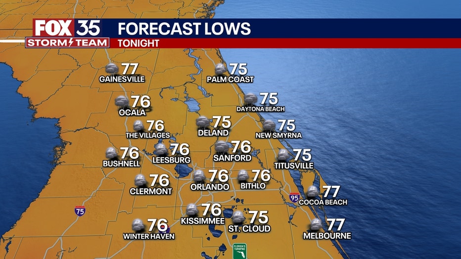
It will be very humid Monday night with overnight lows in the upper 70s to nearly 80 degrees, which tends to be extremely uncomfortable.
What will the weather look like on Tuesday & Wednesday?
Tuesday and Wednesday are being considered Weather Impact Days due to potential widespread storms and downpours. Mainly the second half of both days. Anytime, each afternoon and evenings are "fair game" for this activity.
Rain totals will vary immensely across our area. Everyone will get rain between this two-day span.
Storm Radar:
However, some places hit the hardest may get over 5 or 6" of rain between the two days with localized flash flooding possible.
A handful of Severe Storm Warnings possible too for 60MPH wind gusts and/or large hailstones in a few towns/cities.
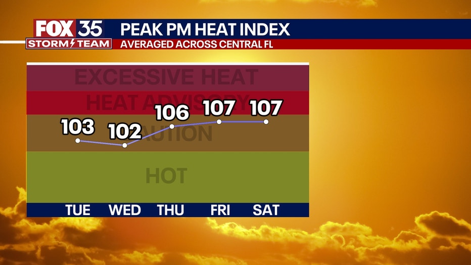
Temperatures are expected to come down into the low 90s.
High temps:
What will the weather look like for the remainder of the week?
A few storms are still possible on Thursday afternoon, but they’ll be much less widespread.
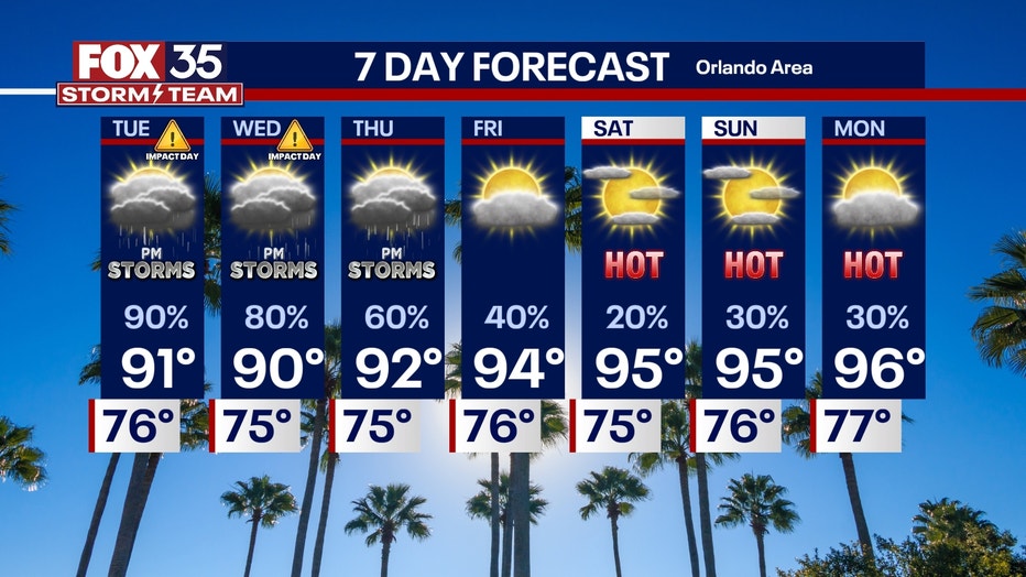
Starting Friday and into the weekend, drier air will move in, leading to hotter and more stable weather.
Rain chances will drop significantly, and temperatures will climb back into the mid to upper 90s.

More radar maps from FOX 35 Storm Tracker Radar
- Brevard County
- Flagler County
- Lake County
- Marion County
- Osceola County
- Orange County
- Polk County
- Seminole County
- Sumter County
- Volusia County
- U.S./National Radar
The Source: This story was written based on information shared by the FOX 35 Storm Team Meteorologists on July 21, 2025.