

Orlando weather: Rain chances lessen as temperatures heat up
Orlando weather: Storms, showers decrease as temperatures heat up
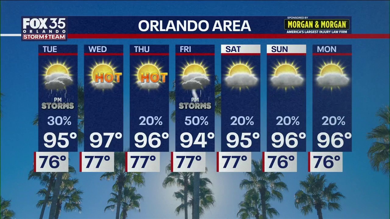
Central Florida will see scattered Tuesday evening commute storms before a ridge of high pressure brings upper-90s heat and drier conditions for the midweek back-to-school start. Rain chances rebound on Friday afternoon with widespread downpours and stronger storms expected between 2 p.m. and 8 p.m.
ORLANDO, Fla. - As Central Florida students head back to school this week, chances of rain will taper off while temperatures begin to surge.
Highs will return to the mid-to-upper 90s by midweek alongside plentiful sunshine and drier conditions, with no widespread extreme weather on the immediate horizon.
A few storms for Tuesday
What we know:
Looking toward Tuesday, we're expected to have storms in the afternoon and evening. One or two storms could be on the stronger side, FOX 35's Noah Bergren said.
Though the storms won't be widespread, those in the area can expect a scattering of activity likely to impact the evening commute in spots with downpours, lightning, and gusty winds.
Heat builds Wednesday to Thursday
A pattern shift with a "dome" of high pressure forming over Florida and the southeast United States will send temperatures climbing into the higher 90s.
Records will not be in jeopardy, but this will be hotter than average (92) for the time of year. As the temperatures heat up, mostly dry weather with little to no rain each afternoon and evening is predicted.
Some storms to return Friday
A briefly higher chance of afternoon/evening storms and downpours is predicted for Friday. Some strong showers and storms will move south across Central Florida.
Numerous downpours and storms are expected to peak anywhere from 2 p.m. to 8 p.m.
Tracking the Tropics: 3 developments in Atlantic
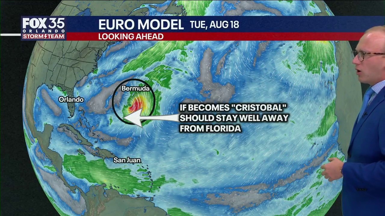
After a seemingly quiet start to the 2026 Atlantic Hurricane Season, the National Hurricane Center is monitoring three tropical disturbances in the Atlantic. Two of those disturbances have low chances of development over the next week, while one has a medium chance of development, the NHC said.
Tracking the tropics
As multiple waves are currently scattered across the Atlantic, one has a chance to become a tropical system.
There is a medium chance (60%) of development in the southern Atlantic, and a narrow window of favorably positive conditions may develop this weekend into early next week. It should curve north of the islands and safely away from Florida and the U.S., but a brief tropical storm or low-end hurricane is not impossible.
If a tropical storm forms, it will take on the name "Cristobal" – being the third tropical storm of 2026. The storm could impact enhanced surf and rip current risks next week if it does in fact form.
The Source: Information in this story was gathered from FOX 35's Noah Bergren.