

Orlando weather: Flood advisories, severe thunderstorm warnings
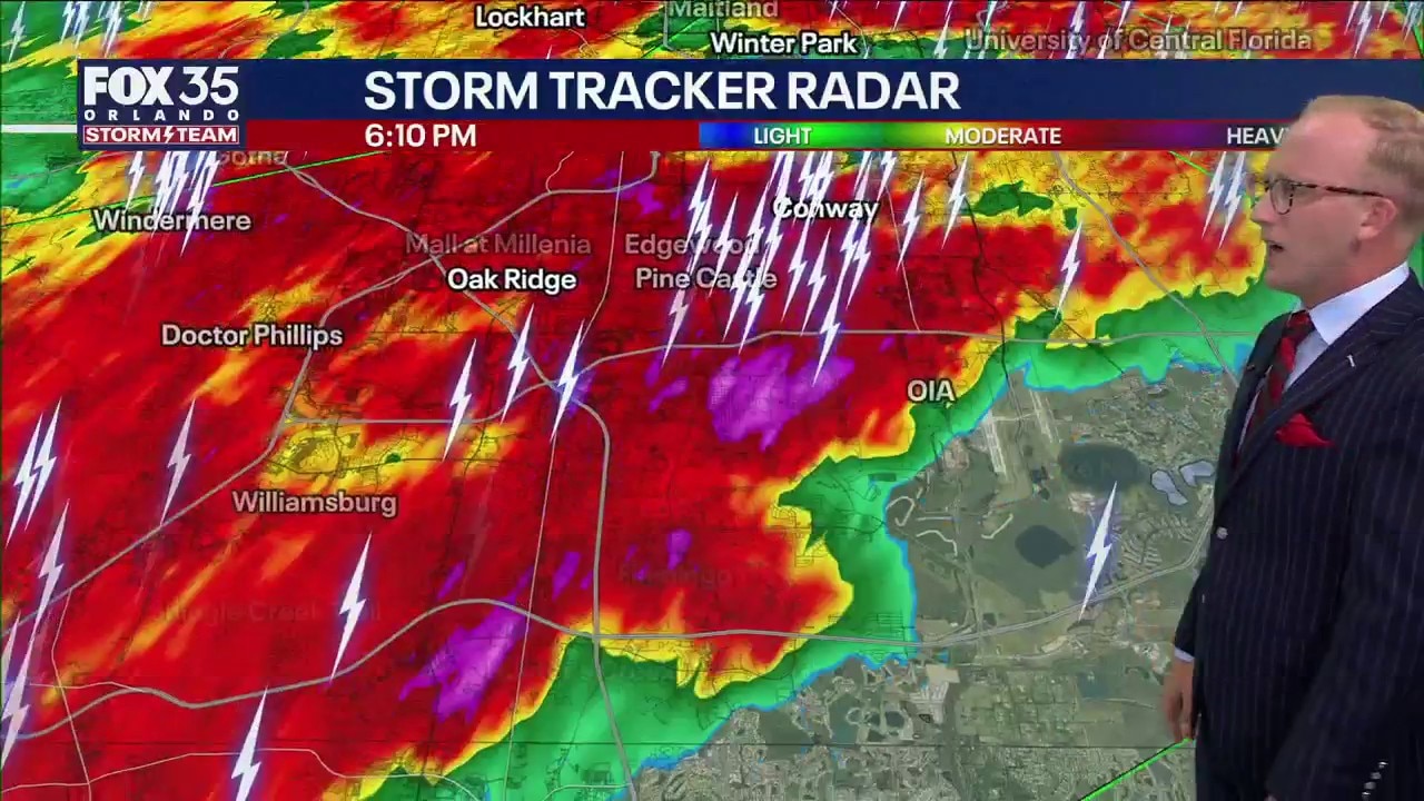
Orlando weather: Strong storms moving across Central Florida
The FOX 35 Storm Team is tracking several strong to severe thunderstorms moving through Central Florida. FOX 35's Noah Bergren has the latest forecast and update.
ORLANDO, Fla. - The FOX 35 Storm Team is tracking strong thunderstorms moving across Orlando and Central Florida.
Flood advisory issued for Lake Orange, Seminole, and Volusia counties
Lake, Orange, Seminole, and Volusia counties are under a flood advisory due to excessive rainfall.
Timeline:
A few isolated downpours will begin to form and pop up on the radar at around midday. The highest chances of rain and storms overall today will be from 2 p.m. to 10 p.m.
A few isolated storms could be on the strong side, with the main impacts being strong gusty winds and pockets of torrential rain that could lead to minor flooding.
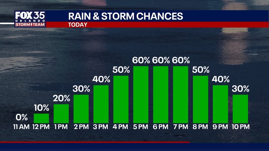
Frequent dangerous lightning can be expected as well and could delay afternoon dismissal for some districts across Central Florida.
How hot will it get?:
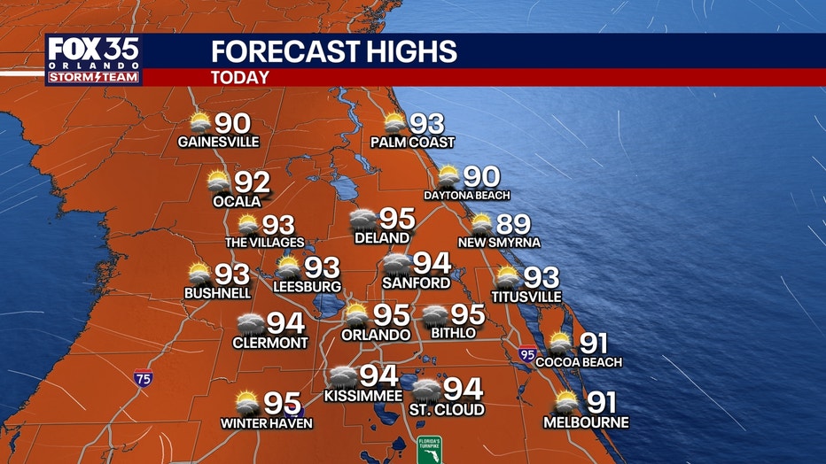
Temperatures will be above average, climbing into the mid 90s inland and low 90s at the coast. Feels-like temperatures will still be steamy, but not at extreme levels. Plan for peak heat indices to reach a range of 100-106°.
Increasing storm chances by end of the week
Moisture builds back into the region midweek which will bring higher chances of showers and storms, with a 60 to 70% chance through the weekend.
While this will be a more typical set up for us to see this time of year with afternoon sea-breeze driven storms, heavy rain and a few isolated strong storms are possible. It won't be a washout, but with the potential of frequent dangerous lightning, it's a good idea to have backup plans indoors.
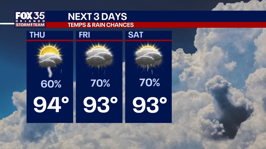
Repeated rounds of torrential downpours over the same areas each afternoon could lead to isolated areas of flooding as well.
The Source: The information in this story was provided by the FOX Storm Team.