

Hurricane Erin live tracker: Cone, spaghetti models, satellite updates and forecast

Hurricane Erin 5 a.m. update
Hurricane Erin continues its northwestward track through the Atlantic, prompting new warnings and raising concerns along the U.S. East Coast, with dangerous high surf and life-threatening rip currents expected along Florida’s coastline through midweek.
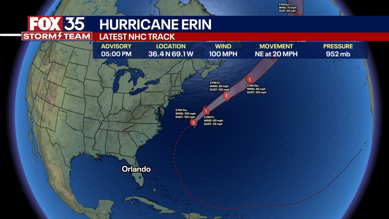
ORLANDO, Fla. - Hurricane Erin is a large and powerful storm with maximum sustained winds of 100 mph and a central pressure of 948 mb.
As of 8 a.m., the storm was located about 400 miles south-southeast of Cape Hatteras, North Carolina, and was moving north-northwest at 13 mph.
Outer bands of the hurricane are expected to reach the coast of North Carolina by this evening. Bringing dangerous surf and life-threatening rip currents are impacting much of the U.S. East Coast – including the Florida coast.
Authorities strongly caution beachgoers against swimming due to these hazardous conditions.
Hurricane Erin - Cone Models
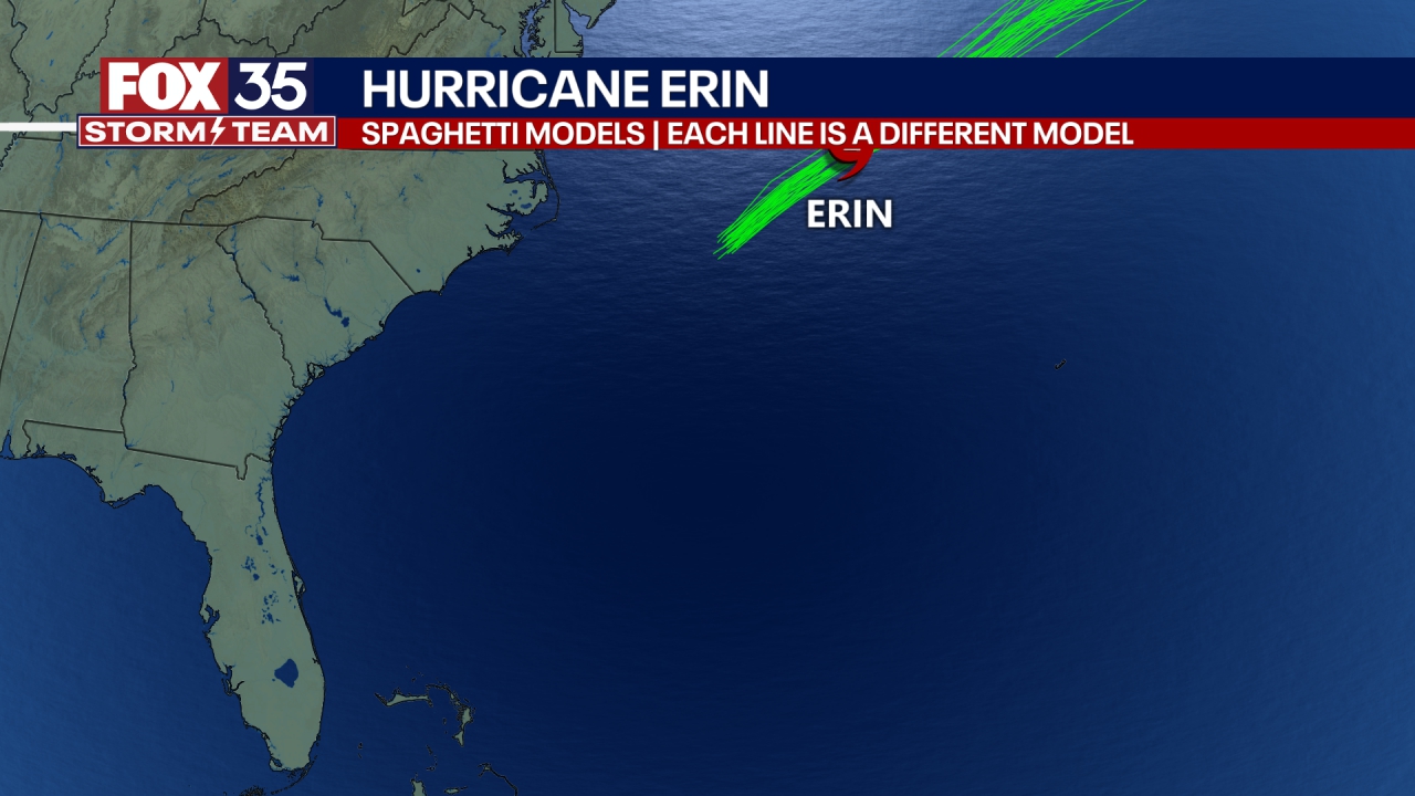
Hurricane Erin - Spaghetti Models
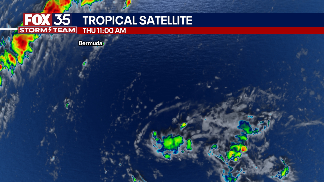
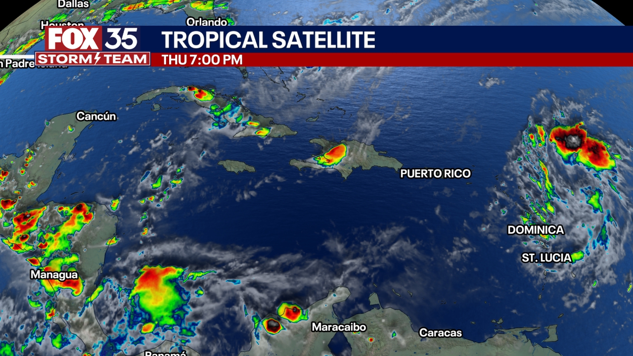
Hurricane Erin - Satellite Images
More radar maps from FOX 35 Storm Tracker Radar
- Brevard County
- Flagler County
- Lake County
- Marion County
- Osceola County
- Orange County
- Polk County
- Seminole County
- Sumter County
- Volusia County
- U.S./National Radar
The Source: This story was written based on information shared by the FOX 35 Storm Team, NOAA and the National Hurricane Center on August 20, 2025.