

Fire pit alert: 2 cold fronts to drop temperatures in Central Florida

2 cold fronts coming to Central Florida: When you'll need to bundle up
FOX 35 Storm Team Chief Meteorologist Jayme King has the forecast.
ORANGE COUNTY, Fla. - We start this Friday off with a cold front sliding through Florida.
Any light rain will end and clearing will be the rule of thumb as we head into the late morning and early afternoon hours. Sunshine will prevail for the afternoon hours, breezes will be on the rise, especially in the coastal regions.
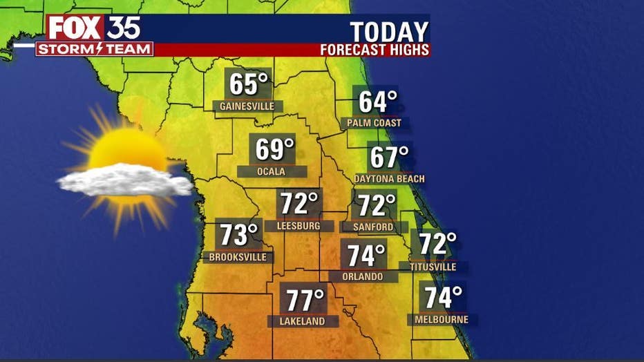
Expect cooler high temps for the afternoon with North Florida staying in the 60s, low-mid 70s closer to Orlando. If you've got plans to be out and about today, the hour-by-hour forecast looks great. Areas like Winter Park look fabulous!
RELATED: WATCH: Snow falls in Florida following first winter storm of 2022
"It'll be a great day to stroll Park Ave. to check out those after holidays deals!" says FOX 35 Storm Team Chief Meteorologist Jayme King.
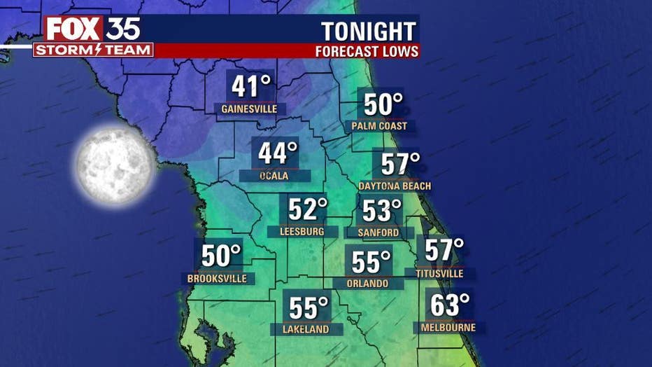
Tonight, skies are clear and temps are cool. The chilliest air will be found across Marion and Alachua counties with 40s expected there late tonight and into Saturday morning.
Download the FOX 35 Storm Team Weather App to get the latest forecast at your fingertips.
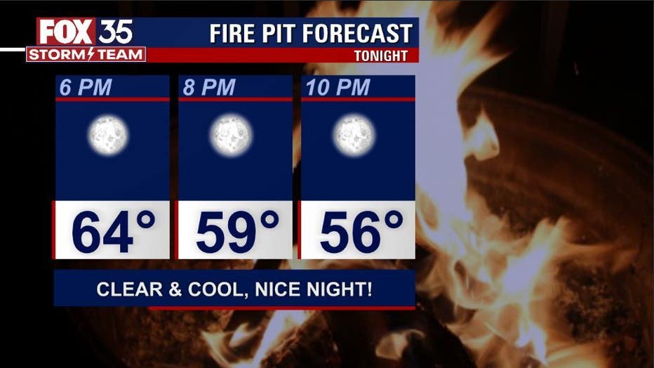
Oh, what a night for a fire pit huddle: temperatures will fall through the 50s all evening long.
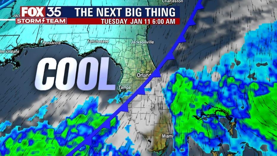
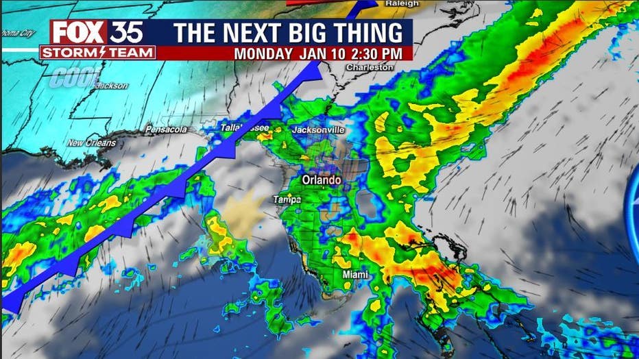
Our future weather outlook shows another strong approaching Florida on late night Sunday into Monday. In advance of the front, Sunday's high temps head for the 80° mark in many locations. This warm up will be short-lived as the front will first increase rain chances, followed by dropping temps by Tuesday.
Rainfall in the advance of the front looks to be mainly "showery" with only a low risk of storms moving in.
Stay with the FOX 35 Storm Team for updates. Click for Orlando radar and Central Florida forecast.
Watch FOX 35 News for the latest Central Florida weather.