

Cool start before sunny, comfortable day in Central Florida

Weather Forecast: February 10, 2022
FOX 35 Storm Team Chief Meteorologist Jayme King has the forecast.
ORLANDO, Fla. - Calm, beautiful weather continues for Central Florida on this Thursday.
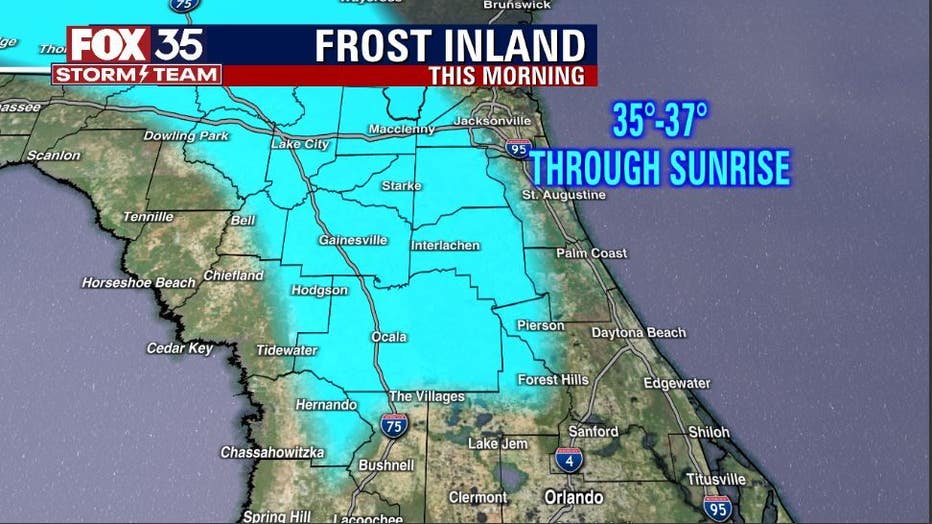
There could be a few issues with some early morning frost for the inland counties Northwest of the Orlando metro area. Temperatures there are in the 30s and while not cold enough for a bona fide freeze, frost will likely develop through sunrise.
DOWNLOAD: FOX 35 NEWS APP | FOX 35 STORM TEAM WEATHER APP
SUBSCRIBE: FOX 35 NEWSLETTER | FOX 35 Orlando on YouTube
FOLLOW: Facebook | Instagram | Twitter
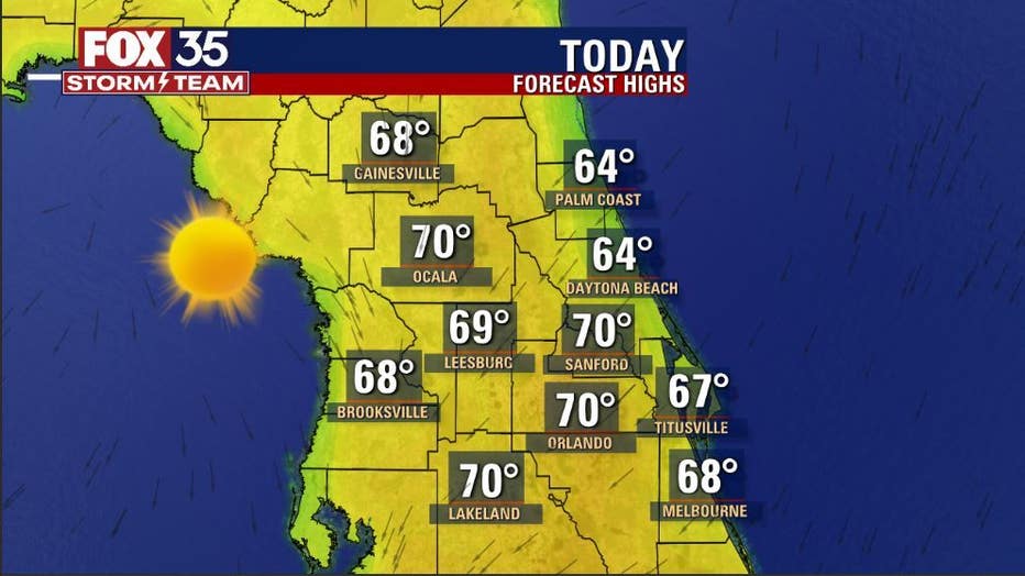
After we kick the a.m. chill, p.m. highs spread out through the 60s to right near 70. Sunshine dominates the skies in all locations, so we're looking and feeling pretty good locally today.
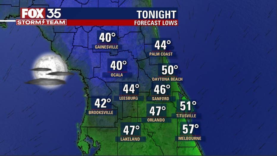
Tonight, a few extra clouds will be lurking about, which should help to keep the overnight temps a bit higher compared to previous evenings.
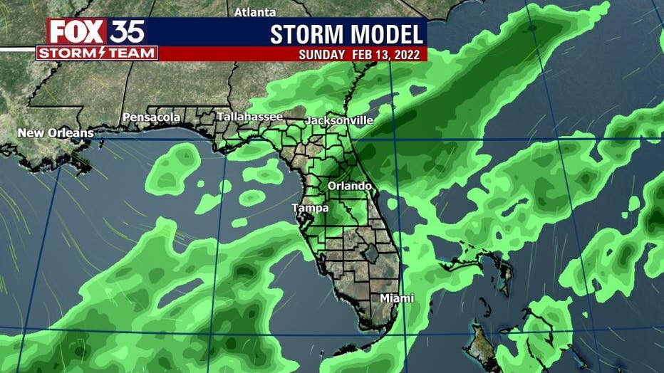
As of right now, the next best chance of rain comes into the area overnight Saturday into Sunday. Scattered showers will accompany our next cold front. Coverage looks to be in the 20-40% range.
Behind the departing front, temperatures will fall off again after a bit of a weekend warm-up. Valentine's Day Monday brings plenty of sunshine and cool highs in the low-60s, lows during this time will be in the 40s.

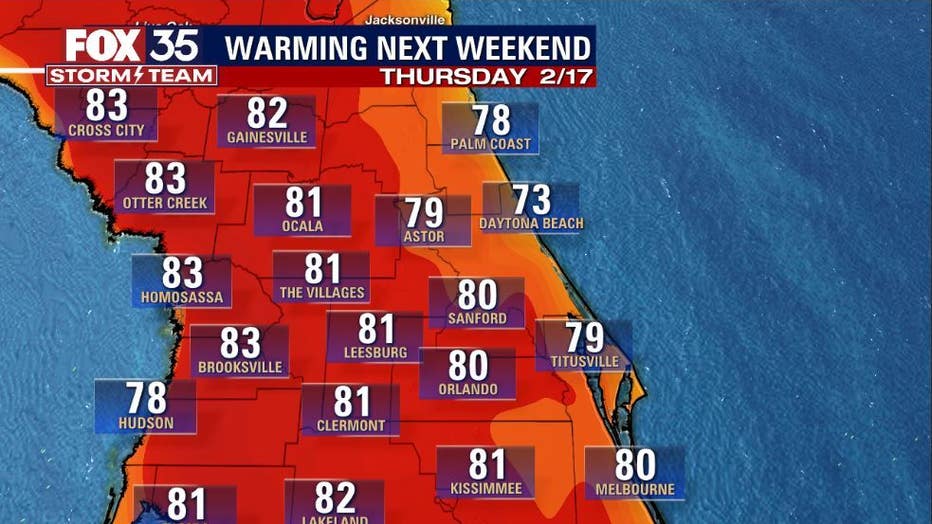
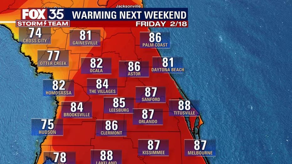
Cooler weather not your thing? Well, some of our longer-range forecast models are hinting at temperatures by late next week heading for the mid-upper 80s in advance of yet another approaching front. Something to watch for sure! Stay tuned!
Watch FOX 35 News for the latest updates. Click here for Orlando weather, Central Florida weather conditions, and live radar.