

Cold front to pass through this week, bringing cooler and drier weather

Weather Report: September 27
FOX 35 meteorologist Allison Gargaro gives the latest on the weather in Central Florida.
ORLANDO, Fla. - The weekend has felt a little more like summer in east Central Florida. Temperatures were in the low-90s with afternoon thunderstorms.
Things will be changing by the middle of this week as a cool front sweeps through the region Tuesday night or Wednesday morning.
Ahead of this system, we can expect deep moisture to continue. We will keep the 60 to 70 percent chance for showers and afternoon thunderstorms, bringing heavy rain and dangerous cloud-to-ground lightning.
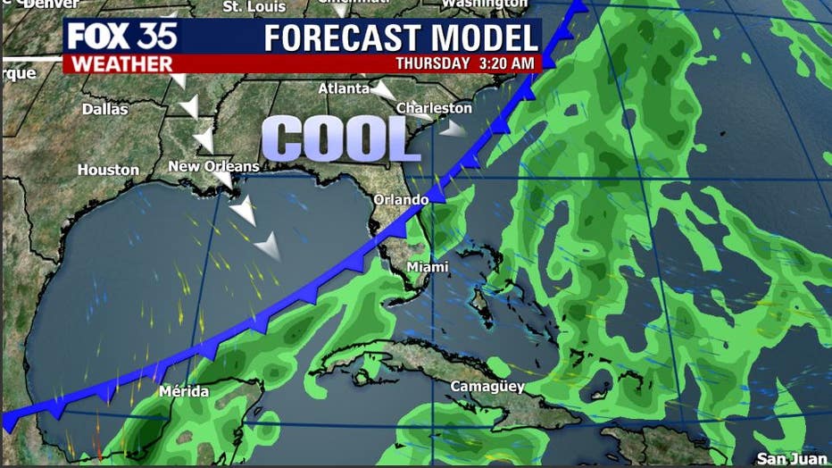
Once the front moves through, there will be much cooler and drier air filling in east Central Florida. Rain chances will drop to 40 percent on Wednesday and down to 20 percent by the end of the week.
WEATHER ALERTS: Download the FOX 35 Weather App to track the tropics on your phone, receive severe weather alerts, and get the latest daily forecasts
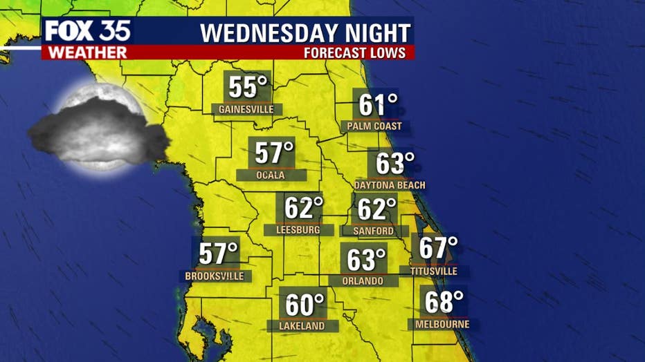
As for temperatures, you can expect highs in the low to mid-80s with overnight lows in the 60s.
It might not be sweater weather yet, but we are inching closer to fall-like conditions.
Tune in FOX 35 Orlando for the latest on the weather in Central Florida.