

Weather Alert Day - Monday - Front to bring along severe weather risk to parts of Florida, heavy rain and tornadoes possible

Possibility of severe weather on Monday
FOX 35 Meteorologist Mike Linden says overnight Sunday into Monday has the possibility for severe weather.
ORLANDO, Fla. - After a rainy Saturday, Sunday was a much sunnier day, but severe weather could possibly re-enter Central Florida, bringing along heavy rain, strong winds and a chance of tornadoes.

Front to bring risk of severe weather to parts of FLorida
FOX 35 meteorologist Mike Linden says that heavy rain and tornadoes are possible.
A few fast-moving showers are expected throughout Sunday. FOX 35 meteorologist Mike Linden says that they will likely be over fairly quickly if you see them, not putting a damper on the day.
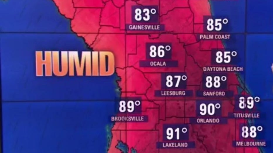
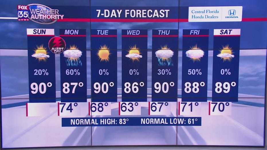
Temperatures are then expected to heat up as the day progresses, reaching the lower 90s.
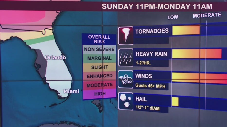
A new risk of severe weather is possible overnight and into Monday. A front that is moving above Florida is accompanied by a moderate risk of severe weather. It is moving towards the state and could push storms into the northern part of Florida on Sunday night.
If the storms blow in overnight Sunday and into Monday, strong winds are likely to come along with it, reaching up to 45 miles per hour. Heavy rain is also expected and a low to moderate chance of tornadoes. Hail could occur as well but the risk for this is very low.
With this said, FOX 35 is activating a ‘FOX 35 Weather Alert Day' for overnight Sunday and into Monday. Our meteorologists will work to bring you frequent updates on the front and the possibility of severe weather. Download the FOX 35 Weather App to receive these updates, live radar, and more on your phone.
CLICK HERE TO DOWNLOAD THE FOX 35 WEATHER APP
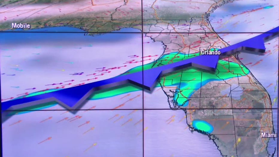
The incoming front will “take its time” coming into Florida, FOX 35 meteorologist Mike Linden added. It is possible that the front reaches the Orlando-metro in the afternoon on Monday, around 3 p.m.
Moving behind the front are some cooler temperatures and dryer air. Tuesday and Wednesday should be relatively dry.
Tune in to FOX 35 News for the latest updates on the risk for severe weather in Central Florida.
MOBILE USERS: Click here to tune in to FOX 35 News