

Warm temperatures to continue through the weekend
LAKE MARY, Fla. - Tonight’s forecast low: 67 degrees
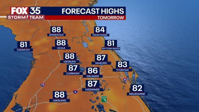
Tomorrow’s forecast high: 86 degrees
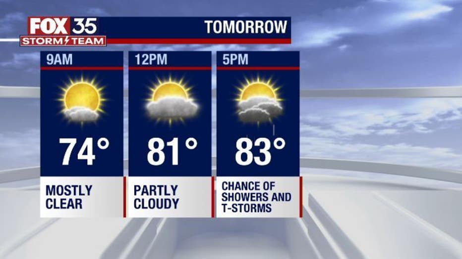
Main weather concerns: The rain stays to the west throughout the evening. The highest chance of showers remains in Marion, Sumter, Lake, and West Orange Counties. These showers will wrap up before midnight. Tomorrow will be another warm and humid day, which will lead to isolated showers and storms. Between 3 p.m. and 5 p.m. there will be heavy rain, cloud-to-ground lightning, and gusty winds.
WHAT IS THE WEATHER FORECAST FOR WALT DISNEY WORLD, UNIVERSAL, AND SEAWORLD?
Tomorrow will be another wonderful day for the parks. Make sure to pack a poncho for an afternoon thunderstorm. High temperatures will reach 86 degrees by the afternoon.
WHAT IS THE WEATHER FORECAST FOR THE BEACHES IN CENTRAL FLORIDA?
A perfect beach day tomorrow with a moderate risk for rip currents and surf around 3ft. Winds will be mild out of the southeast at 10-15 mph. The weather will be sunny with a slight chance of showers in the afternoon. Do not forget sunscreen!
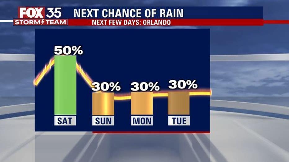
LOOKING AHEAD: Moving into the next work week, we get into more of a "Summer like" pattern. Highs will gradually get warmer during the week, and by the end of the week reach near the mid-90s. Rain chances stick around all week due to daytime heating and sea breeze circulations.