

Rising rain, thunderstorm chances could affect the Daytona 500

Wet weekend could affect Daytona 500
FOX 35 meteorologist Jayme King has a look at the forecast for 'The Great American Race' in Daytona Beach.
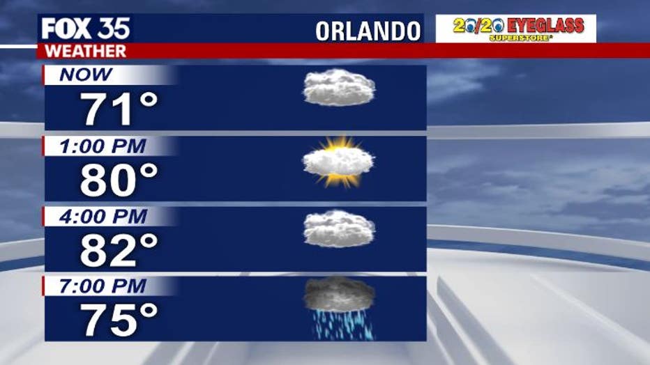
ORLANDO, Fla - It will be a wet weekend, as showers and strong thunderstorms move across East Central Florida.
Winds out of the south will keep temperatures above-normal on Friday, with afternoon highs hitting the low 80s.
RELATED: Going to the Daytona 500? Here's what you need to know
Expect much of the same on Saturday and Sunday, as the heat and humidity remain elevated.
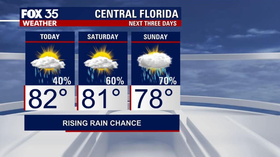
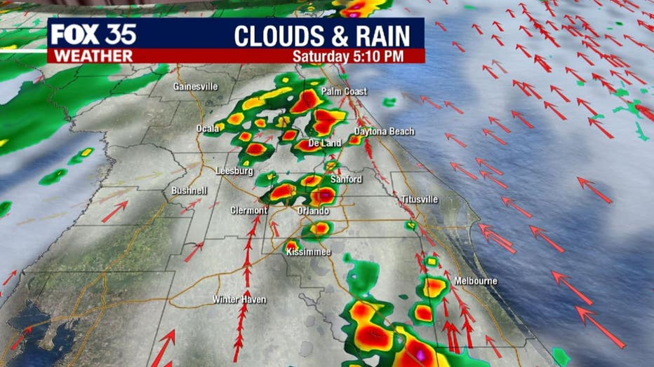
On Saturday, scattered showers and strong thunderstorms will move across Central Florida, mainly after 2 p.m.
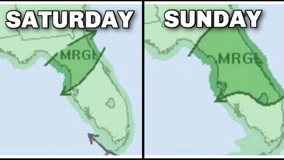
The Storm Prediction Center has put a portion of the viewing area under a "Marginal Risk" of severe weather on Saturday.
The main threat being strong, gusty winds.
That highlighted area for severe weather increases in size on Sunday, encompassing more cities in East Central Florida.
WEATHER ALERTS: Download the FOX 35 Weather App to track the tropics on your phone, receive severe weather alerts, and get the latest daily forecasts
On Sunday, expect mostly cloudy skies, with a high near 76-degrees at the Daytona International Speedway.
Showers and thunderstorms will get an early start, firing up after 8:00 a.m. The chance for rain will remain elevated at 70% through the afternoon. Cross your fingers!
Watch FOX 35 for the latest weather updates.