Orlando weather: Afternoon thunderstorms raise concerns over flooding
WHAT IS THE WEATHER FORECAST FOR TODAY AROUND ORLANDO?
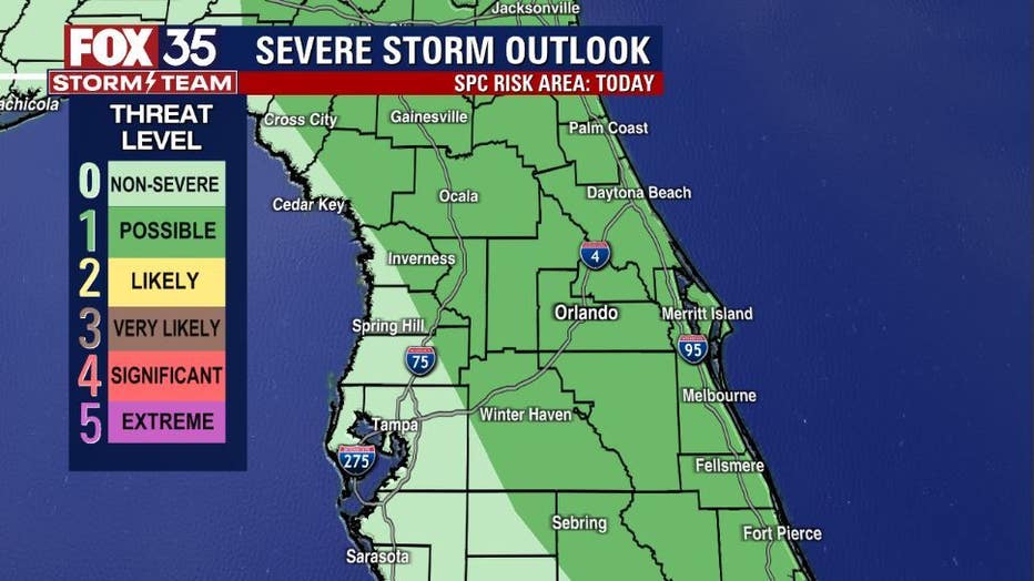
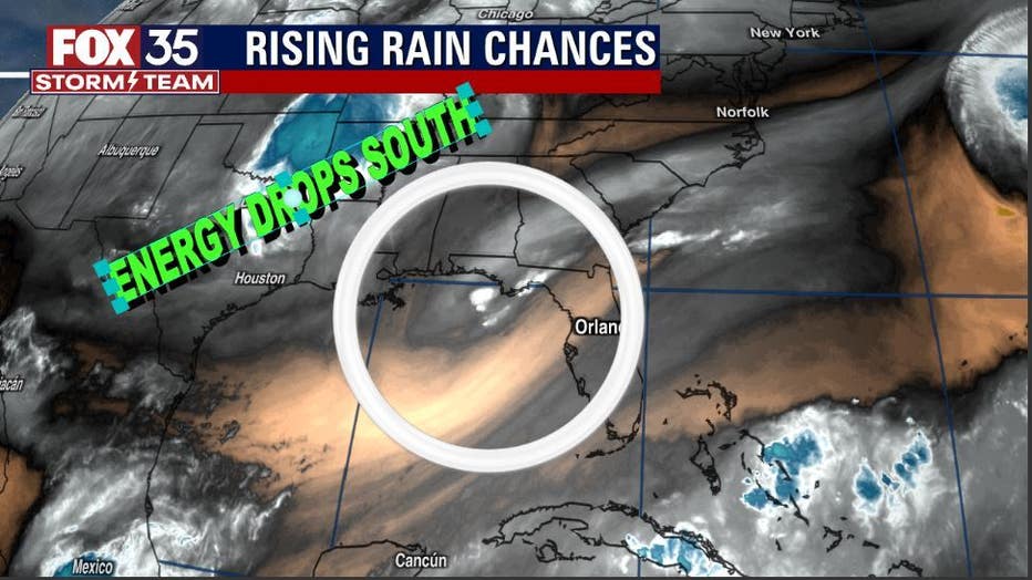
ORLANDO, Fla. - A risk for some strong to severe storms remains in place for the early evening. Local sea breezes, hot temperatures, and approaching energy from the Northeast Gulf have sparked up some afternoon thunderstorms. Chances remain at 60-70% through 6 p.m. Storms ease in coverage and intensity after sundown. Heavy rain, lightning, gusty winds, and even some small hail are all possible. View FOX 35 Storm Tracker Radar in the live stream player above.
Today's forecast high: 93 degrees
Tonight's forecast low: 72 degrees
Main weather concerns: Hot and humid conditions will be the name o' the weather game this Monday. Inland highs park in the low-mid 90s with a heat index near 100 degrees before storms develop. A "LEVEL-1 POSSIBLE" risk for some strong to severe storms later this afternoon and evening. Local sea breezes, hot temps, and approaching energy from the Northeast Gulf will spark up the storms mainly after 2 p.m. this afternoon. Chances remain at 60-70% through 6 p.m. this evening. Storms ease in coverage and intensity after sundown. Heavy rain, lightning, gusty winds, and even some small hail are all possible.
WHAT IS THE WEATHER FORECAST FOR WALT DISNEY WORLD, UNIVERSAL, AND SEAWORLD?
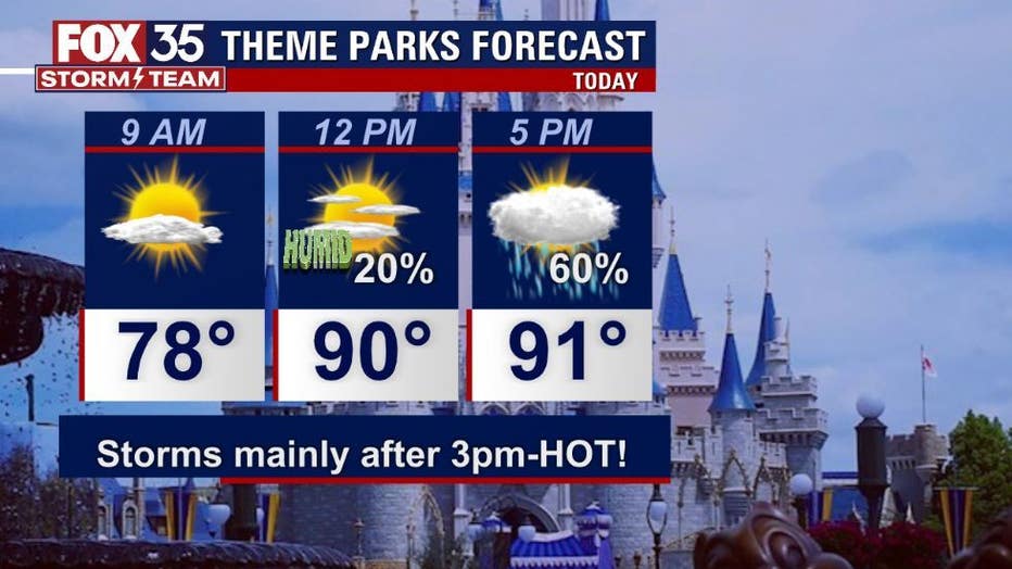
Monday brings early sun to the theme parks. Rain is possible throughout the afternoon, really ramping up late afternoon with chances holding steady through the early evening. Lots of lightning and heavy downpours will be the main hazards.
WHAT IS THE WEATHER FORECAST FOR THE BEACHES IN CENTRAL FLORIDA?
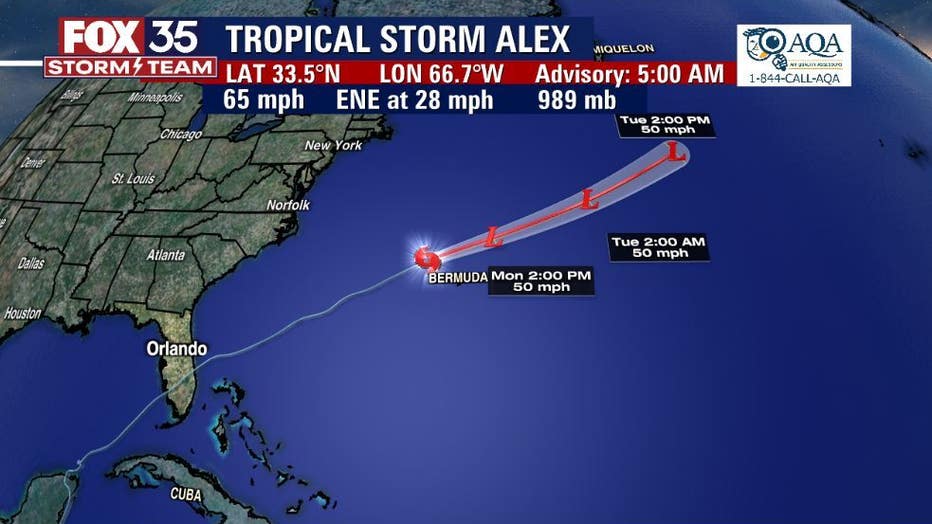
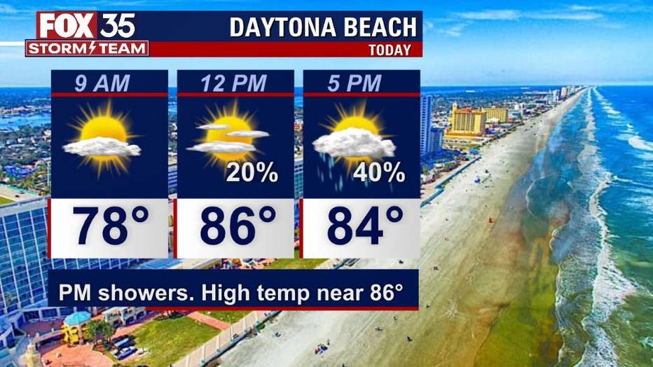
Monday brings decent beach conditions early. Rain chances rise after 12 p.m. or so. Lightning will be the main hazard. Surf is in the 2-3' range as some swell from distant ALEX courses into the coastal waters. Rip current risk remains in the moderate range.
LOOKING AHEAD: Expect more of the same weather for much of the week. Hot and humid with highs in the 90s, lows in the 70s.
Daily rain chances will ebb and flow through the week and will remain dependent on local moisture sources and seabreeze developments.
The tropics remain quiet over the next 5 days, tropical storm development is NOT EXPECTED!