

Orlando weather: Halloween stays mostly dry before heavy rain moves in
Orlando AM Weather Forecast: Few showers possible for Halloween, higher chances Sunday
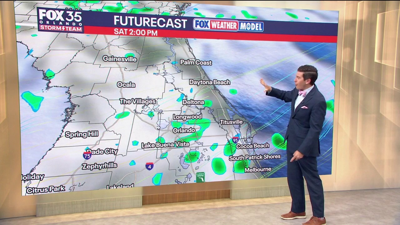
We're kicking off our Halloween Weekend with muggy but bright conditions. Through the day, our chances for showers start to increase, with a few possible for trick-or-treating. By tomorrow, another system moves in. Meteorologist T.J. Springer has the details on that and our next system coming down the pike.
ORLANDO, Fla. - Happy Halloween, Central Florida! The gusty onshore breeze and rough beach conditions are still hanging on as we kick off the weekend.
The stronger easterly wind continues to come in from the Atlantic with high pressure anchored to our north. While this setup keeps a few showers around, drier mid-level air looks to hold strong enough to give us a mainly dry evening for trick-or-treaters.
MOSTLY DRY FOR HALLOWEEN FESTIVITIES, SOAKING RAIN AT TIMES SUNDAY
The north-east to east wind will stay breezy today, blowing at 10–15 mph with coastal gusts up to 20–25 mph. Trapped low-level moisture will push a few fast-moving Atlantic showers onshore, keeping rain chances around 30%.
Most neighborhood trick-or-treating should stay dry, but don't get too used to it. A significant surge of tropical moisture and an upper-level disturbance will swing in from the west on Sunday, driving rain chances up to 80%.
Expect widespread showers and embedded thunderstorms across the peninsula Sunday into Monday, packing efficient downpours that could lead to localized street flooding in low-lying and saturated areas.
WARM AND MUGGY HALLOWEEN, COOLER TEMPS AHEAD
Afternoon highs today will warm into the mid-80s across the Orlando metro, while coastal towns hold around 80° to 82° under the direct ocean breeze. Dew points remain elevated, so it will feel muggy and warm if you're heading out in full costume this evening.
Overnight lows tonight won't offer much relief either, bottoming out in the upper 60s to near 70° across the metro and our NW neighborhoods.
Our coastal locales hold in the low to mid-70s. Once the thick cloud cover and widespread rain arrive on Sunday and Monday, afternoon highs will drop back into the upper 70s to around 80°.
COLD FRONT BRINGS SHOWER & STORM CHANCES THURSDAY
Behind our soggy Sunday and Monday setup, the onshore flow will gradually relax by midweek, but we won't stay completely dry for long. All eyes turn to Thursday and Thursday night as a cold front approaches Central Florida from the NW.
While this boundary will be on a weakening trend as it swings in, it will tap into lingering moisture to drag a thin line of scattered showers and isolated storms across the area. Severe weather potential looks limited with this system, but it will keep rain odds sitting around 30–40% for your Thursday plans.
Cooler and drier air looks to filter in behind the boundary heading into next weekend, but we'll be watching the trends closely.
HAZARDOUS SURF, COASTAL FLOODING, AND CHOPPY SEAS
Marine and coastal hazards remain an issue along the Atlantic coastline. A Small Craft Advisory is in effect across local Atlantic waters as seas run 6 to 9 feet offshore. Coastal Flood Advisories remain posted, with minor saltwater flooding and beach erosion likely around afternoon high tide cycles.
Large breaking waves of 5 to 7 feet and a HIGH risk of life-threatening rip currents will persist through the weekend. Swimming isn't advised, so be careful if you plan on hitting the beach!
The Source: This story was written based on information provided by FOX 35 meteorologist T.J. Springer on October 31, 2026.