

Orlando weather: Summerlike day for Central Florida before cooler weather arrives
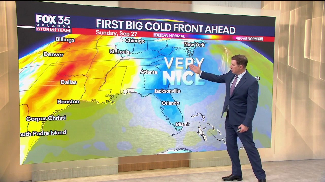
Orlando AM Weather Forecast: Changes on the way
A few more afternoon storms and summerlike temperatures for Central Florida, before a cold front arrives and brings noticeable changes later this week. FOX 35 Storm Team meteorologist Brooks Garner takes a look at the forecast.
ORLANDO, Fla. - We’re heading into a transition week in Central Florida. The next few afternoons stay fairly active, but a front arriving later this week will finally open the door to noticeably drier and more comfortable air this weekend.
Storms stay active through Thursday
Despite it being the first day of fall, we still have plenty of moisture in place, so scattered to numerous showers and thunderstorms will fire up again Tuesday afternoon and evening.
Coverage looks a little higher Wednesday and Thursday, with storms developing along the sea breeze and other leftover boundaries.
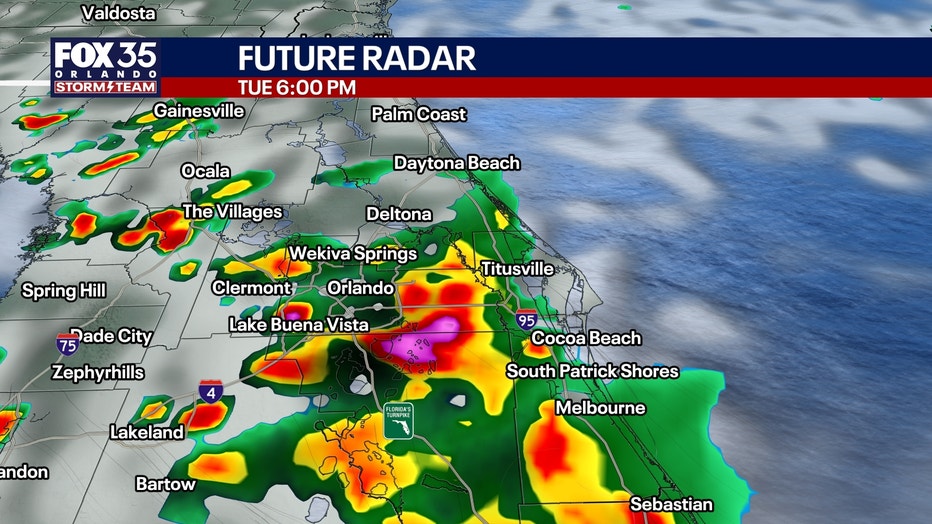
Because winds through the atmosphere are fairly light, some storms may move slowly or repeatedly affect the same area. That could lead to pockets of 1 to 3 inches of rain and some localized street or poor-drainage flooding.
Severe weather is not expected to be widespread, but a stronger storm or two could still bring frequent lightning and wind gusts around 40 to 50 mph.
How hot will it get?:
Highs remain near 90°, with it feeling closer to 100-103° before storms cool things down.
Stronger cold front arrives late week
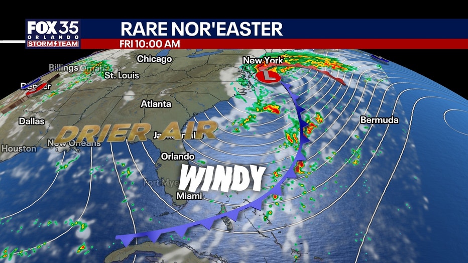
The front begins pushing through Central Florida Thursday marked by gusty winds and scattered showers.
A very rare nor'easter storm system off of New England this weekend will drive this true autumn air farther south than it would normally go.
The bigger change shows up Friday as drier air gradually works south. The winds remain gusty (25-35 mph) and rain chances will begin dropping, as will the humidity.
'Real' fall feel this weekend
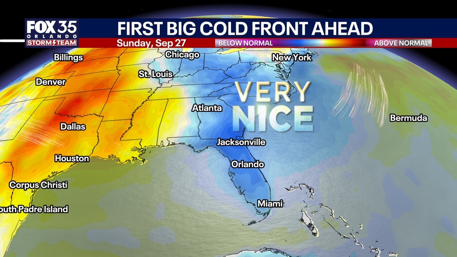
The weekend will bring the most noticeable change: Temperatures will dip to around 60° in the cool spots, with mid-60s elsewhere.
That'll feel great. Highs will reach the mid-80s during the afternoon, but the air should feel much less tropical with much lower humidity.
Rougher conditions at the beach
The stronger north to northeast flow will also make the Atlantic increasingly rough late this week.
Boating conditions deteriorate Thursday and Friday, with winds around 15-25 knots and seas building to roughly 7-10 feet offshore.
Rough surf and elevated seas may linger into Saturday even as rain chances begin coming down.
Tracking the tropics
Tropical Storm Fay is rapidly losing organization in the eastern Atlantic. Thunderstorm activity around the center has collapsed, and Fay is expected to weaken into a remnant system later today before eventually dissipating.
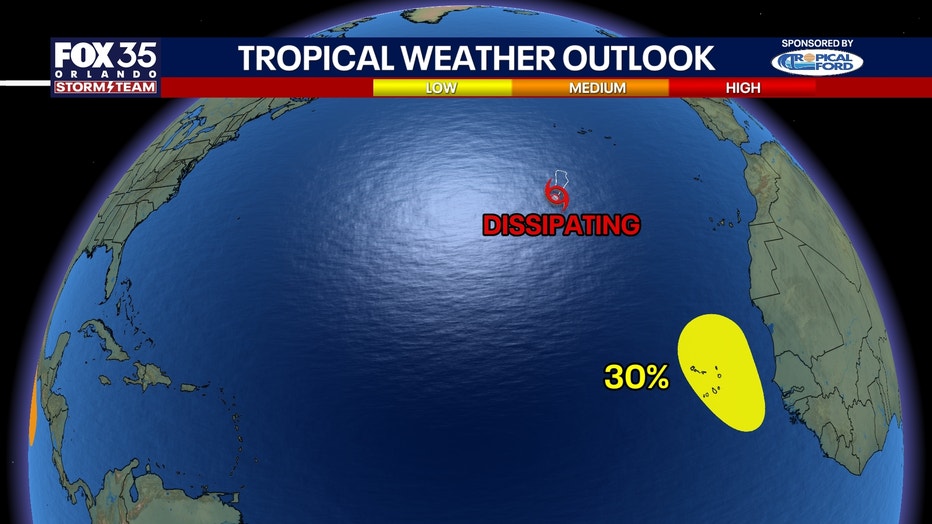
Fay never reached hurricane strength, so the Atlantic’s remarkably long hurricane-free stretch continues.
Another disturbance may try to develop near the Cabo Verde Islands, but any organization would likely be brief and far from Florida.
For now, there are no tropical threats showing up for Florida.
The Source: The information in this story was provided by the FOX 35 Storm Team.