

Orlando weather: Strong winds, some showers continue for Central Florida
Orlando AM Weather Forecast: Some showers and strong winds
Monday will be another windy day for Central Florida. Some showers will also be possible throughout the day. FOX 35 Storm Team meteorologist Brooks Garner takes a look at the forecast.
ORLANDO, Fla. - It will be another windy day for Central Florida, especially near the coast, with northeast gusts of 30-40 mph.
Fast-moving showers will sweep inland from the Atlantic, with the greatest coverage near the beaches. A few heavier squalls could produce gusts of 40-50 mph.
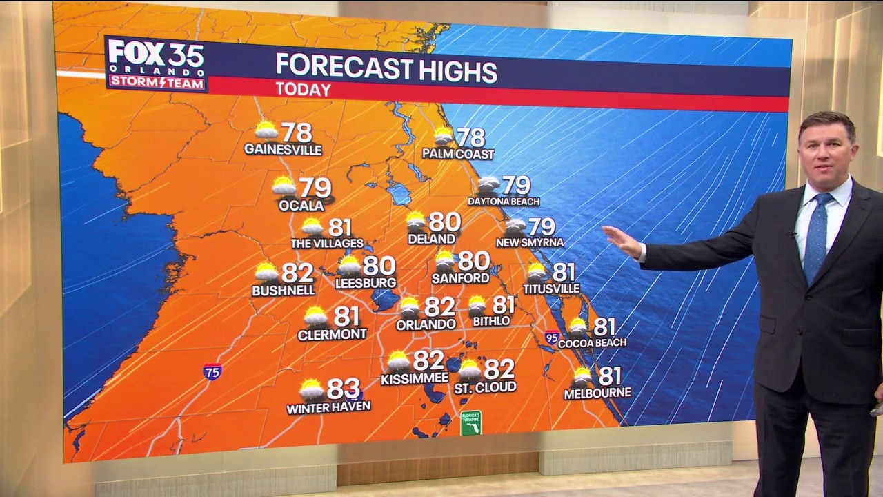
How hot will it get?:
Otherwise, intervals of sunshine with highs near 80° to the lower 80s.
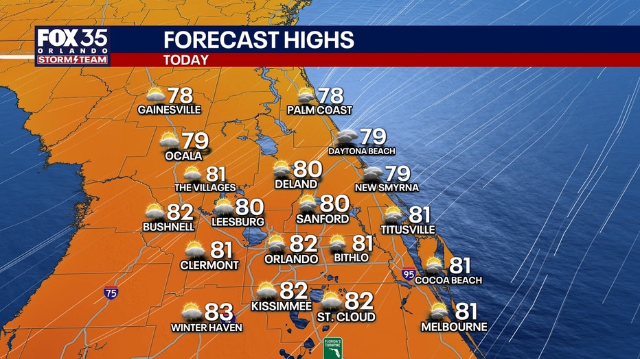
Tuesday: Still breezy, but fewer showers north and west of the Cape. Rain chances remain elevated along the Treasure Coast at 40-70%, compared to 10-30% farther inland and north. Highs near 80° to the lower 80s.
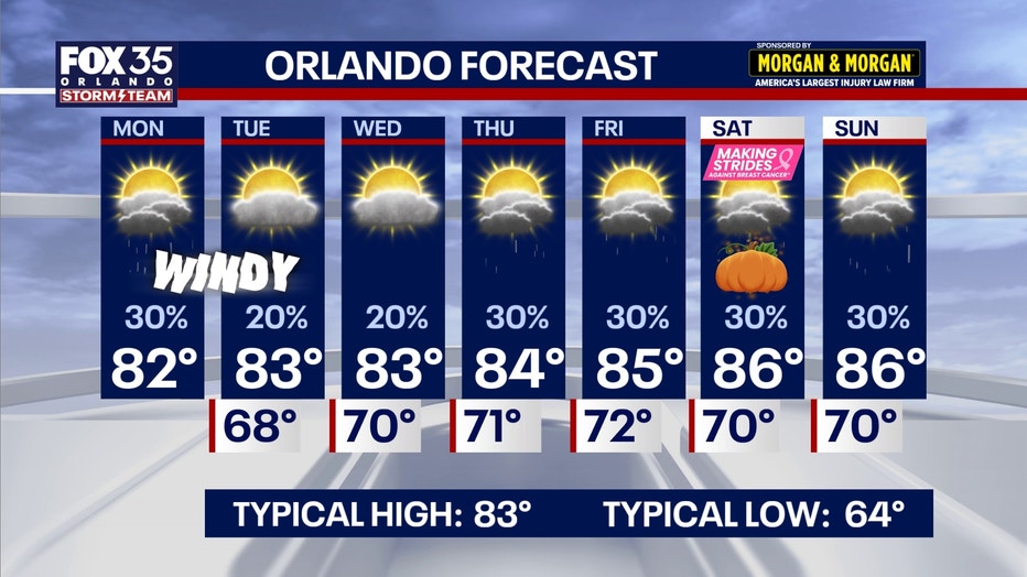
Later this week: Gusty northeast winds continue through Thursday and Friday. Another increase in moisture Wednesday and Thursday will bring more scattered showers, especially from the Cape southward, with an isolated thunderstorm possible. Highs in the lower to middle 80s.
Coastal hazards through midweek
A prolonged period of dangerous beach and boating conditions continues along Florida's Atlantic coast.
Strong northeast winds, powerful surf and astronomical high tides will combine to produce significant erosion and saltwater flooding.
Dangerous surf:
Coastal Flood Warning: Minor to moderate flooding during high tide, particularly along vulnerable beachfront and Intracoastal communities. Low-lying roads, parking lots, docks and yards may flood.
High Surf Advisory: Breaking waves of 7-11 feet will create dangerous shorebreak and a high risk of life-threatening rip currents. Moderate to major beach erosion is possible.
Wind Advisory: Coastal winds of 20-25 mph with frequent gusts of 30-40 mph through 8 PM Monday.
Gale Warning: Northeast winds of 20-30 knots, gusting around 35 knots, with dangerous offshore seas. Small Craft Advisories will likely follow as winds gradually ease.
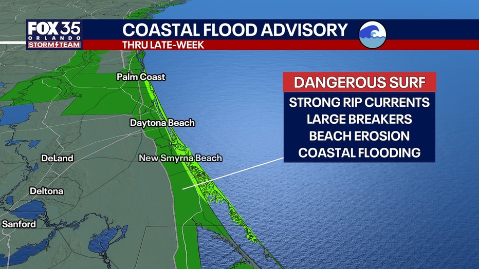
Beachgoers should remain out of the ocean, and recreational boaters should avoid heading offshore. Dangerous conditions will continue even as winds slowly diminish later this week.
Rest of the week
A fresh surge of Atlantic moisture will increase shower coverage across Central Florida.
The best opportunities for rain will generally be near and south of Cape Canaveral, although scattered showers could reach inland communities. A few thunderstorms are possible.
Temperatures remain seasonable to slightly above average.
Friday into Halloween weekend
The persistent onshore flow should gradually weaken as the pressure pattern changes. Highs remain in the lower to middle 80s, with overnight lows in the 60s to lower 70s.
Saturday is Halloween and also features Making Strides Against Breast Cancer events.
Some earlier guidance suggested a possibility of showers Saturday evening, but timing and coverage remain uncertain.
We'll refine the outlook as the week progresses.
Tracking the tropics
No tropical cyclone development is expected across the Atlantic, Caribbean or Gulf over the next seven days.
The low-pressure system responsible for our prolonged coastal weather is not currently expected to develop into a tropical cyclone.
The Source: The information in this story was provided by the FOX 35 Storm Team.