

Orlando weather: Higher rain chances all week in Central Florida
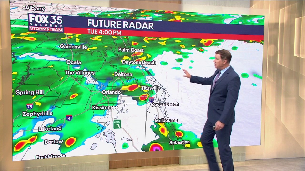
Orlando AM Weather Forecast: Wet weather this week
Central Florida can expect showers and storms this week. FOX 35 Storm Team meteorologist Brooks Garner is tracking the rain.
ORLANDO, Fla. - Mist, drizzle, and a few very light showers are underway this morning across Central Florida.
Timeline:
By late morning, a short break should arrive before the main round of rain moves in after lunchtime.
A few isolated downpours and storms will give way to more scattered to widespread moderate rain by the afternoon commute.
Plan for rain chances to peak at an 80% chance this afternoon and evening.
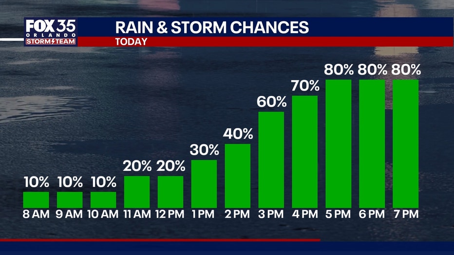
Wet and unsettled week
Additional rounds of heavy rain are on the way for this week, with an 80% chance each day.
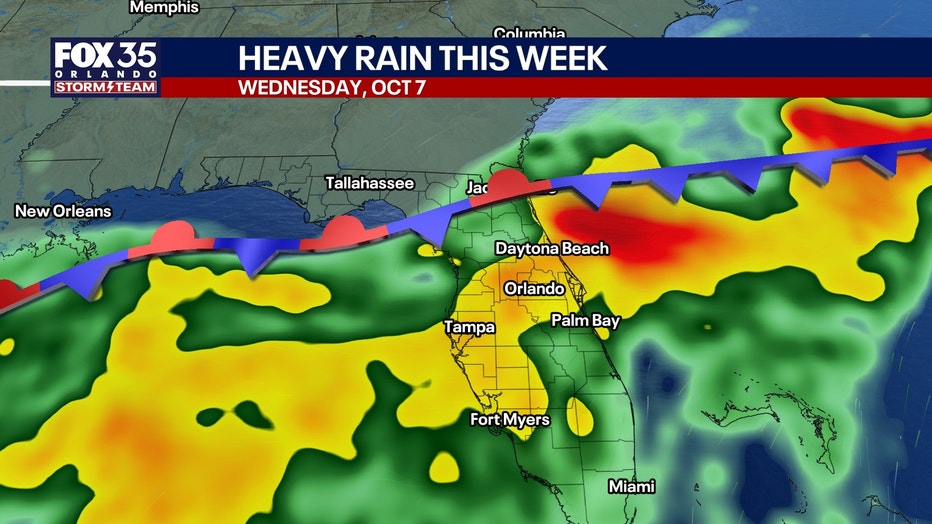
The rain will come in waves, with some mornings experiencing showers.
The heaviest activity still looks to arrive during the afternoon. It won't be a total all day washout all week long as some breaks can be expected.
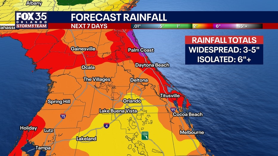
Widespread rainfall totals will range from roughly 3 to 5 inches, with some spots closer to 6" or more.
Minor flooding is possible for low-lying or poor drainage areas. An end to this unusually wet stretch looks to arrive sometime this weekend or into early next week.
Tracking the tropics
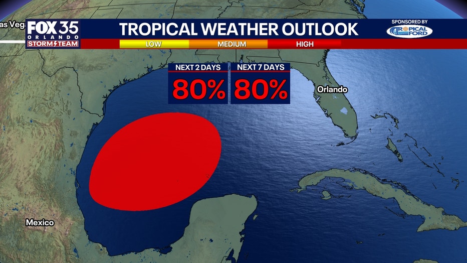
INVEST 92L - An area of low pressure over the Bay of Campeche has a high 80% chance of development over the next two and seven days.
A tropical depression is possible over the next day or two. The future strength and track of this system will depend on where exactly it forms and the speed in which it moves to the north.
Regardless, it's going to move to the east and eventually turn north, where it runs into strong wind shear this weekend and helps limit further development and weakens the system.
It will move towards the northern Gulf Coast, where heavy rain looks to be an impact regardless if a named storm forms or not.
The Source: The information in this story was provided by the FOX 35 Storm Team.