Orlando weather forecast: Storms returns to Central Florida on Thursday

Weather Forecast: September 15, 2022
FOX 35 Storm Team Chief Meteorologist Jayme King has the forecast.
ORLANDO, Fla. - Tonight' low: 74 degrees
Tomorrow's high: 88 degrees
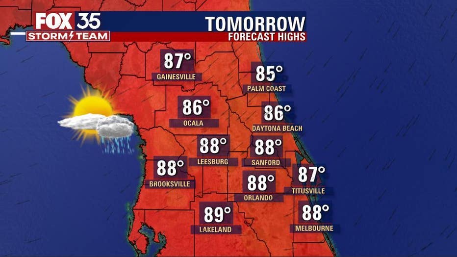
Rain: 80% chance
Main weather concerns:
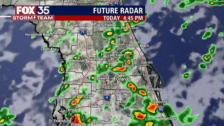
Another round of scattered showers and storms this afternoon. Higher coverage of storms will develop south of Orlando, with the marquee threats being heavy rain, gusty winds, and lightning.
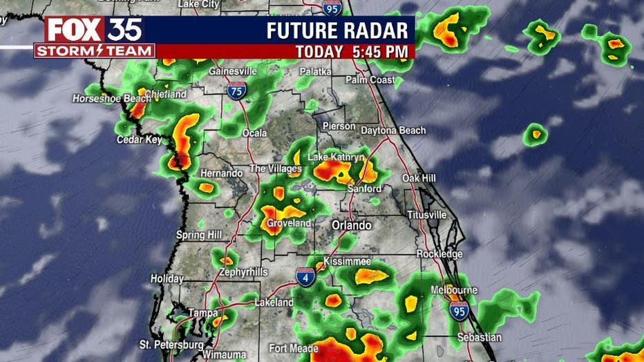
These storms will be slow moving so rain totals between 2-4 inches are expected, even more with stronger storms. Yesterday, places along the space coast received 4-8" of rain, and with the waterlogged storms today, this can lead to localized flooding. Coverage hangs in the 70% range.
BEACHES:
Clouds gradually increase on Friday throughout the day with storm chances increasing after 1 pm. The high temperature will peak in the mid 80s. Risk current risk will be moderate with surf between 2-3 feet. Make sure to swim next to a lifeguard stand.

THEME PARKS:
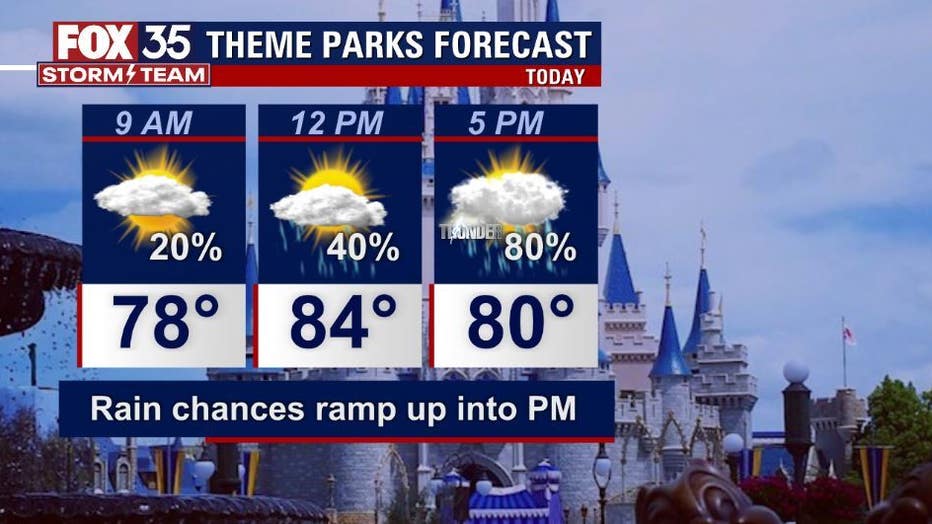
Attractions forecast on Thursday will feature highs in the upper 80s. The clouds and rain will move in increasing coverage to the 80% range in the afternoon. Most of the rain will head out just in time to enjoy the fireworks. Heavy rain and lightning will accompany the stronger storms. Make sure to stay weather aware.
EXTENDED OUTLOOK:
Storm chances stick between 70-80% through the weekend. A front moving south across Florida will keep moisture elevated across the area. It will not be until next week when drier air moves in and our rain chances lower! Keep the umbrella handy and download the FOX 35 Storm Team weather app to stay up to date with the current radar!
TROPICS:
Tropical storm Fiona has max sustained winds at 50 mph and is moving West at 14 mph. As of right now, Fiona is 465 miles east of the Leeward Islands. According to our exclusive FOX MODEL, Fiona will continue its westbound journey toward the Leeward Islands by Friday night, before tracking over toward Puerto Rico and the Virgin Islands this weekend. Tropical storm watches and warnings are in effect for the islands. As of right now, Fiona still will have no impact on Florida. Depend on the FOX 35 STORM TEAM for the latest updates!
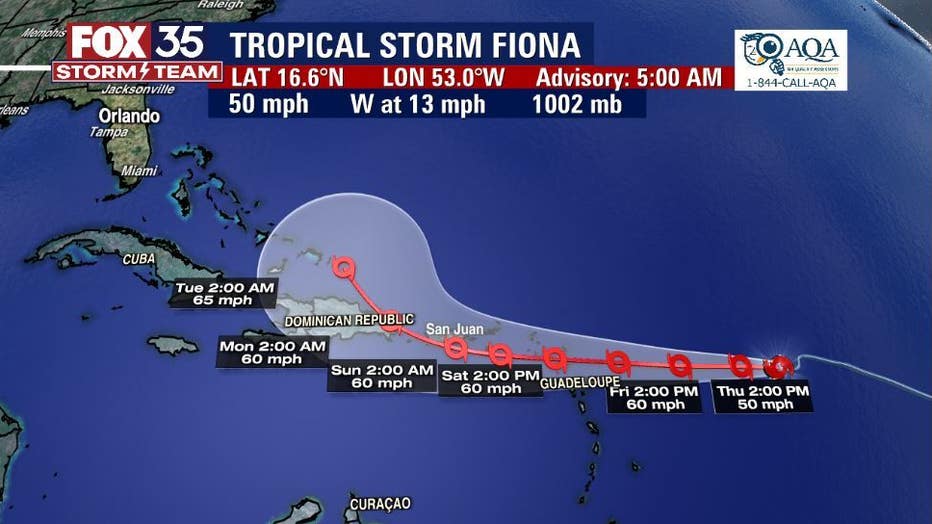
Our EXCLUSIVE FOX MODEL is very much inline with the current FIONA forecast from the NHC. Long term tracking takes FIONA at moderate tropical storm intensity (winds at 60-65mph) across Puerto Rico this weekend and near the Dominican Republic by late weekend into early next week. From there our FOX MODEL takes the system out to sea, well East of the Florida Peninsula. You can depend on the FOX 35 STORM TEAM when it comes to tracking the tropics.
Our FOX MODEL updates through the day and as those updates come in, we will share the latest with you!

