

Orlando weather: Drier air, lower humidity for Central Florida to start the week
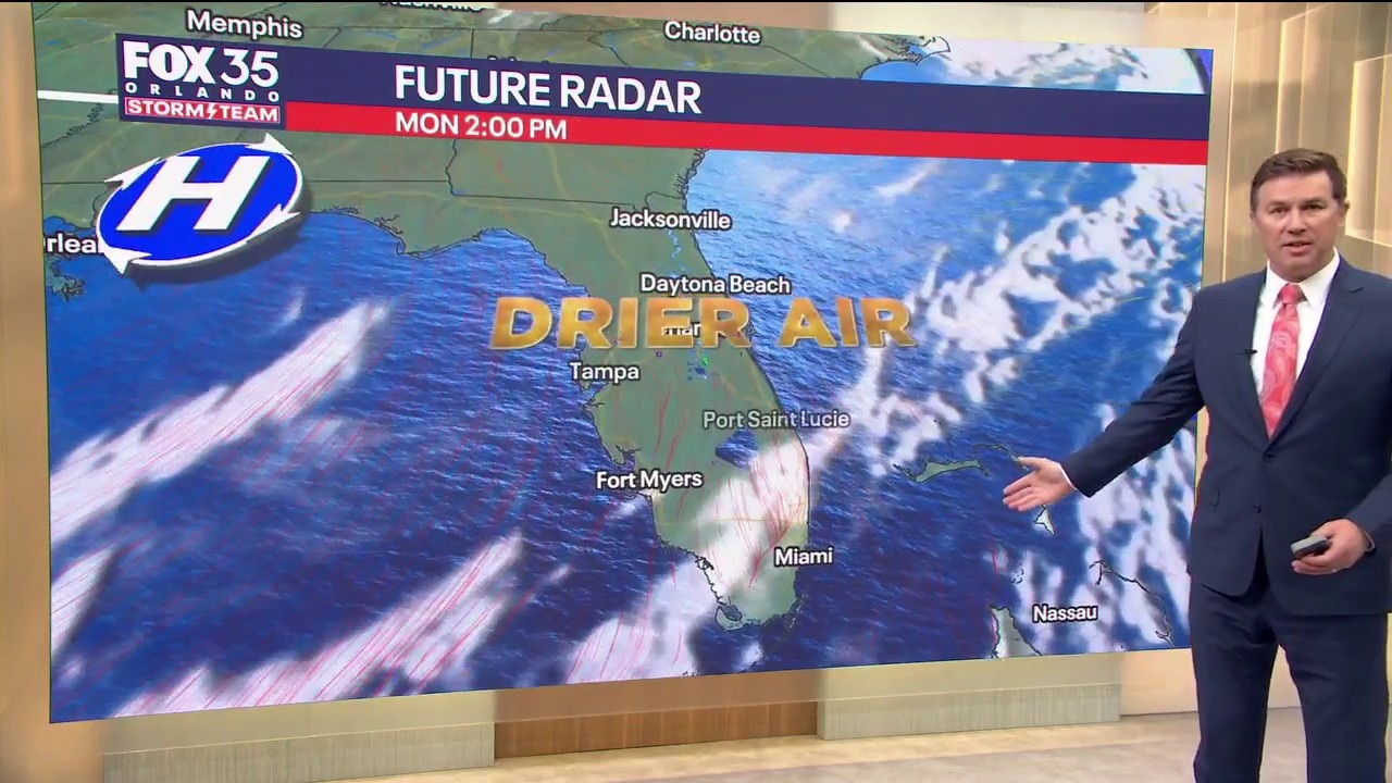
Orlando AM Weather Forecast: Drier air arrives in Central Florida
Rain chances and humidity levels drop as we start the workweek. Cooler and drier air have arrived in Central Florida. FOX 35 Storm Team meteorologist Brooks Garner takes a look at the forecast.
ORLANDO, Fla. - After more than a week of persistent tropical downpours, including rain bands from Hurricane Isaias, Central Florida is finally drying out!
A weak cold front is sliding south through the peninsula today, bringing much-needed sunshine and noticeably lower humidity.
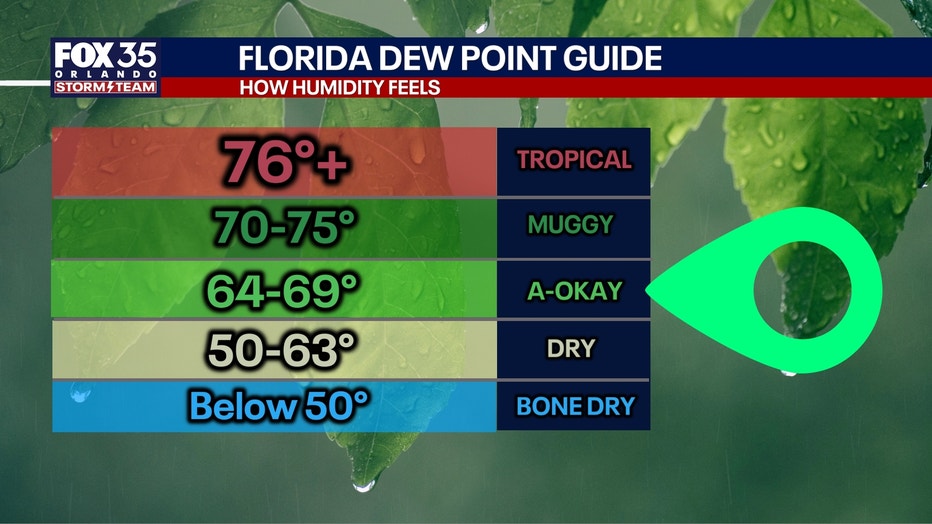
Florida dew points:
Temps in the 80s:
Expect mostly sunny skies across much of the area, with slower clearing along the Treasure Coast.
Highs will reach the middle 80s, but with dew points dropping into the 60s, it will feel much more comfortable outside.
TODAY: One of the nicest days we've seen in quite a while! Orlando should reach around 86° with plenty of sunshine and virtually no rain threat. Tonight, temperatures drop into the middle to upper 60s inland, with lower 70s closer to the coast.
TOMORROW: Tuesday stays warm with highs in the middle to upper 80s. Some clouds will return as winds turn onshore, but rain chances remain very low, around 10% or less.
Rain chances gradually return later this week
The dry weather won't last all week. Moisture will slowly return from the Atlantic beginning Wednesday, bringing increasing opportunities for showers Thursday and Friday.
Thursday's rain chances climb to 30-50%, especially south of Orlando. By Friday, a few afternoon thunderstorms may also develop, with rain chances ranging from around 20% north of Orlando to 60% near Lake Okeechobee.
Another front this weekend
A second cold front is forecast to reach Central Florida Saturday, potentially bringing another round of showers and thunderstorms.
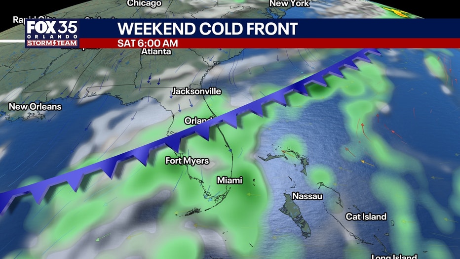
This front may have difficulty pushing much drier air south of I-4. Behind it, strong high pressure building to our north could create a windy onshore flow Sunday into Monday.
That could mean gusty showers moving in from the Atlantic, along with increasingly hazardous beach and boating conditions.
Temperatures may also turn a little cooler by Sunday, with highs potentially dropping into the upper 70s north of Orlando.
Beach and boating conditions
A moderate risk of dangerous rip currents continues at Central Florida's Atlantic beaches today.
Swim near a lifeguard. Otherwise, boating conditions should remain generally favorable through Friday, with northwest winds around 10-15 knots today becoming northeasterly Tuesday and easterly by midweek.
Tracking the tropics
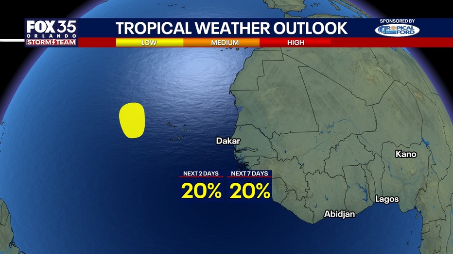
Isaias has moved away from Florida, and its direct impacts on Central Florida are over.
The previously identified tropical wave in the far eastern Atlantic remains something to monitor but is not threat to the USA.
The Source: The information in this story was provided by the FOX 35 Storm Team.