

Orlando weather: Heavy rain, flooding concerns for Central Florida on Thursday
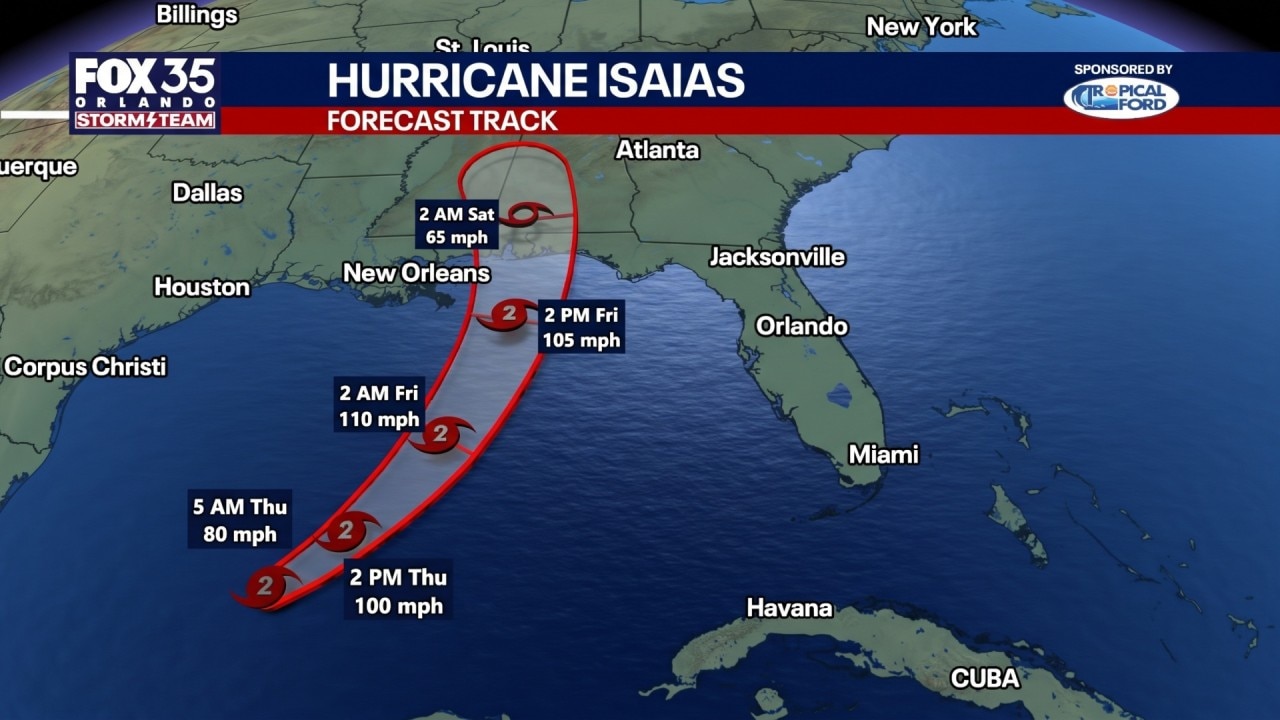
Tropics forecast: Isaias strengthens into Cat 2 hurricane, targeting northern Gulf Coast
Hurricane Isaias strengthened Thursday as it moved toward the U.S. Gulf Coast, with Hurricane Hunters finding that maximum sustained winds had increased to 100 mph.
ORLANDO, Fla. - The FOX 35 Storm Team is tracking widespread showers and storms across Central Florida on Thursday evening, which could lead to flash flooding in some areas.
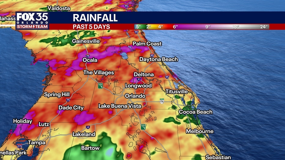
Rainfall totals: How much are we expecting?
By the numbers:
Between 2–4 inches of rain are forecast, while some areas could see between 5–7 inches of rain, according to forecasts.
Due to the higher rainfall projections, there are concerns for flash flooding as the ground is already saturated following several days of rain.
Flood watch, flood warnings issued
Local perspective:
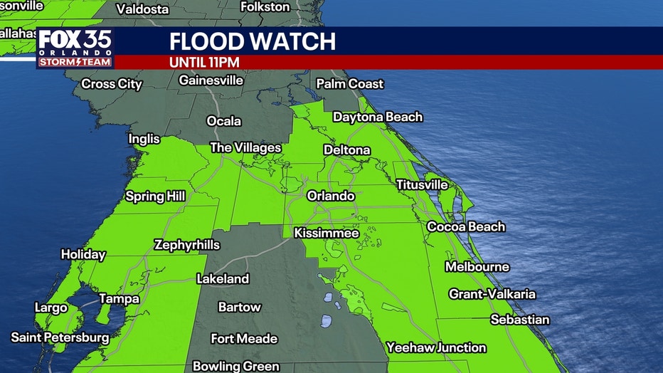
A flood watch has been issued until 11 p.m. for several counties in Central Florida, and for counties along the Gulf and Atlantic coasts, due to the excessive rainfall expected. There is also concern that runoff could lead to flooding of rivers, creeks, and streams, particularly in low-lying areas.
What counties are under a flood watch in Central Florida? Brevard, Flagler, Lake, Marion, Orange, Osceola, Seminole, Sumter, and Volusia.
Rivers rising across Central Florida
Flood warnings remained in effect Thursday evening for parts of Central Florida after heavy rain pushed rivers higher, threatening roads, homes, docks and boat ramps.
The St. Johns River near Astor continued rising Thursday, with moderate flooding expected in parts of Lake and Volusia counties. The National Weather Service said the river was at 2.9 feet Thursday morning and was expected to reach about 3 feet just after midnight before remaining near that level through the weekend.
At that level, water could approach or enter some of the lowest homes near Wildhog Road and McPherson Lane. Portions of Alligator Road and Holiday Road could flood, along with the Juno Trail Apartments parking lot, Astor Landing Campground and the Lake Dexter Boat Ramp.
The Withlacoochee River at U.S. 41 in Dunnellon also remained under a flood warning affecting Marion, Citrus and Levy counties.
The river was at 28.5 feet late Thursday morning, above the 28.2-foot flood level. Docks and boat ramps along the river could flood. Water levels are expected to slowly fall over the next several days but remain high.
Officials urged drivers to avoid flooded roads and never drive around barricades or through standing water.
Rain continues Friday and Saturday
Friday should offer more breaks between showers as our stalled front begins lifting northward, partly influenced by Hurricane Isaias moving through the Gulf.
Rain chances remain elevated at 60 to 80%, although Friday may bring a few more opportunities for sunshine.
Saturday turns stormier again as deep tropical moisture returns. Widespread afternoon and evening thunderstorms are expected, with another 1 to 3" of rain possible. A few stronger storms could produce wind gusts around 45 mph.
It will also become breezy Saturday, with southerly wind gusts of 20 to 25 mph outside thunderstorms.
Improving weather Sunday and into next week
Sunday will still feature scattered showers and storms, but increasing breaks in the clouds should allow temperatures to climb into the upper 80s and lower 90s.
A weak front moves through Monday, followed by noticeably drier air Tuesday and Wednesday.
Rain chances drop to 0% or less by midweek, humidity levels fall, and overnight temperatures could return to the 60s.
After this prolonged stretch of tropical humidity and rain, some much more comfortable weather is finally on the horizon.
Tracking the tropics: Hurricane Isaias
Isaias strengthened into a Category 2 hurricane early Thursday evening.
This is the latest hurricane to ever form during the Atlantic season, which runs from June through November. Weather satellites have monitored the entire ocean since the mid-1960s.
The hurricane will continue to intensify over the Gulf.
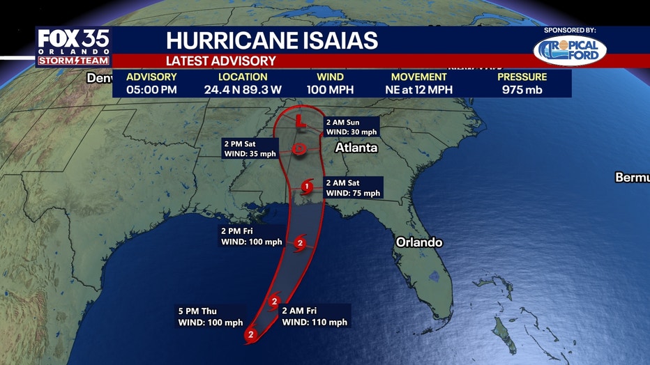
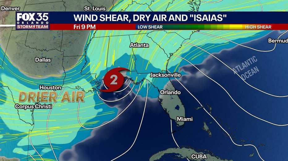
A Hurricane Hunter aircraft found an increasingly organized circulation despite moderate westerly wind shear.
Very warm Gulf waters near 86°F and ample moisture are helping the hurricane strengthen.
The NHC now forecasts Isaias to reach 110 mph Friday morning, just below Category 3 intensity, before stronger wind shear of 40 to 50 knots begins weakening the storm as it approaches landfall.
However, weakening winds near the center will not eliminate the danger. The hurricane's wind field may expand significantly, spreading damaging winds over a larger area and ushering in a large swatch of storm surge.
Landfall late Friday:
The latest NHC forecast continues to bring Isaias into the northern Gulf Coast late Friday night or early Saturday, with the greatest hurricane wind threat across southern Mississippi, southern Alabama and the western Florida Panhandle.
Inland impacts this weekend:
After landfall, Isaias will interact with an approaching upper-level trough and transition into a powerful post-tropical system.
Heavy rain, gusty winds and a risk of isolated tornadoes could spread inland across portions of Alabama, Georgia, Tennessee and surrounding southeastern states.
The remnant circulation may slow and become incorporated into a strong upper-level low over the Tennessee Valley.
For Central Florida, the greatest direct hurricane impacts remain well to our northwest.
Our primary weather concern continues to be repeated heavy rainfall and thunderstorms through Saturday, followed by improving conditions early next week.
The Source: The information in this story was provided by the FOX 35 Storm Team.