

Orlando weather: Spotty showers tonight; storms increase Sunday with cooler air by Tuesday
Orlando PM Weather: Tracking another cold front, big cool-down on the way
One cold front has moved through and another one is on the way. Meteorologist Laurel Blanchard talks about our Spring Break forecast and when rain chances go back up. Tune in to see that and when our temps tumble once again.
ORLANDO, Fla. - Mostly cloudy skies are expected through the rest of the evening.
Winds that shifted yesterday are now blowing directly onshore along the east coast, which could spark a few spotty showers this evening. S
Weekend forecast
What To Expect:
Skies will remain partly to mostly cloudy overnight, with lows falling into the upper 50s and low 60s.

As the onshore flow continues Saturday, more moisture will be transported into the atmosphere. That'll help keep the chance of a few showers in the forecast. It won't be a washout with rain chances around 20%.

Highs look to warm back up into the lower 80s under a mix of clouds and sun. It'll be muggier overnight Saturday with lows in the middle 60s.


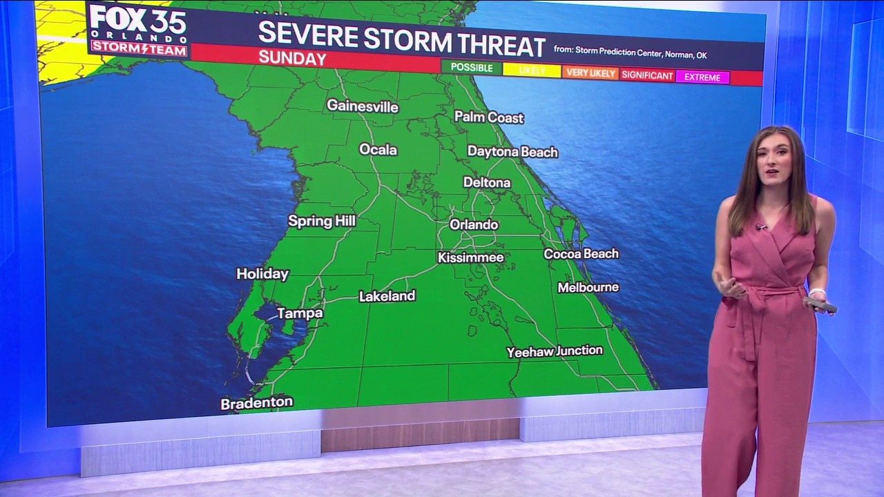
A cold front that moved through Thursday is expected to lift northward across the state as a warm front.
That boundary, combined with sea breeze activity, will help produce scattered showers and thunderstorms. Rain coverage is expected to be more widespread than earlier in the weekend, though timing will be key.

Morning plans and activities later in the evening should be largely unaffected, but showers and storms are most likely during the afternoon and early evening. Highs will reach the low 80s.
The main threats include gusty winds, heavy downpours and occasional thunder.
Cloudy, breezy start to next week
Looking Ahead:
Monday will begin partly cloudy and breezy. Another cold front is forecast to move through later in the day, bringing rain Monday evening into early Tuesday morning.

Behind the front, a more noticeable cooldown is expected. As people prepare for St. Patrick’s Day, temperatures will drop from the 80s into the 60s by Tuesday, meaning an extra layer may be needed.

By the time the rain ends, some areas could receive up to about 3 inches of rainfall, depending on where the heaviest showers develop.

If you're getting out and about, highs for St. Patrick's drop back into the upper 50s and lower 60s. That'll be around 15° colder than average for this time of year.

Temperatures stay cooler than average into the middle part of next week with highs Wednesday near 70°.
There are some signals that an area of low pressure spins up and tries to bring a little more rain on Wednesday, but chances are slim, around 20%.
The Source: This story was written with information from the FOX 35 Storm Team.