

Orlando weather: Rare June cooldown settles into Central Florida
Orlando Weather Forecast: Big drop in humidity on the way
FOX 35 Storm Team Senior Meteorologist Noah Bergren is tracking lower humidity and comfortable temperatures heading into the weekend.
ORLANDO, Fla. - A stretch of unusually dry and comfortable weather is expected across Central Florida through the weekend as northeast winds usher in lower humidity and cooler-than-normal temperatures for early June.
Winds will increase from the northeast Wednesday evening and continue overnight, with speeds of 15 to 25 mph.
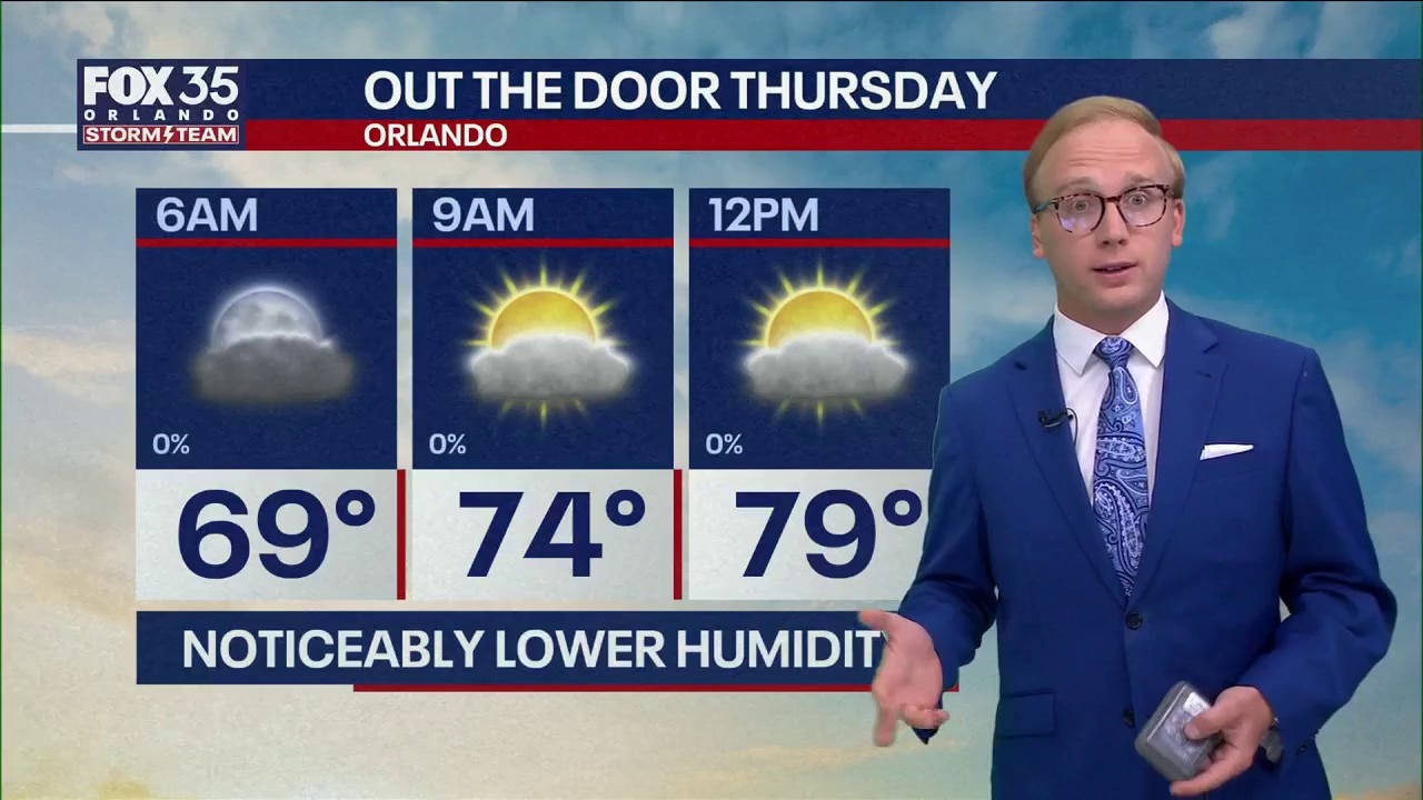
Thursday forecast for Orlando
What To Expect:
Skies are expected to gradually clear overnight as humidity levels drop significantly. Low temperatures will drop into the 60s over most of the region.

Thursday afternoon will be sunny and breezy, with northeast wind gusts reaching 25 to 30 mph at times.

Afternoon highs are forecast to remain in the mid-80s, creating conditions more typical of April than June.

High rip current risk
According to an advisory from the National Weather Service, the Atlantic Coast has a high rip current risk. With the coastline indicated in red, officials are asking beach goers to exercise safety and know how to identify and how to swim in a rip current.

Rip currents risks along Florida Atlantic coast
A beach alert is in effect for coastal towns in Flagler and Volusia counties. The National Weather Service reported a high rip tide risk along the Florida coast from Jacksonville to Boca Raton. FOX 35's Jessica Dobson informs how to stay safe at the beach.
Dry, cooler air sticks around
Looking Ahead:
Dry weather is expected to continue through Friday and Saturday. High temperatures will range from the mid- to upper 80s, while humidity levels remain well below normal for this time of year. Rain chances are expected to remain near zero through Saturday.

The pattern is expected to shift by Sunday as warmer, more humid air returns to the region. Forecasters are calling for a slight chance of afternoon showers, with rain chances increasing next week.
Temperatures are expected to climb back into the 90s beginning Monday and continuing through at least the middle of next week. Daily afternoon showers and thunderstorms are also expected to become more common.
Tracking the Tropics
In the tropics, forecasters are not monitoring any areas for tropical development over the next seven days.
A non-tropical area of low pressure is expected to form in the central Gulf of Mexico and move toward Louisiana from Thursday into Friday. The system could bring gusty winds and minor coastal flooding to parts of the Gulf Coast. While the low may briefly acquire some tropical characteristics, forecasters do not expect it to become a named storm.

We'll bounce back into the upper 80s and low 90s for this weekend. As humidity levels build back into the region, so will our rain and storm chances next week.
The Source: Information in this story was gathered from FOX 35's Noah Bergren.