

NHC: Tropical Storm Dolly remnants could bring heavy rain to Florida
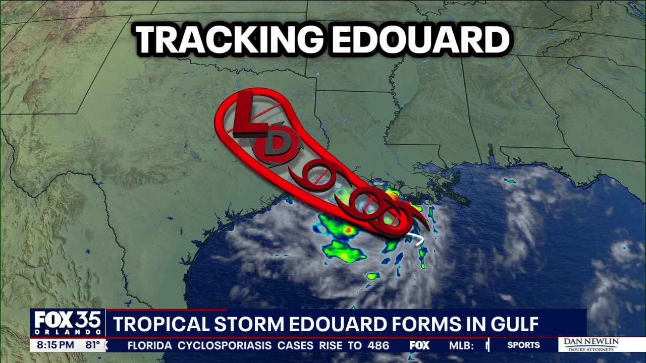
Tropics forecast: Tropical Storm Edouard form in Gulf
Tropical Storm Edouard formed in the Gulf on Monday evening and is expected to strengthen before reaching the Texas coast Tuesday, bringing heavy rain, flooding and dangerous coastal conditions.
The National Hurricane Center has dropped development chances tied to the remnants of Tropical Storm Dolly to zero. However, the increase in tropical moisture is expected to bring increased rain chances to parts of Florida this week.
Tropical Storm Edouard has formed in the northern Gulf, near Texas and Louisiana. It is expected to become Tropical Storm Edouard by Monday night, becoming the fifth named storm of the 2026 Atlantic Hurricane season.
Dolly less likely to redevelop, NHC says, but more rain on the way
What we know:
Remnants from Tropical Storm Dolly are not expected to redevelop. The NHC dropped the development chances to 0% during its 5 p.m. update on Monday.
It's producing showers and thunderstorms over portions of Hispaniola and the Caribbean. For Florida, the increase in tropical moisture is expected to increase rain chances.
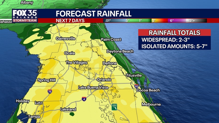
How much rain could hit Florida?
According to forecast models, more than 2" of rain could fall over the next week in parts of Orlando and Tampa.
Will Tropical Storm Edouard form near Louisiana, Texas?
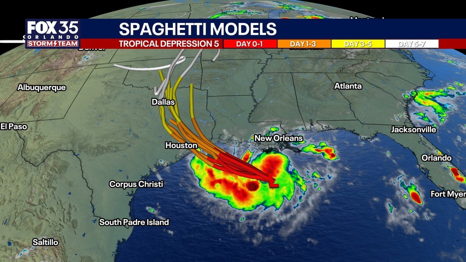
Tropical Storm Edouard, formerly known as Tropical Depression 5, Potential Tropical Cyclone 5 and Invest 97L, has formed in the Gulf, near the coasts of Texas and Louisiana. It's expected to become Tropical Storm Edouard by Monday night, the NHC said.
"Some strengthening is expected during the next day or so, and the system is forecast to become a tropical storm by tonight," the NHC said.
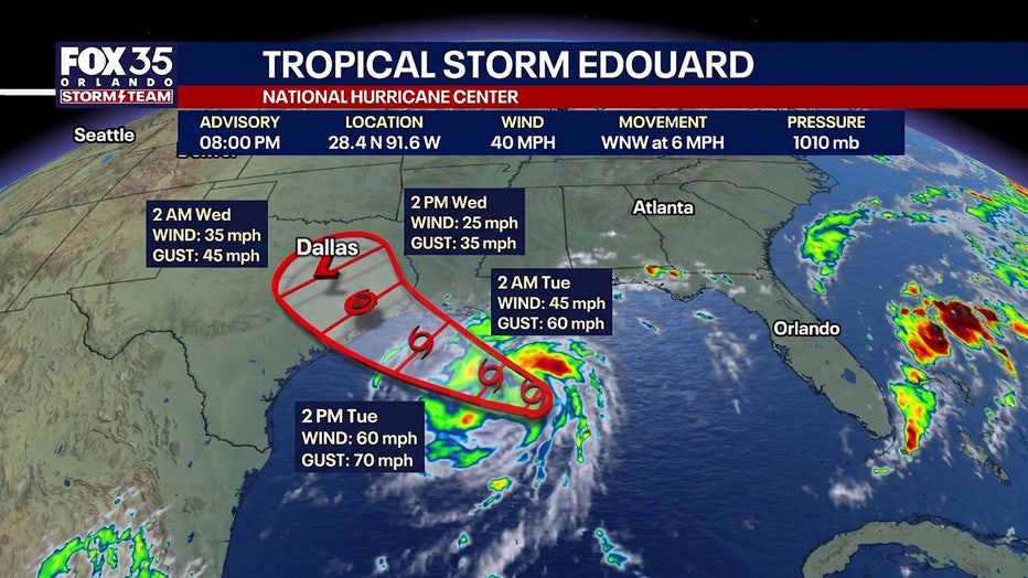
Tropical storm warnings have been issued for parts of Louisiana and Texas.
When does hurricane season end?
The Atlantic hurricane season runs every year for six months from June 1–November 30.
The most active months are typically between August, September, and October. The Atlantic season actually has two peaks: mid-September and mid-October, though activity tends to drop quickly after the second peak.
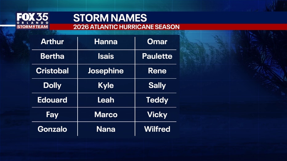
2026 Atlantic hurricane season storm names
There are 21 storm names issued for every hurricane season – and those names rotate every six years, unless retired.
So far, there have been four named tropical storms during the 2026 Atlantic hurricane season: Arthur, Bertha, Cristobal, and Dolly, all of which have been short-lived storms.
Forecasters are tracking Potential Tropical Cyclone Five (PTC-5) to see if it becomes a tropical storm, which would then be known as Tropical Storm Edouard, the fifth named storm of the season.
Who picks the hurricane storm names?
The hurricane storm names are decided by an international body of forecasters and the World Meteorological Organization. They are used to help meteorologists, forecasters, journalists, and the public communicate warnings and updates about a specific storm.
"Assigning names to tropical cyclones makes tracking and discussing specific storms more straightforward, especially when multiple storms are active simultaneously. Naming also helps to avoid confusion among meteorologists, media, emergency management agencies and the public," the WMO said on its website.
There are four factors considered when coming up with the names:
- Short in character length for ease of use in communication
- Easy to pronounce
- Appropriate significance in different languages
- Uniqueness – same names cannot be used in other regions.
The Source: The information in this article is from the FOX 35 Storm Team and the National Hurricane Center.
e