

Central Florida severe weather: Multi-day chance for storms, winds, tornadoes and hail
ORLANDO, Fla. - A period of unusually active weather will start Thursday and end next Monday in Central Florida. This means there are multiple chances for showers, storms and severe weather.
Here's what you need to know to prepare.
When will the severe weather start?
What we know:
These storms will form from a system passing over Florida and could produce damaging winds, large hail and torrential rains. There is also a small chance of a tornado.
Storms moved in on Thursday evening. On Friday, the weather pattern features more of the same, with more afternoon thunderstorms likely as daytime heating interacts with lingering moisture.
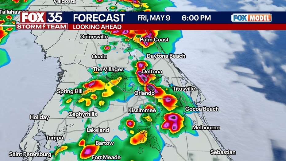
Storms are expected to arrive a tad earlier, about 2 p.m., and will last later, going to about 9 p.m. Hail, wind and lightning are all likely from any storm.
Will the severe weather impact Mother's Day weekend?
Timeline:
A low pressure system will form on Saturday and Sunday in the gulf and will spread showers and storms into Florida from the southwest to the northeast.
Most of the activity will be on the West Coast and Florida Panhandle for the two days, but a few thunderstorms will be possible each day for Mother's Day weekend.
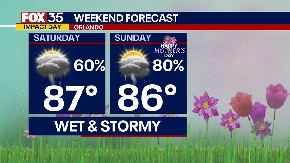
The timing of the storms will be any part of both these days, but not be quite as intense as Thursday and Friday.
Will the severe weather continue next week?
What's next:
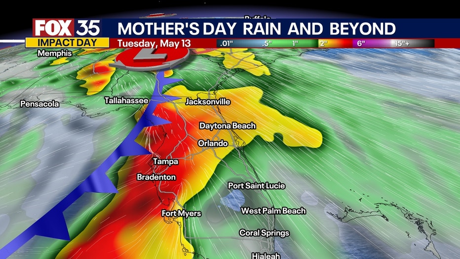
We will be watching a strong front late on Monday coming across Florida.
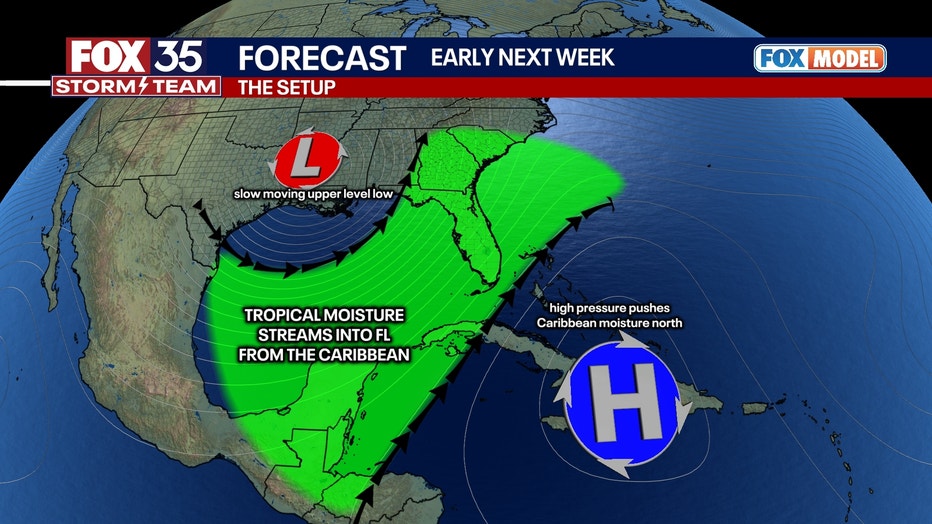
Strong wind fields will be present in the atmosphere, including tropical moisture. A lot of rain is likely, with severe weather a distinct possibility. Some tornadoes are possible in this setup because of the strong upper-level winds.
The timing looks to be late afternoon, evening, and even overnight for rain and storms.
STAY CONNECTED WITH FOX 35 ORLANDO:
- Download the FOX Local app for breaking news alerts, the latest news headlines
- Download the FOX 35 Storm Team Weather app for weather alerts & radar
- Sign up for FOX 35's daily newsletter for the latest morning headlines
- FOX Local: Stream FOX 35 newscasts, FOX 35 News+, Central Florida Eats on your smart TV
The Source: This story was written based on information shared by the FOX 35 Storm Team.