

Warm weather pattern continues
ORLANDO, Fla. - Unseasonably warm temperatures continue on Monday, thanks to a ridge of high pressure anchored over the Atlantic Ocean.
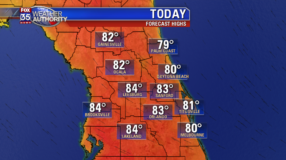
After some morning clouds and patchy fog, expect mostly sunny skies and afternoon high temperatures near 84 degrees.
Winds will be out of the east southeast at 5-10mph.
On Tuesday, expect a few onshore moving showers, but the remainder of the work week will be mostly dry.
Near record warmth will persist, with afternoon high temperatures climbing into the low-to-mid 80s and overnight lows in the 60s.
A front moves over Central Florida on Friday, which will help generate isolated showers, mainly over the East Coast.
Temperatures will drop a bit, with highs in the mid-to-upper 70s along the coast, and in the upper 70s inland.