

Orlando weather: Scattered storms, rainy stretch ahead before drier days arrive
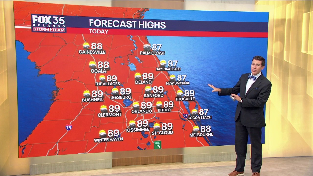
Orlando AM Weather Forecast: Hit or miss storms today, especially east of Orlando
Our unsettled pattern is holding with scattered storms on tap once again. Meteorologist T.J. Springer has the timeline and lets us know when we get in on a cool down.
ORLANDO, Fla. - A weak cold front is dropping into North-Central Florida today and that, as well as the sea-breeze this afternoon, will aid in igniting showers and storms.
With the dominant westerly wind, rain chances will favor our East Coast beaches versus our western neighborhoods. Activity will be more isolated the farther north and west you travel from Orlando.
There's still tons of moisture in the air which will result in torrential rain and gusty wind in the strongest of storms. Temps stay seasonable, topping out in the upper 80s to lower 90s.
When you factor in the humidity, it'll feel like the middle to upper 90s. Any showers and storms fade away through the early part of tonight with lows dipping only into the lower to middle 70s.
What will the weather look like tomorrow?
What to Expect:
Our unsettled pattern holds into the start of the workweek, but it won't be a washout. Once again, we'll be watching the sea breeze attempting to come in from the East Coast, but the westerly wind will keep it pinned near the coast.
Some upstairs energy in the atmosphere dips our way and that lift should help ignite some storms too.
Overall, the activity will be scattered in nature but favoring all the FOX 35 Viewing Area, compared to more of our eastern locales. Highs stay warm, rising into the upper 80s. Overnight, it'll be mainly dry with lows in the lower to middle 70s.
Looking ahead
What to Expect:
Another disturbance begins to work toward us on Tuesday, that, as well as this slow-moving front, will make for numerous more showers and storms. Rain chances jump up to around 60%.
Heavy rain and gusty wind are the main concern when any stronger storms get going. Highs stay near normal, rising to near 90°. A secondary cold front begins to drop in on Wednesday and this will keep our chances of rain elevated, but it won't be a washout.
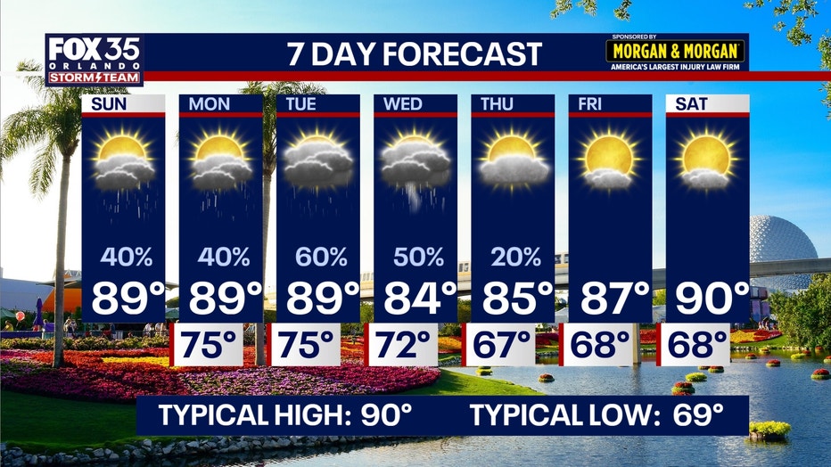
Hit-or-miss showers and storms are on the table as this front shifts southward.
With that, drier and less humid air begins to take over Thursday into Friday, with temps only rising into the middle to upper 80s. A couple showers or storms are possible on Thursday, but it's looking much drier as the workweek winds to a close.
High pressure builds in and conditions are looking bright and dry to kick off next weekend. Highs look to rise to around 90°.
The Source: This story was written based on information provided by FOX 35 meteorologist T.J. Springer on May 31, 2026.