

Tracking the Tropics: National Hurricane Center monitors 20% development chance off Florida coast
Tracking the Tropics: 20% chance of development. Will Bertha form?
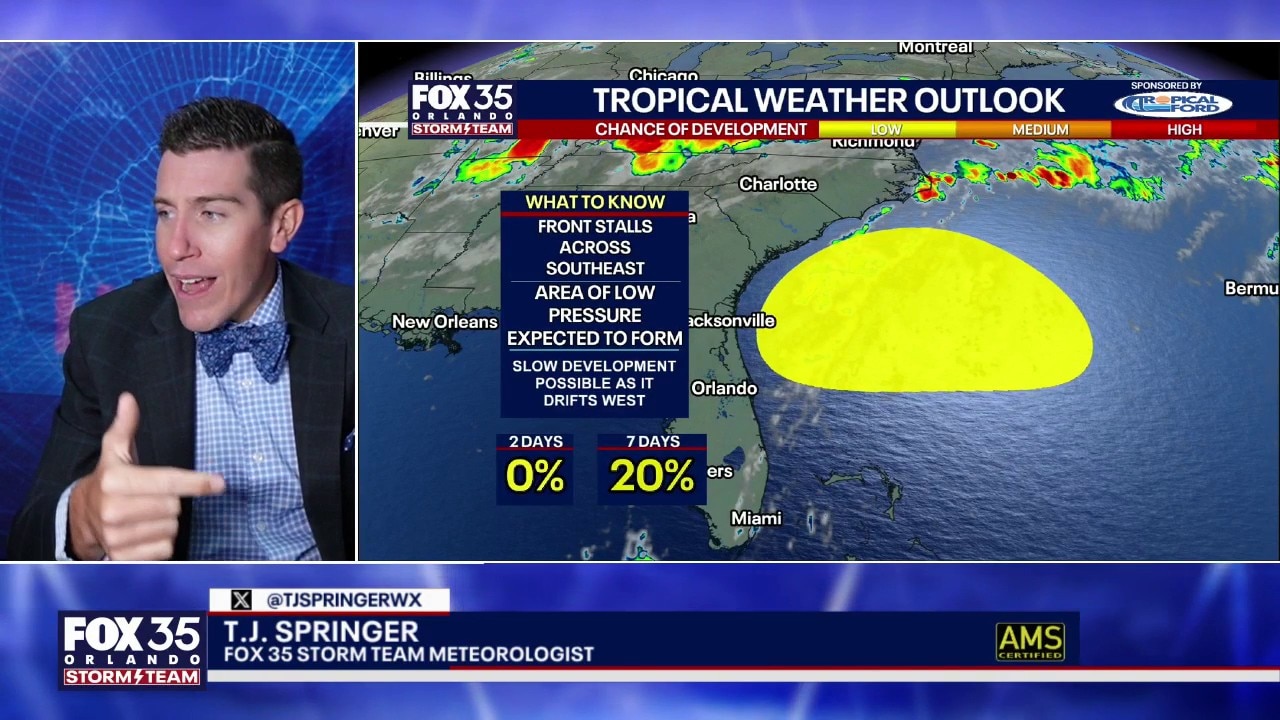
The National Hurricane Center has designated a low 20% chance for gradual tropical development off the Southeast U.S. coast over the next seven days.
The National Hurricane Center is monitoring the Southeast U.S. coastline – specifically off the shores of Florida, Georgia, and South Carolina – regarding a disturbance that could develop next week.
Though the chance of the disturbance forming is low – at 20%, the NHC predicted around 8 a.m., June 27 – the system is moving slowly westward.
The NHC is monitoring the system over the next seven days.
Saturday 6/27 8am EDT: NHC is monitoring the potential for a disturbance to slowly develop off the SE US coast next week. Right now, the chance of formation by the end of next week is low (20%) while the system moves slowly westward. Check https://t.co/tW4KeGdBFb for updates pic.twitter.com/pHrneymYRo
— National Hurricane Center (@NHC_Atlantic) June 27, 2026
What we know:
A low pressure area is expected to form offshore of the southeastern coast of the United States along the western end of a frontal system early next week, the NHC reported at 8 a.m., Saturday.
FOX 35's T.J. Springer predicted the window for development is fairly small. Chances of a depression will increase by mid-week, but will "fade away," he said.

According to the National Hurricane Center:
- The possibility of the system forming over the next 48 hours is low – near zero percent.
- The possibility of the system forming over the next seven days is low – at 20 percent.
NEW: National Hurricane Center draws an official "low" (20%) chance for tropical development off the coast of Georgia over the next 7 days.
— Noah Bergren (@NbergWX) June 27, 2026
Talking though more specifically about next Tuesday / Wednesday timeframe.
A cluster of thunderstorms passing by Chicago and the Midwest… pic.twitter.com/HdvZAD6020
FOX 35's Noah Bergren reported, "For central Florida, I don’t see much chance at this time this is any notable impact to the Orlando area. If it formed into anything. It would either go into Georgia or get pushed back out to sea away from Florida next week."
"Regardless, still expect high daily rain and storm coverage in east flow Monday-Wednesday next week in Central FL."
Will Bertha form?
A Google model shows an insistently strong signal for "Bertha" to form mid-next week, tracking into Georgia or northeast Florida, Bergren said.
FOX 35's Laurel Blanchard weighed in saying, "If Bertha does form, if it either push back into Georgia or follow along the front away from the East Coast."
The Source: Information in this story was gathered from the National Hurricane Center.