

TIMELINE: Heavy rain, flooding possible across Central Florida Thursday

Orlando Weather Forecast: June 1, 2023
Thursday has been declared a FOX 35 Weather Impact Day. Here's what you need to know.
ORLANDO, Fla. - Thursday has been declared a FOX 35 Weather Impact Day in Orlando and across Central Florida due to the potential for heavy rain and localized flooding.
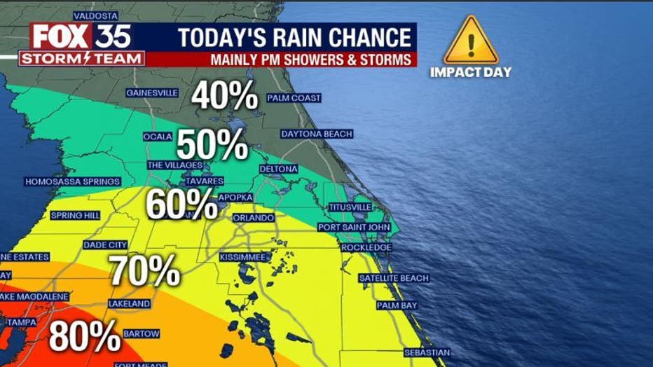
Main weather concerns: Heavy rain will return to the area primarily for the afternoon hours. Gulf of Mexico low pressure is located just west of Florida and this is serving to increase the moisture locally. The tropical connection will provide passing downpours and some cloud-to-ground lightning strikes.
The areas of heavy rain could produce between 1-2" per hour. The timing appears to be between 2pm-9pm. Only isolated showers are expected overnight into Friday morning.
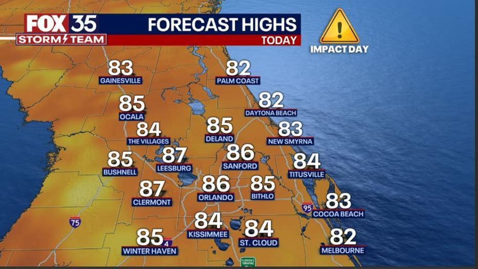
Today's high: 86 degrees | Tonight's low: 71 degrees
Highs hit in the steamy mid-80s this afternoon, lows tonight head for the lower 70s.
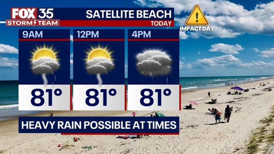
BEACHES: The beaches see warm temps with mostly cloudy skies. Highs reach 83 degrees. Surf is in the 1-2' range with a moderate risk for rip currents.
There is a 50% chance of showers and thunderstorms mainly after 11am. Some of the storms could produce heavy rain at times.
THEME PARKS: Mixed skies and humid weather is likely today. Afternoon highs will reach the mid to upper-80s. Shower and thunderstorms arrive mainly after 2 p.m., heavy rain is possible at times., lightning strikes look likely in any stronger storms. Stay weather aware and when thunder roars head indoors.

OUTLOOK: The FOX 35 Storm Team is monitoring an area of low pressure in the Gulf of Mexico. While most forecast models keep this feature West of Florida, the heavy rain threat will continue from a distance. Isolated areas of flooding and ponding of water will be possible through Friday.
Winds should not be of issue due to the weakened nature of the Gulf low and further separation from Florida as we head into the weekend. Stay with the FOX 35 STORM TEAM as we track the tropics and all of our local weather!