

Orlando weather: Warm start to the week before another cooldown
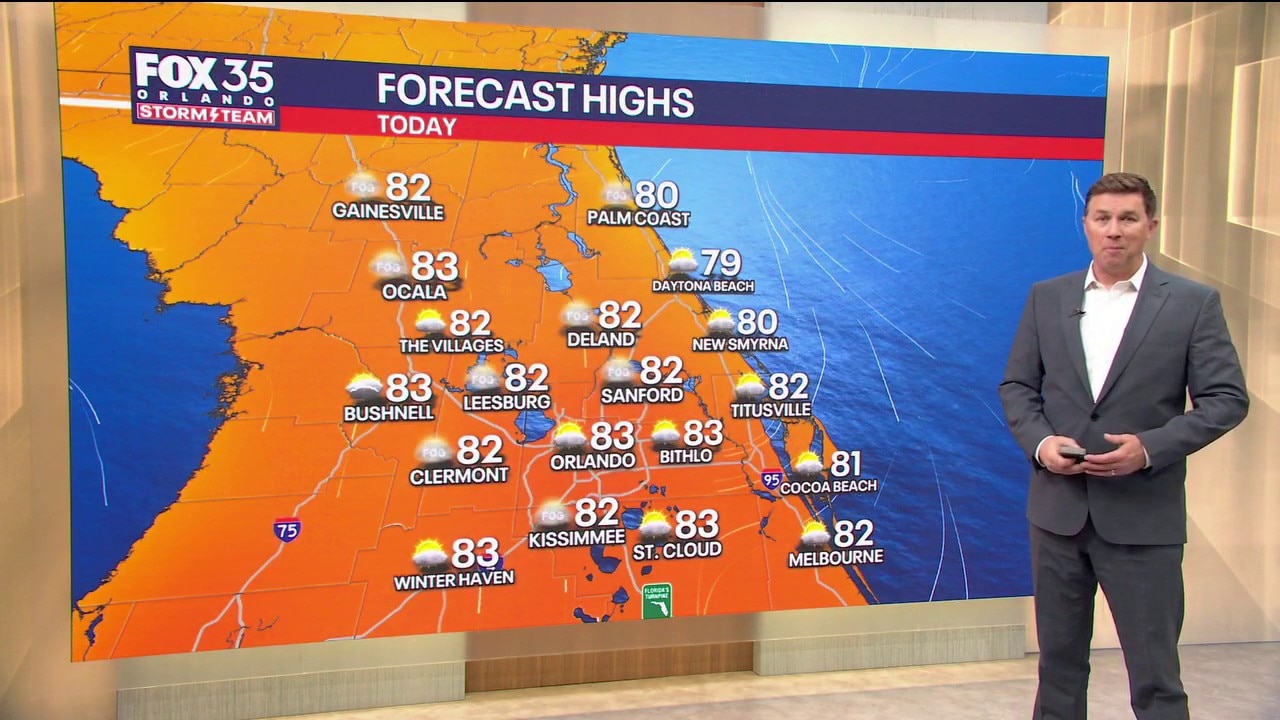
Orlando AM Weather Forecast: Warm start to the week
The first half of the week will be warm before a cold front moves into the area by the end of the week. FOX 35 Storm Team meteorologist Brooks Garner takes a look at the forecast.
ORLANDO, Fla. - A nice start to the week will give way to scattered thunderstorms Wednesday, followed by a strong cold front Thursday night.
Behind that front, Central Florida is on track for its COLDEST AIR OF THE FALL SEASON this weekend!
Meanwhile, significant flooding continues along the St. Johns River, with additional rises expected.
Weather changes this week
What to expect:
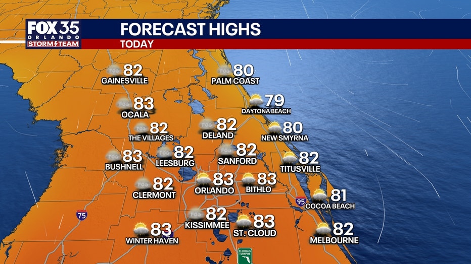
Monday & Tuesday: Patchy dense fog is possible early this morning, especially around the I-4 corridor. Otherwise, a mix of sunshine and clouds with comfortable humidity and highs in the lower 80s. Morning temperatures generally range from the upper 50s to upper 60s. Mostly dry conditions continue through Tuesday.
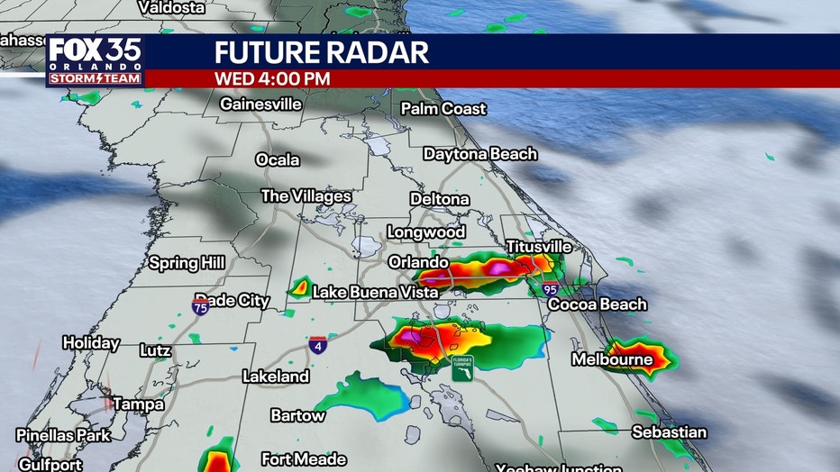
Wednesday: Rain chances are increasing as an upper-level disturbance arrives earlier than previously anticipated. Expect scattered afternoon and evening showers and thunderstorms, with rain chances around 30-40%. Highs reach the lower 80s. While most storms should remain ordinary, a couple could become strong if sufficient instability develops. Confidence in that potential remains limited.
Thursday & Friday: A powerful cold front sweeps through Central Florida Thursday night, bringing another opportunity for showers into early Friday, especially south of Orlando. Widespread heavy rain is NOT expected. Friday turns noticeably cooler and breezy as drier air arrives behind the front. West-northwest winds could gust 15-25 mph, with afternoon highs struggling to reach the upper 60s to lower 70s.
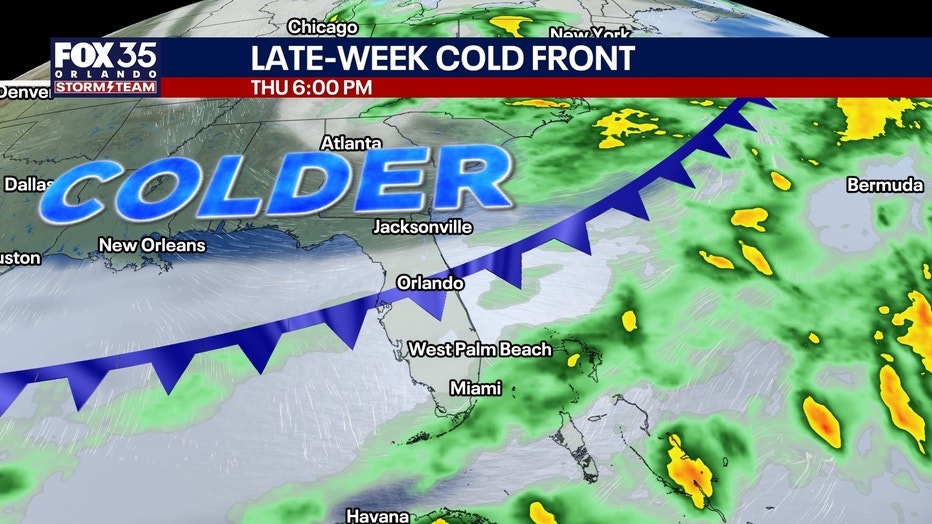
First big blast of chilly air
How cold will it get?:
This is shaping up to be our most significant cooldown so far this autumn!
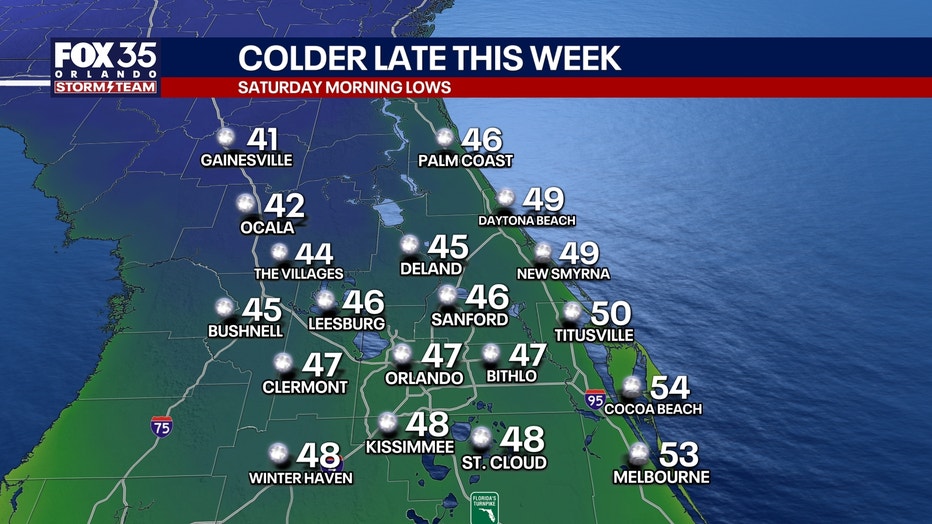
Saturday: Lows in the middle to upper 40s across much of Central Florida, with lower to middle 50s near the immediate Atlantic coast.
Wind chills: A lingering northwest breeze could make it feel like the lower 40s around Orlando. There is now a 30-40% chance wind chills will briefly reach the UPPER 30s near and northwest of I-4!
Mostly sunny, breezy and unusually cool on Saturday afternoon. Highs only in the lower to middle 60s, with some upper 60s toward the southern Treasure Coast.
Sunday: Another chilly morning in the 40s inland, followed by a modest afternoon warm-up. Highs will generally be around 5 degrees warmer than Saturday.
Temperatures begin moderating early next week, with highs returning to the lower and middle 70s by Monday.
St. Johns River Flooding
Despite several days of relatively dry weather, runoff from last week's extraordinary rainfall continues moving north through the St. Johns River basin. River flood warnings remain in effect for Cocoa, Geneva, Sanford, DeLand and Astor.
The river west of Cocoa appears to be reaching MAJOR FLOOD STAGE early this morning, while Geneva could approach major flood stage by the weekend.
Additional slow rises are expected at other forecast points. Flooding will remain a prolonged concern even as local weather conditions improve.
Beach & boating hazards: A HIGH risk of dangerous, life-threatening rip currents continues at Central Florida Atlantic beaches today. Stay out of the ocean!
Marine conditions will gradually improve through midweek before strengthening northwest winds behind Thursday night's front create poor to hazardous boating conditions Friday into Saturday.
Tracking the tropics
No significant tropical threats to Florida are anticipated. Hurricane season officially ends November 30.
The Source: The information in this story was provided by the FOX 35 Storm Team meteorologists.