

Orlando weather: Rain chances ramp up Friday before weekend storms arrive
Orlando AM Weather Forecast: Rain chances on the rise
Drier conditions will continue for parts of Central Florida on Friday before rain chances ramp up this weekend. FOX 35 Storm Team meteorologist Brooks Garner is tracking the storms.
ORLANDO, Fla. - The drier air that helped hold rain chances down Thursday is fading as an upper-level low moves into Florida from the east today.
That means a noticeably wetter pattern today, especially in our coastal counties, with scattered to locally numerous showers and storms developing from late morning into the afternoon.
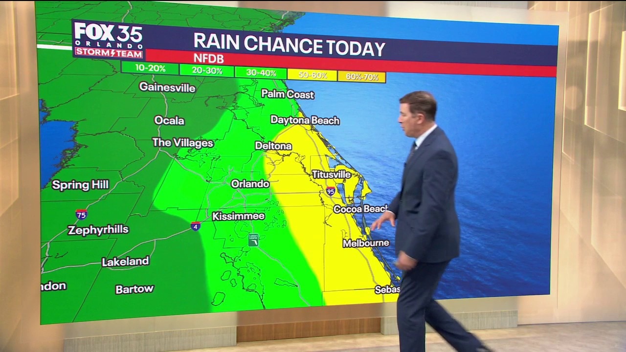
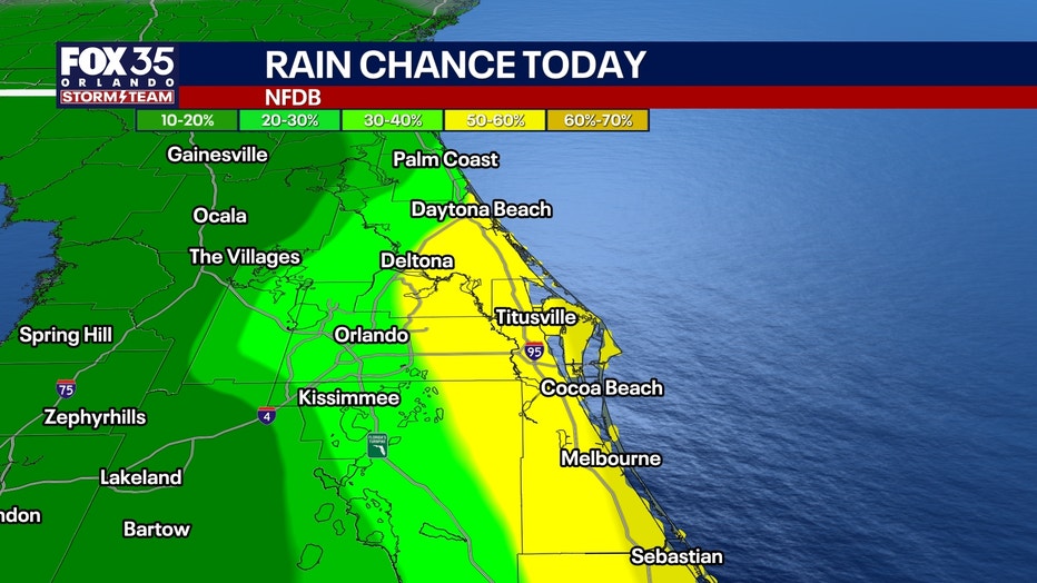
Rain chances:
- 20-30% Orlando, and northwest of I-4
- 40-60% across most of the rest of Central Florida
Because colder air aloft is moving overhead, an outside chance exists that a few storms could become strong this afternoon and evening.
The bigger threat begins tomorrow. Main threats:
- Frequent lightning
- Gusty winds 40-50 MPH
- Small hail
- Localized 1-3" downpours
- Minor flooding in poor drainage spots
Storms may develop earlier than the typical summertime sea-breeze pattern. There may be multiple rounds of rain, instead of just one daily thunderstorm.
How hot will it get?:
Highs will be in the mid-to-upper 80s along the coast and in the upper 80s to near 90s inland.
Tonight, lows will be in the 70s.
Better boating conditions
The pressure gradient is weakening, so today will not be as windy as the past few days.
Northeast winds increase to 10-15 MPH this afternoon with occasional gusts around 20-25 MPH.
Seas gradually improve to 3-5 feet today, then 2-3 feet this weekend.
The bigger boating concern shifts from wind and seas to passing thunderstorms.
Unsettled all weekend
The upper-level low slowly crosses Florida and moves into the eastern Gulf through Sunday.
At the same time, deeper moisture returns, keeping scattered to numerous showers and storms in the forecast each day.
Morning showers will remain possible near the coast, followed by more widespread development from late morning through the afternoon.
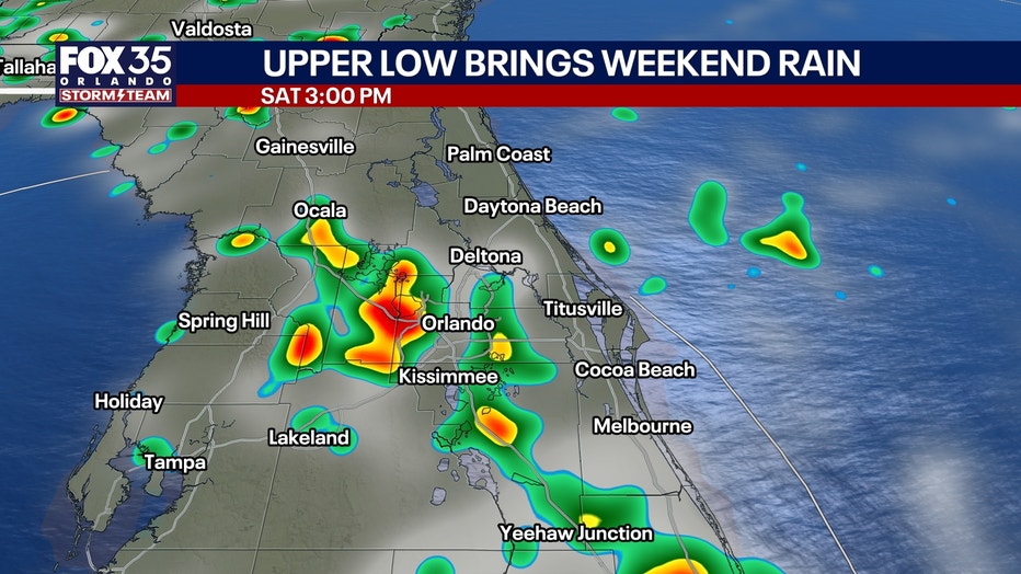
A few stronger storms remain possible Saturday and Sunday with frequent lightning, gusty winds and locally heavy rainfall of 1-3".
Not washouts, but certainly a wetter and more active weekend.
Wet pattern continues next week
The upper low gradually weakens, but plenty of moisture remains over Florida.
That keeps rain chances near or above normal Monday through at least midweek, with scattered to numerous afternoon and evening storms continuing.
Temperatures remain close to normal, generally upper 80s to around 90.
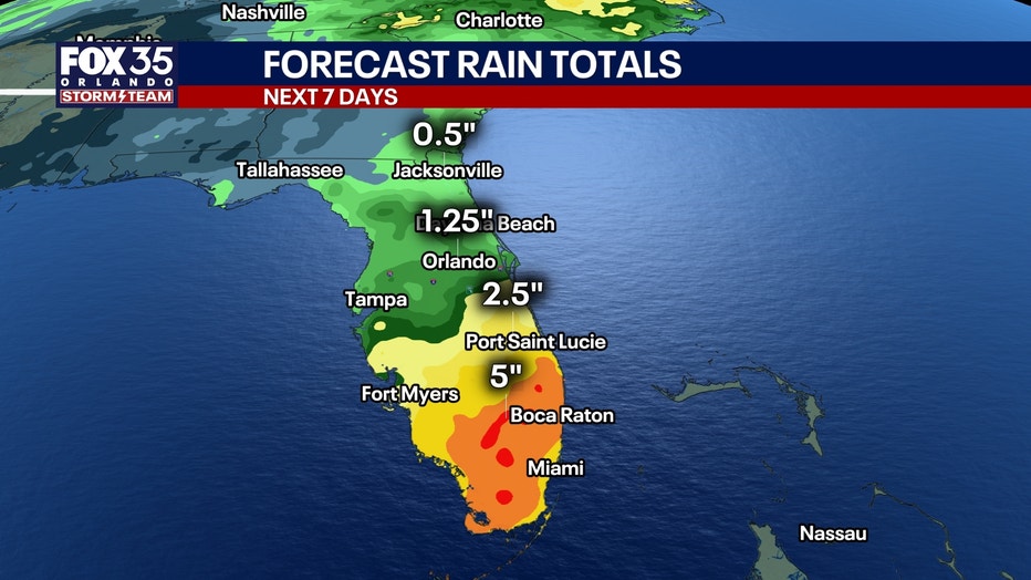
The highest rain totals over the next 7 days will occur in South Florida, with lower totals the farther north you go.
Tracking the tropics
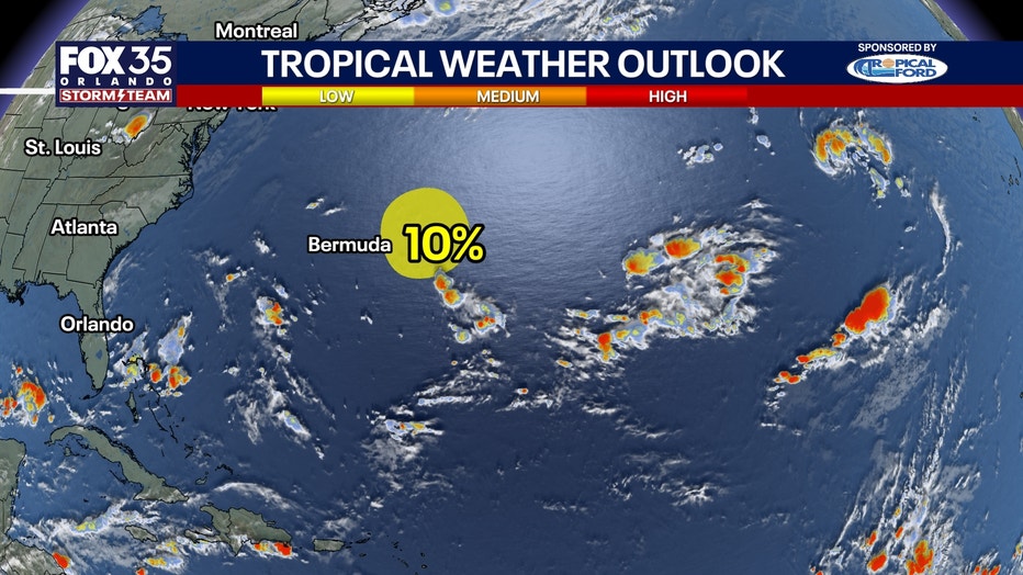
AL98 remains several hundred miles east of Bermuda, but development is becoming increasingly unlikely.
NHC has lowered formation chances to just 10% through both 48 hours and seven days.
No threat to Florida.
The Source: The information in this story was provided by the FOX 35 Storm Team.