

Orlando weather: Rain chances increase for Central Florida this weekend
Orlando AM Weather Forecast: Higher rain chances this weekend
Rain chances increase for Central Florida this weekend. Halloween looks to be mostly dry, but isolated showers are possible. FOX 35 Storm Team meteorologist Jessica Dobson takes a look at the forecast.
ORLANDO, Fla. - The gusty onshore wind and rough coastal conditions are still our big weather story as we progress into Halloween weekend.
High pressure wedged across the eastern states continues along with an area of low pressure offshore to funnel a persistent northeast breeze straight into Central Florida.
That onshore conveyor belt is still keeping passing Atlantic showers in play and prolonging coastal impacts into the weekend.
Isolated showers, drier pockets for Halloween
What to expect:
Northeast winds will stay breezy today, blowing at 10–15 mph with coastal gusts up to 20–25 mph.
Moisture trapped in the low levels will continue to spark scattered, fast-moving Atlantic showers pushing ashore, keeping rain chances around 20–30% along the coast and 15–20% inland.
The good news for Halloween weekend? Drier air in the mid-levels is nudging in from the north. While we can't completely rule out a stray coastal sprinkle drifting inland Saturday evening, widespread rain is off the table, giving trick-or-treaters mostly dry conditions.

Soaking rain and storms return Sunday
Don't get too used to the drier weather, because the weather pattern turns much wetter as we step into Sunday.
A surge of deep tropical moisture combined with a reinforcing disturbance swinging in will send rain chances spiking back up to 60–70% Sunday into Monday.
Expect widespread showers and embedded thunderstorms pushing across the peninsula. Rounds of rain will bring the potential for torrential rain, capable of producing localized street flooding, especially across coastal counties and low-lying spots that are already saturated.
We also could see a couple of stronger storms which is something we'll have to monitor. If you have outdoor plans on Sunday or an early commute on Monday, keep the umbrella handy.
Warm and muggy
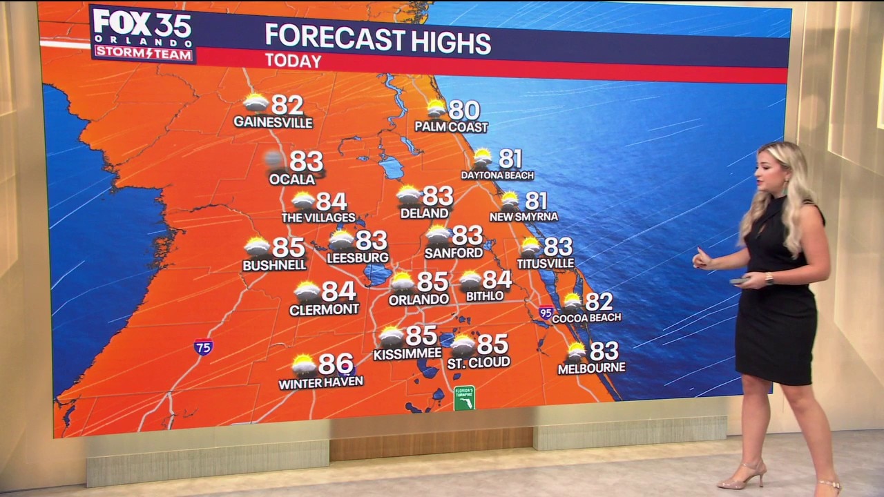
Afternoon highs will top out in the lower 80s today across the Orlando metro and interior communities, with coastal towns holding around 78°–80° under the ocean breeze.
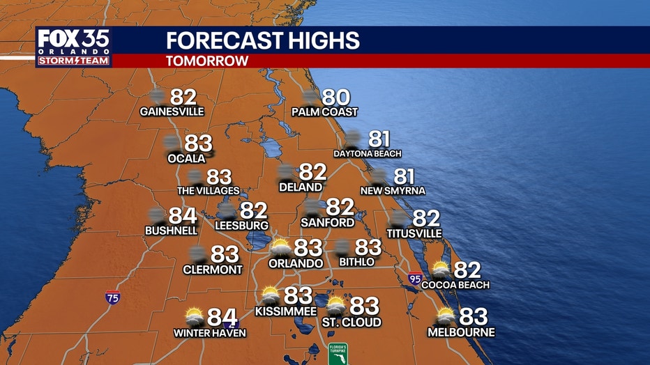
By Saturday and Sunday, temperatures will climb into the mid-80s across the metro ahead of an approaching storm system.
Dew points will stay elevated too, so expect it to feel noticeably sticky and warm if you're out in costume Saturday evening.
Overnight lows are staying mild in the upper 60s for the metro, mid-60s for northwest counties like Marion, Lake, and Sumter, and holding in the lower 70s along the coast.
Lingering beach impacts and choppy boating
Marine conditions are slowly trending downward from peak gale conditions, but don't drop your guard at the coastline just yet.
A Small Craft Advisory remains in effect as offshore seas hover at 5 to 9 feet, building slightly back to 6 to 10 feet this weekend as easterly winds freshen.
Coastal Flood Advisories remain posted through Saturday, with minor flooding still possible during high tide.
Entering the ocean is still strongly discouraged thanks to rough surf, lingering beach erosion, and a HIGH risk of rip currents.
Tracking the tropics
Quiet in the Atlantic:
The Atlantic basin remains completely quiet close to home. The National Hurricane Center expects no tropical cyclone development across the Gulf, Caribbean, or Atlantic over the next 7 days.
Pockets of dry air and unfavorable upper-level winds continue to squash any tropical organization. There are zero tropical threats to Florida or the U.S. mainland.
The Source: This story uses information gathered and produced by the FOX 35 Storm Team.