

Orlando weather: Drier air moving through Central Florida before weekend storms return
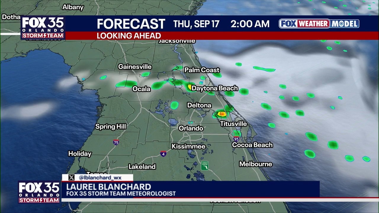
Orlando PM Weather Forecast: Drier air moving through Central Florida
Rain chances will decrease Thursday and Friday as a drier air mass moves over Florida, limiting showers and thunderstorms. A few passing showers remain possible, but widespread rainfall is not expected. Breezy conditions will continue, with wind gusts between 15 and 25 mph.
ORLANDO, Fla. - Gusty winds coming in from the east will continue Wednesday night, bringing occasional passing showers.
Rain chances are higher east of Orlando, as moisture moves inland from the Atlantic.
Coastal showers through Wednesday evening
What To Expect:
Bands of showers will continue moving inland from the Atlantic, with the highest coverage near the coast. Heavier storms will produce only brief downpours, occasional lightning and locally stronger wind gusts around 40–45 mph.
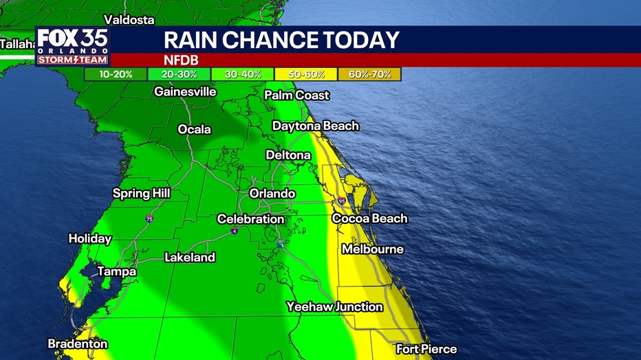
Drier air arriving from the northeast should gradually reduce rain chances northwest of I-4.
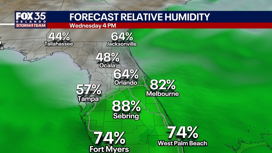
South of Orlando and the Cape, deeper moisture will remain in place longer, allowing numerous scattering showers and a few storms through the afternoon.
Rough beaches and hazardous boating
The stronger onshore wind will create rough surf and dangerous beach conditions today and Thursday.
A HIGH RISK of life-threatening rip currents is in effect at all area beaches. Entering the surf is not advised.
Offshore, east-northeast winds of 20-25 knots will build seas to 6-8 feet in spots, creating hazardous conditions for small boats.
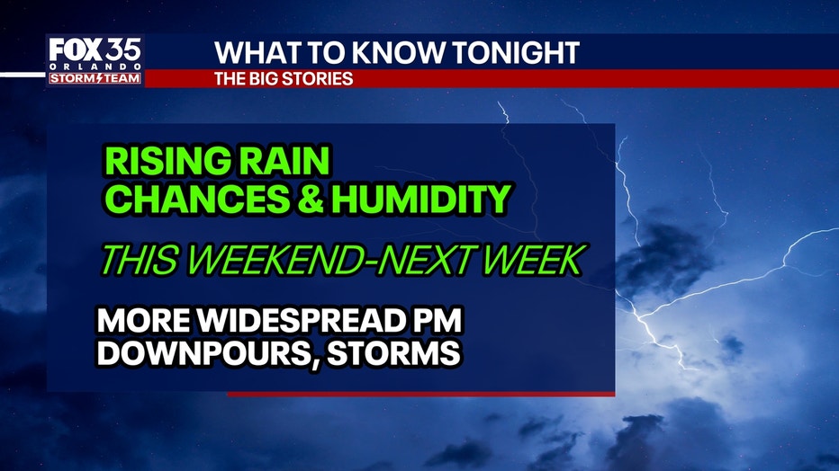
Drier Thursday, ahead of wetter weekend
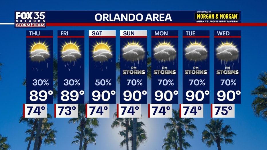
Rain chances will decrease Thursday and Friday as a drier air mass moves over Florida, limiting showers and thunderstorms. A few passing showers remain possible, but widespread rainfall is not expected. Breezy conditions will continue, with wind gusts between 15 and 25 mph.
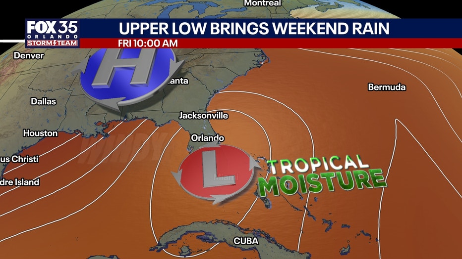
Higher rain chances return Saturday and continue into early next week as tropical moisture spreads into Central Florida. Scattered afternoon and evening showers and thunderstorms are expected each day, with highs in the upper 80s to around 90 degrees.
Orlando also continues to experience one of its hottest and driest years on record. Through Sept. 16, the city is on pace for its sixth-hottest year since recordkeeping began in 1892, has recorded the third-most days at or above 95 degrees with 58, and ranks as the fifth-driest year, with rainfall running 14.36 inches below average.
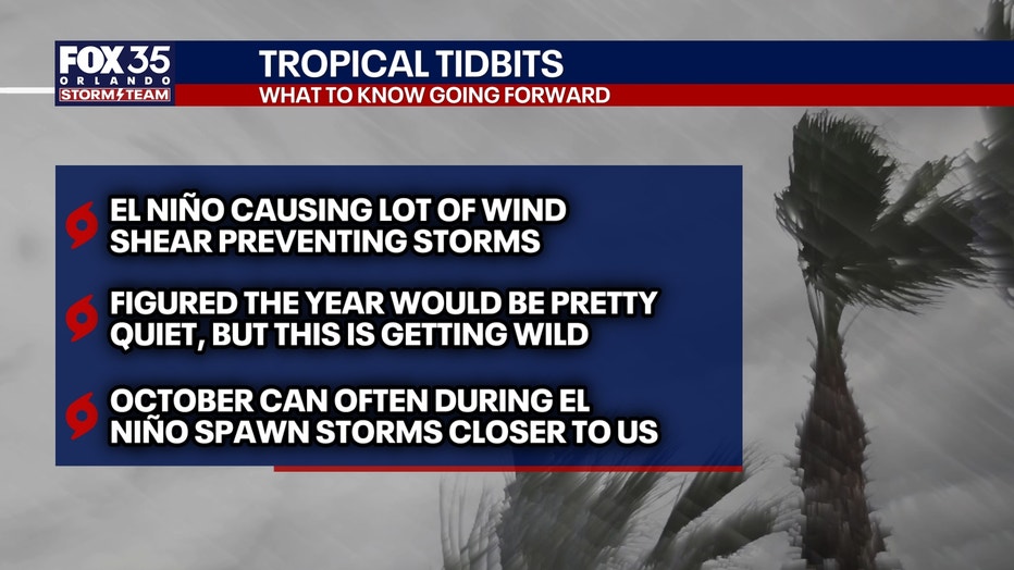
Forecasters attribute the prolonged heat and dry conditions to El Niño, which is also expected to contribute to a wetter-than-normal winter.
Tracking the tropics
No tropical concerns for Florida right now.
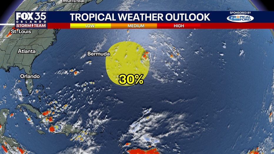
A disturbance about 600 miles east of Bermuda has a 10% chance of developing during the next two days and a 30% chance during the next seven days.
Any development would remain well away from Florida.
The Source: The information in this story was provided by the FOX 35 Storm Team.