

Orlando weather: Cold night across Central Florida, gradual warm-up ahead
Orlando Weather Forecast: Frost for some tonight!
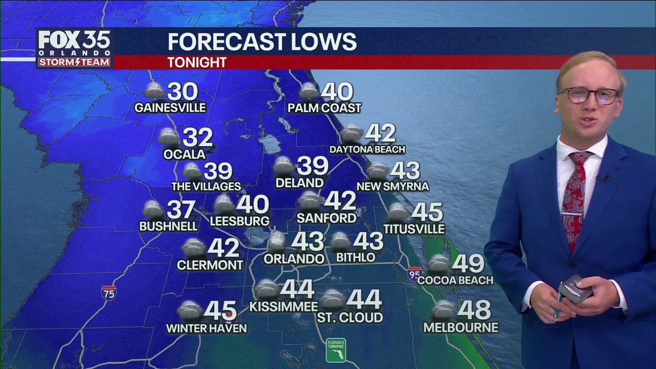
FOX 35 Storm Team Senior Meteorologist Noah Bergren is tracking cold tonight! Temperatures could dip into the 30s and 40s in those areas. Orlando should stay in the 40s. When warmer air returns and much more.
ORLANDO, Fla. - Partly cloudy skies with colder air is air settling in compared to last night.
Temperatures will fall well below average across Central Florida.
Another chilly night ahead
What To Expect:
Temperatures will turn chilly once again tonight, dropping into the low 40s in the Orlando area and into the 30s northwest of the city. You'll certainly want the jacket once again as you make your way out the door tomorrow morning. We'll see a broad range in lows by daybreak.

Temperatures will dip into the mid 30s for areas like Marion to northern Lake and Sumter counties. This is where the slim chance of patchy frost will be possible. Areas along and near I-4 will be closer to the low and mid 40s, while Brevard County will be in the low and mid 50s.

High pressure continues to build, which will keep things dry and pleasant but still cooler.
Wednesday's temperatures will remain well below normal, but still an improvement as highs reach the low 70s.

Temps will start to climb back closer to average, rising into the lower to middle 70s by the end of the workweek with plenty of sunshine on the table.

By this weekend, readings are seasonable, but back above average. Afternoon readings on Saturday are back up into the lower to mid-80s under just a few clouds.
The Source: This story was written with information from the FOX 35 Storm Team.