

Hurricane Erin becomes 1st hurricane of 2025 season: Live updates

Tropics Update: August 15, 2025
FOX 35's Noah Bergren gives the latest update on the path, track, and projections for Hurricane Erin from the National Hurricane Center as it strengthens and heads west toward Florida in the Atlantic.
ORLANDO, Fla. - Hurricane Erin formed Friday morning in the Atlantic Ocean, becoming the first hurricane of the 2025 Atlantic hurricane season, and is forecast to become a major hurricane over the next few days.
The National Hurricane Center (NHC) said steady to rapid strengthening is possible over the next day or two, allowing Erin to become a major hurricane (Category 3 or higher). On the forecast track, Erin could become a dangerous Category 4 hurricane.
Erin is expected to continue moving northwest over the Atlantic Ocean and remaining east of Florida and the southeastern United States.
CLICK HERE TO DOWNLOAD THE FOX LOCAL APP
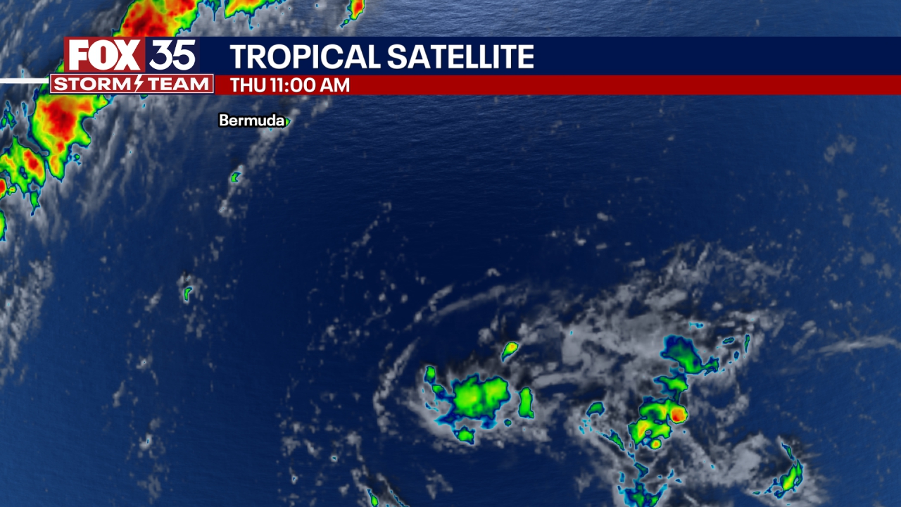
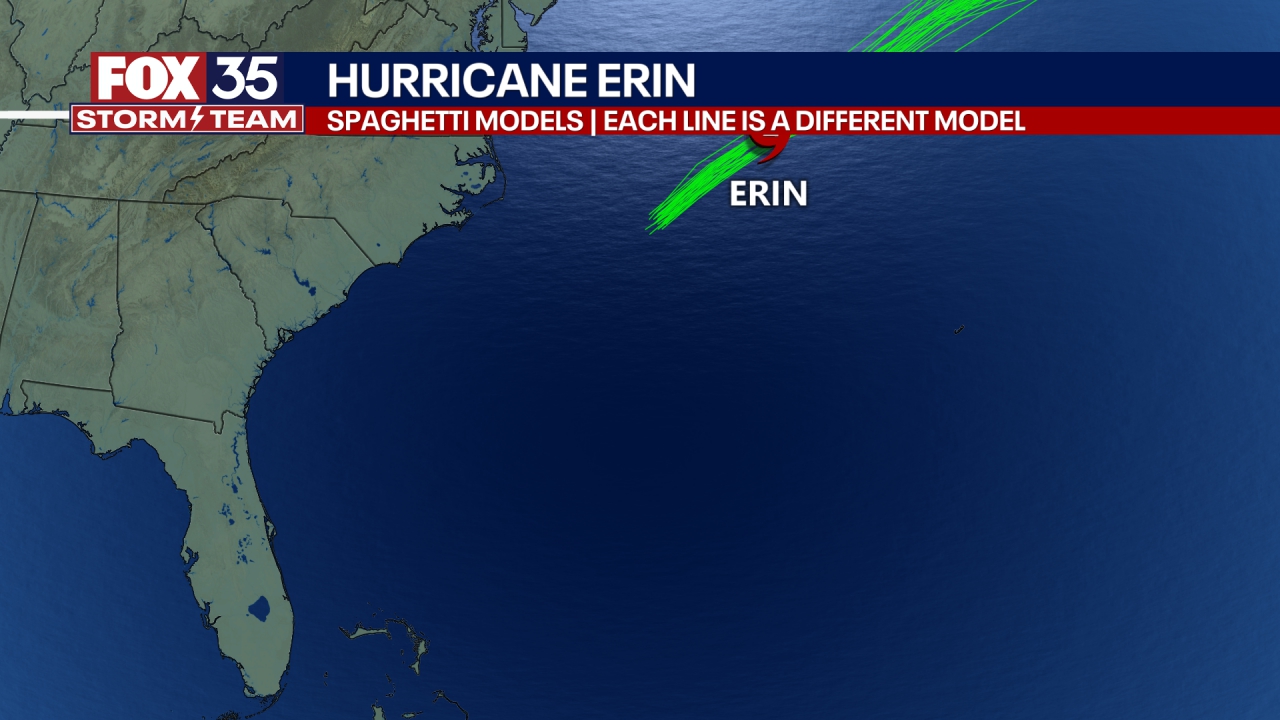
Scroll below to see Erin's latest track, forecast, spaghetti models and satellite images.
Erin becomes 1st hurricane of 2025 Atlantic season
What we know:
As of 2 p.m., Hurricane Erin was about 250 miles east-northeast of Anguilla, moving west-northwest at 17 mph, according to the NHC. The hurricane has sustained winds of 100 mph, making it a Category 1 hurricane. The minimum central pressure is 979 mb.
Hurricane Erin expected to become a major hurricane
What's next:
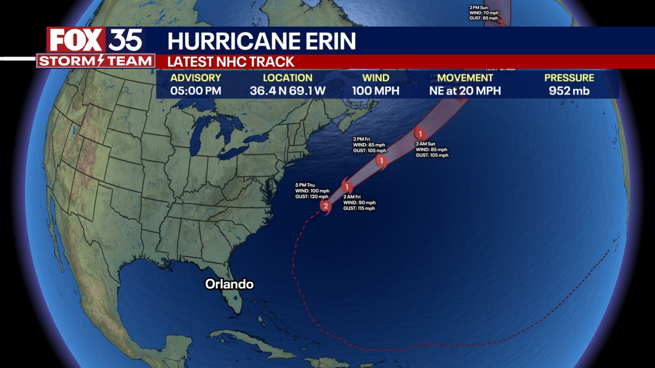
Hurricane Erin is expected to rapidly intensify over the next day or two to become a major hurricane – a Category 3 or higher – by this weekend. On the forecast track, it could become a dangerous Category 4 hurricane.
It’s forecast to pass near or just north of the Leeward Islands on Saturday.
Tropical storm watches are already being issued for some of the Leeward Islands between St. Lucia and Puerto Rico. Puerto Rico and the British Virgin Islands are already bracing for dangerous rip currents and high surf.
Saffir-Simpson Hurricane Wind Scale: How hurricanes are rated
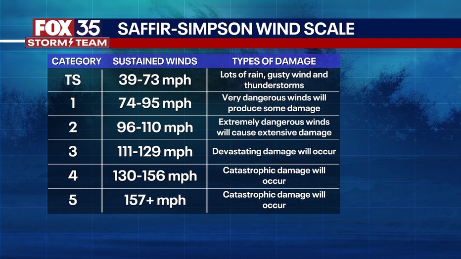
Hurricanes are rated on a five-point scale – Category 1 to Category 5, referred to as the Saffir-Simpson Hurricane Wind Scale. A hurricane that is ranked a Category 3, Category 4, or Category 5 storm is considered to be a "major" hurricane.
- Tropical Storm: A tropical cyclone with sustained winds of 39-73 mph
- Category 1 hurricane: Sustained winds of 74-95 mph
- Category 2 hurricane: Sustained winds of 96-110 mph
- Category 3 hurricane: Sustained winds of 111-129 mph
- Category 4 hurricane: Sustained winds of 130-156 mph
- Category 5 hurricane: Sustained winds of 157 mph or higher
No direct hit for Florida, but strong rip currents and huge waves to impact Florida's Atlantic Coast
Local perspective:
The track takes Erin east of Florida, and while that means we'll be spared from any direct impacts, we will face deadly rip currents all next week as big swells over 10 feet are pushed into Atlantic beaches. The passage of the system will also pull in drier air midweek, reducing our daily chances of rain to "unlikely" for several days and slightly lower humidity levels.
Hurricane Erin Watches and Warnings
Why you should care:
Tropical Storm Watches are in effect for Anguilla, Barbuda, St. Martin, St. Barthelemy, Saba, St. Eustatius and Sint Maarten. Heavy rain, gusty winds, flash flooding and dangerous surf are all possible in the region starting Saturday.
Residents in the Leeward Islands, Virgin Islands and Puerto Rico should monitor updates closely.
Tracking the tropics
Big picture view:
Meanwhile, in the southwestern Gulf, Invest 98-L has made landfall in Brownsville, Texas. Flood watches have been issued for Brownsville as south Texas could see upwards of six inches of rain. However, there is no longer a chance of development for this system.
There is another wave that is also making its way off the coast of Africa, so this will be our next system to watch carefully after Erin, and there is even one behind that we will have to watch.
The Source: The info in this article comes from the National Hurricane Center (NHC), National Weather Service (NWS) and FOX 35 Storm Team.