

Windy weekend: Why you need a backup plan for the beach, boat outings
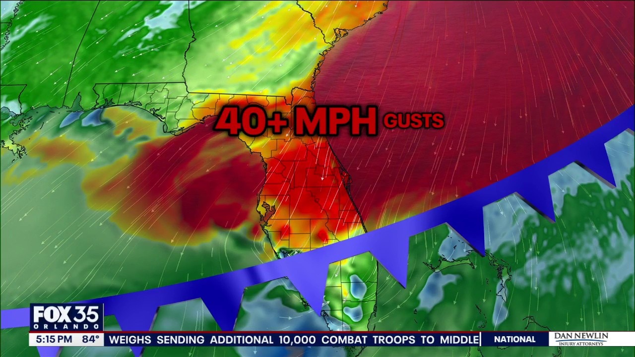
Orlando PM Weather Forecast: 40MPH wind gusts this weekend
A wind advisory has been issued for the Orlando area, starting Saturday afternoon, March 28. Wind gusts are expected to increase from four to over 40 miles per hour.
Florida in late March usually screams "beach day," and with today's gorgeous mid-80s and sunshine, but weather this weekend is expected to take a turn.
Consider this your official heads-up: you have a very narrow window of opportunity to enjoy calm weather Saturday before a fast-moving cold front barrels-in bringing gusty, cool winds, clouds and showers, and dangerous surf and boating conditions.
What we know:
If you were planning to cast a line, take the boat out, or jump in the surf this weekend, here is exactly why you need to pivot your plans.

The wind: Timing the turnaround
After a beautiful and warm Friday, Saturday's cold front will arrive around lunchtime and change everything.
You'll know it's here because clouds will develop, and the winds will sharply shift out of the northeast and crank up fast.
We are talking sustained winds of 15 to 25 mph across Central Florida, with frequent gusts hitting 30 to 40 mph, especially right along the coast. It’s going to be so blustery that a Wind Advisory is triggered for parts of the area and a Gale Watch is in effect for the waters.

Atlantic Coast: Stay on the sand
Here is the absolute bottom line for the beaches: Entering the surf is not advised this weekend. When 40 to 45 mph gusts push against the Atlantic coast, the ocean turns into a washing machine. Here is what that looks like:
- Waves bigger than you: Breaks of four to six feet and seas rapidly build to 8 to 15 feet offshore.
- Small boats: There will be a capsize risk with sharp crests.
- Large boats: Uncomfortable swells that could cause sea sickness.
- Deadly surf: For beachgoers, this wind creates a high risk of violent rip currents and punishing, rough surf.
- A 19-year-old was tragically killed by the rip current at Ormond Beach mid-March, after swimming at an unguarded beach, when he was swept out.
The sand is fine for a walk, but keep your family and your Spring Break guests strictly out of the water.

Intracoastal & inland lakes: Don't underestimate the chop
While you won't see 15-foot ocean swells on a lake, 30 to 40 mph wind gusts are more than enough to create incredibly choppy, miserable, and potentially dangerous conditions on our inland waters.
- Small craft danger: Jon boats, kayaks, and paddleboards will be easily pushed around and at serious risk of swamping or capsizing in the wind-driven chop.
- Tough navigation: Even in larger center-consoles or pontoons, the ride will be wet, bumpy, and far from relaxing.

The smart move for the weekend
While winds will calm down for Sunday to the breezy category, with gusts closer to 25 mph, seas will remain dangerous, and the beaches will feature a continued high risk for deadly rip currents. It'll be best to see the water, but stay out of it.
Next week will feature rapidly-improving maritime conditions.
The Source: Information in this story was gathered by FOX 35's Brooks Garner.