

Central Florida sees cooler temps, spotty showers in the work week
Orland Weather: Cooler temps, spotty showers in the work week
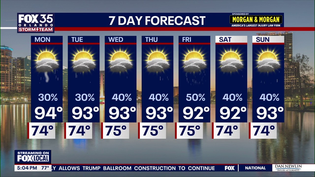
Cloud cover and afternoon showers brought lower, more comfortable temperatures to Central Florida, though localized flooding remains a concern through Sunday evening. A brief break in rain intensity will bring drier air and seasonable low 90s to the region early in the week, with storm chances dropping to around 30% for Monday and Tuesday.
ORLANDO, Fla. - With the cloudy skies today, temperatures stayed cooler and much more comfortable than the scorching heat from last weekend.
Rain will move across the region this afternoon and into this evening. We will be watching closely for the potential of localized flooding.
Drier start to the work week with seasonable temps
Drier air overhead will keep our rain chances a bit lower on Monday, at least compared to normal.
We'll see a few spotty showers and storms Monday afternoon and evening, with chances around 30%.
That trend continues into Tuesday with isolated afternoon/evening storms expected. Affected areas include Orlando and moving east.
Wet end to the workweek
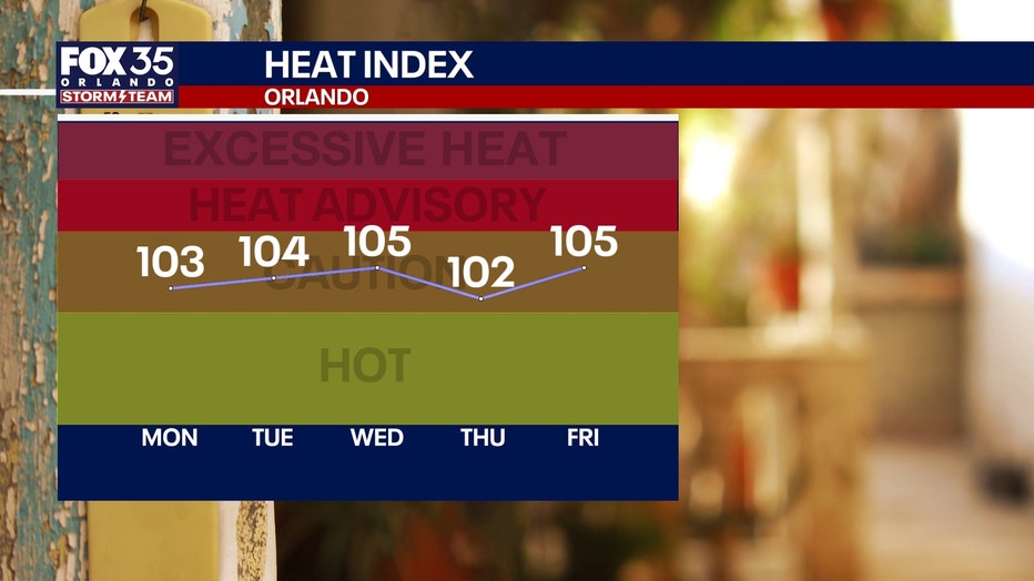
We start to tap into more tropical moisture later in the week as winds start to come back up from the south pushing in more moisture.
That will make for higher rain chances as we progress through midweek onward.
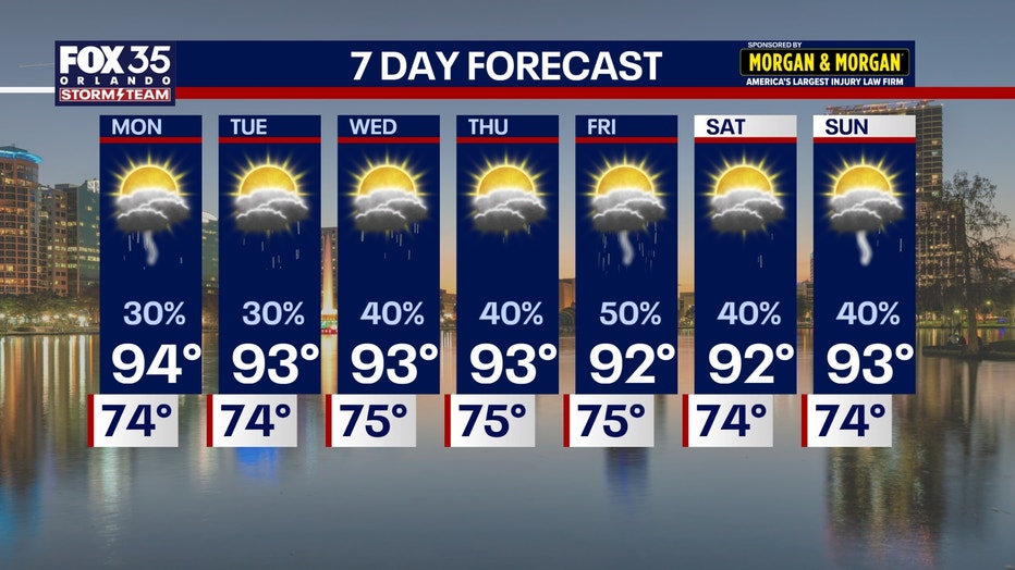
Our days won't be washouts, but we'll see numerous more storms around during the afternoon and evening. Rather, expect the classic Central Florida "rainy season" weather pattern.
With the help of the sea breeze collision as well as a front stalled to our north, rain chances come back up to around 50% to 60%.
So plans in the mornings look good to go, but make sure you have a rain jacket handy just in case.
Read more: Tracking the Tropics – Chance for development increasing in the Eastern Atlantic
The Source: Information in this story was gathered from FOX 35's Laurel Blanchard.