

Orlando weather: Warmer temps before cold front arrives in Central Florida
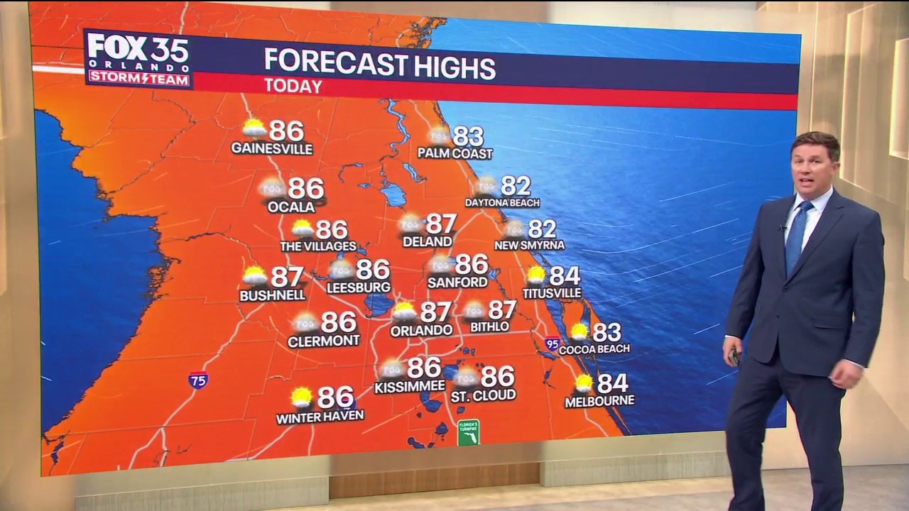
Orlando AM Weather Forecast: Warmer temperatures
Temperatures will climb into the mid-80s today before a cold arrives in Central Florida, bringing slightly cooler temperatures. FOX 35 Storm Team meteorologist Brooks Garner takes a look at the forecast.
ORLANDO, Fla. - Very warm and a little humid for November, with highs in the mid 80s, approaching 87° around Sanford. Heat indices could reach the lower 90s.
Most areas stay dry, although a few isolated afternoon showers are possible inland. Rain chances only 20%.
Cool front this weekend
More of the same on Friday. Highs in the mid 80s, several degrees above normal, with light winds and an afternoon sea breeze. A stray inland shower is possible, but widespread rain is not expected.
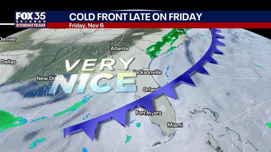
A weak, mostly dry cool front moves through Saturday, shifting winds to the north and northwest.
Saturday remains warm in the low to mid 80s, followed by a more refreshing Sunday with lower humidity and highs in the upper 70s to lower 80s.
No significant rain or thunderstorms expected with the front.
Conditions next week
Comfortable temperatures continue Monday and Tuesday, with highs in the upper 70s and early morning lows dipping into the upper 50s northwest of I-4 and the 60s elsewhere.
Rain chances stay low around 20% Monday and Tuesday, increasing slightly to 30% Wednesday as an upper-level disturbance approaches. Severe weather looks unlikely.
Flooding and St. Johns River
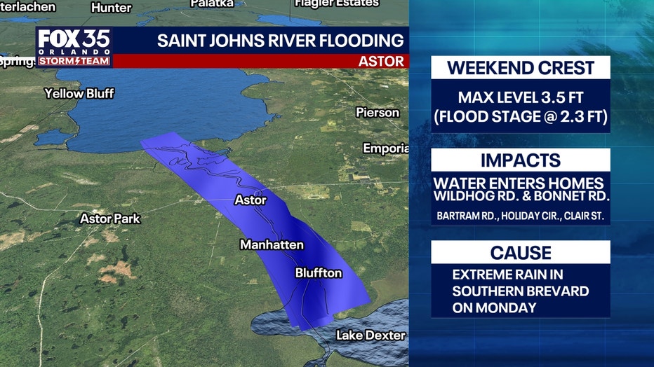
The extended stretch of mostly dry weather is welcome news for southern Brevard County and the Treasure Coast following Monday's catastrophic flooding. However, runoff from that rainfall continues moving north through the St. Johns River basin, producing a prolonged river flood event.
Flood warnings remain in effect at Cocoa, Geneva, Sanford, DeLand and Astor.
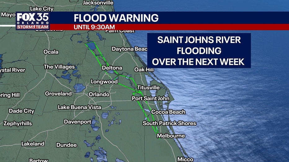
River levels will continue rising over the next several days, with "major" flooding forecast at Cocoa later this week and Geneva potentially approaching major flood stage early next week.
Other locations may experience minor to moderate flooding. Conditions along the river could worsen even as local weather remains dry.
Coastal conditions
An easterly swell builds from around 4 feet today to 5 feet Friday. Behind Saturday's front, north to northeast winds increase to 10-15 knots, with offshore seas reaching 6 feet.
Poor to hazardous boating conditions will develop this weekend, especially in the Gulf Stream.
Tracking the tropics
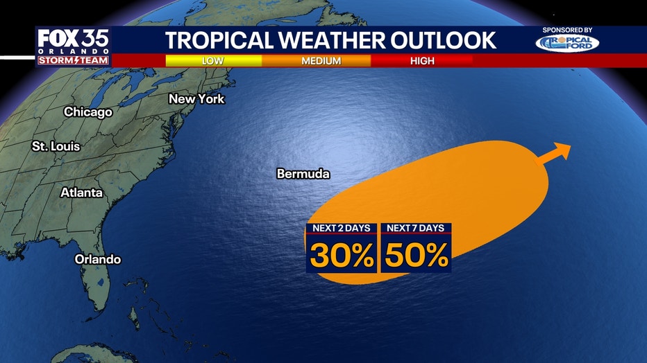
A disturbance in the central Atlantic bears watching for possible brief tropical development over the next several days. Regardless of development, no threat to Florida or the United States is anticipated. There is a medium chance this develops. KYLE is the next name on the list.
The Source: The information in this story was provided by the FOX 35 Storm Team.