

Orlando weather: Pleasant weather continues across Central Florida this week
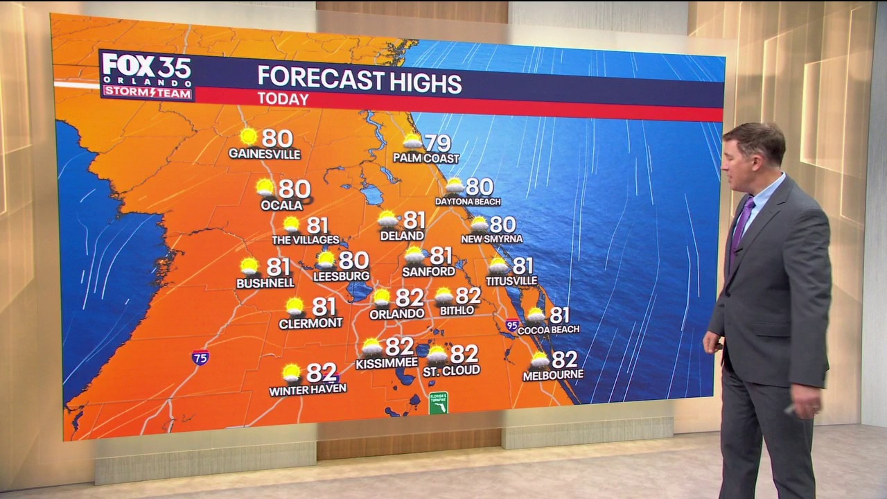
Orlando AM Weather Forecast: Another pleasant day
The fall weather pattern continues across Central Florida, with highs in the low 80s and comfortable overnight temperatures. FOX 35's Brooks Garner takes a look at the forecast.
ORLANDO, Fla. - An autumn weather pattern continues across Central Florida, with highs in the low 80s and comfortable overnight temperatures.
A few passing coastal showers are possible today, but most inland areas stay dry through Thursday.
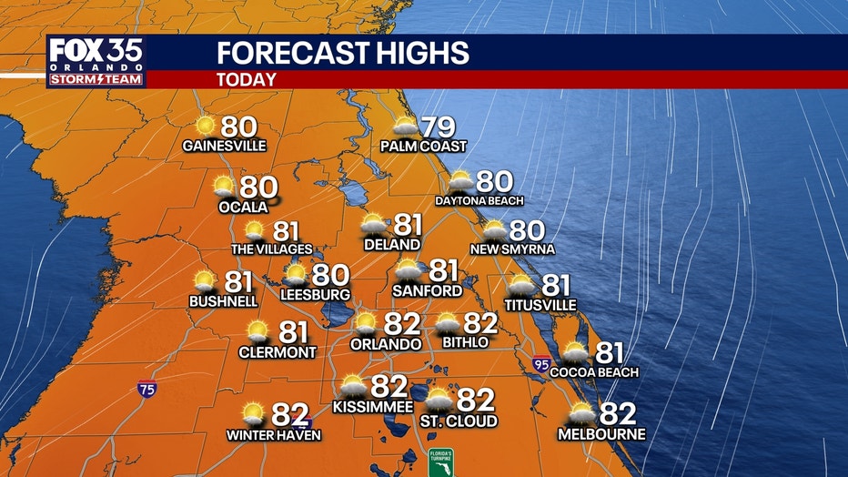
Pleasant weather conditions this week
This weekend, another round of gustier northeast winds develops Saturday and Sunday, bringing dangerous surf and possible minor coastal flooding at times of high tide.
- TODAY: A few quick-moving showers are possible today, mainly along the coast from Cape Canaveral southward. Rain chances are around 20–30%, with most of Orlando and the interior staying dry.
- TOMORROW: Looks a little drier, with highs in the upper 70s to low 80s. Rain chances increase again Friday night into the weekend as an area of low pressure develops near the Bahamas.
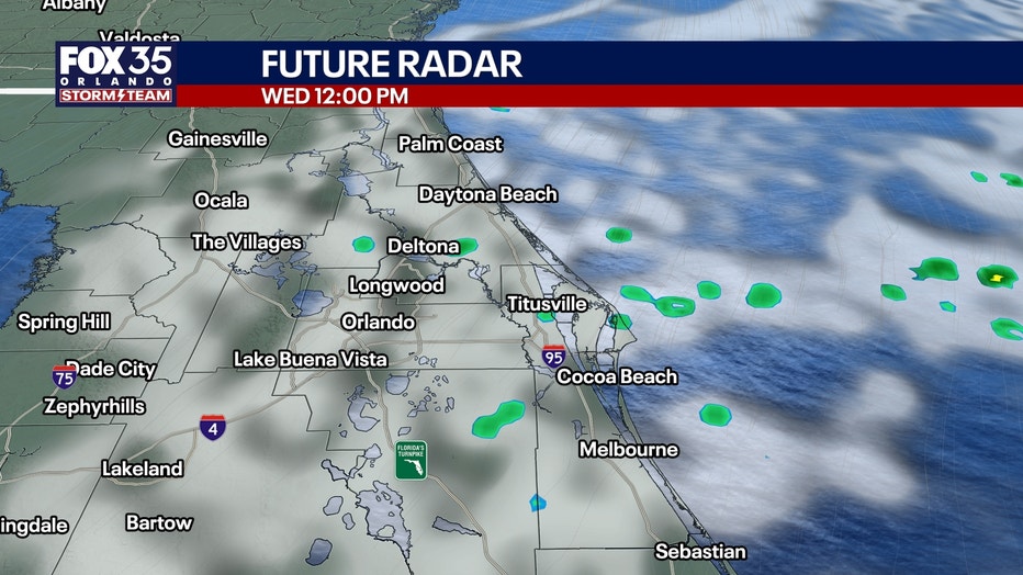
Scattered showers are possible Saturday and Sunday, especially closer to the coast, with an isolated thunderstorm possible.
Windy weekend, dangerous beaches
A low developing over the Bahamas will create a "pressure gradient" which will cause gusty winds for Saturday and Sunday. Sustained at 20–30 mph with higher gusts to 40+ on the beaches.
Wind Advisories may be needed, especially along the coast.
Beach conditions:
This could create another significant coastal event as strong onshore winds combine with unusually high tides:
- Dangerous surf and life-threatening rip currents
- Minor coastal flooding, especially around high tide
- Extremely rough boating conditions, with offshore seas building to 12–15 feet by late Saturday
The dangerous beach conditions will likely continue into early next week. Swimming is discouraged.
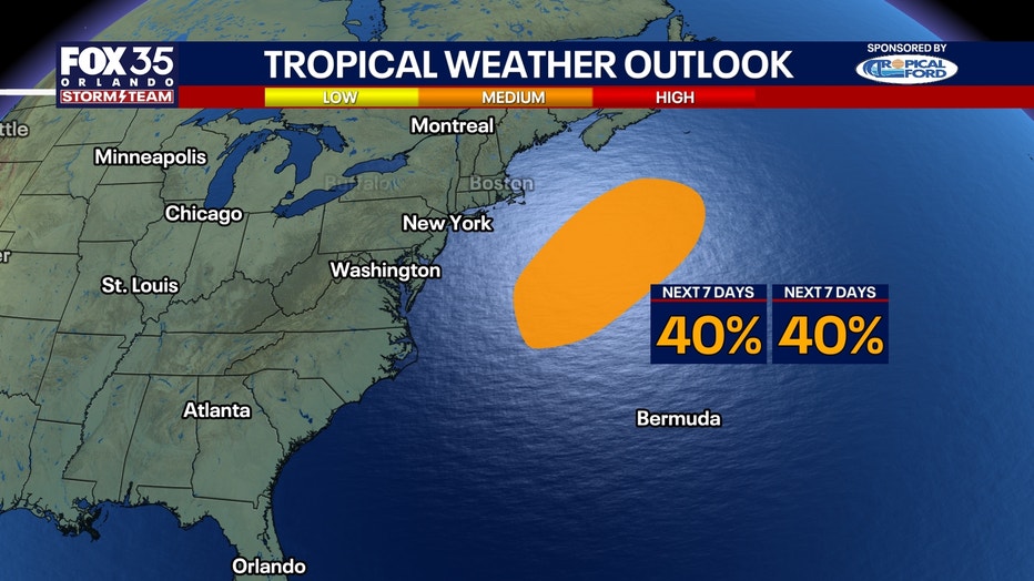
Tracking the tropics: 40% chance of development
A powerful non-tropical low a few hundred miles off the Mid-Atlantic coast continues producing storm-force winds.
The National Hurricane Center gives it a 40% chance of briefly becoming subtropical over the next 48 hours.
If it develops into a named storm, it would be Josephine. Regardless of whether it gets a name, this system is already producing dangerous surf, coastal flooding and strong winds along portions of the East Coast.
Florida impacts?:
The low is expected to move northeast away from the United States later this week, posing no direct threat to Florida.
At this point, it's just a question of storm classification because the impacts will be the same, named or not.
The Source: The information in the story was provided by the FOX 35 Storm Team.