

Orlando weather: Gusty winds and dangerous surf for Central Florida
Orlando AM Weather Forecast: Strong winds and dangerous surf
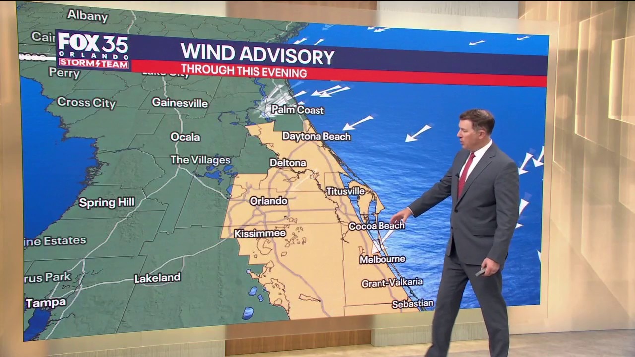
It will be another windy day across Central Florida, with northeast winds of 20-25 mph. Temperatures will be in the low 80s. FOX 35 Storm Team meteorologist Brooks Garner takes a look at the forecast.
ORLANDO, Fla. - Another windy day across Central Florida, with northeast winds of 20-25 mph and frequent gusts of 35-40 mph, especially near the coast.
A Wind Advisory is in effect for all of east central Florida except Lake County through early evening. Drier air will limit showers across much of the Orlando area and northward, with rain chances generally 10-20% from Melbourne north.
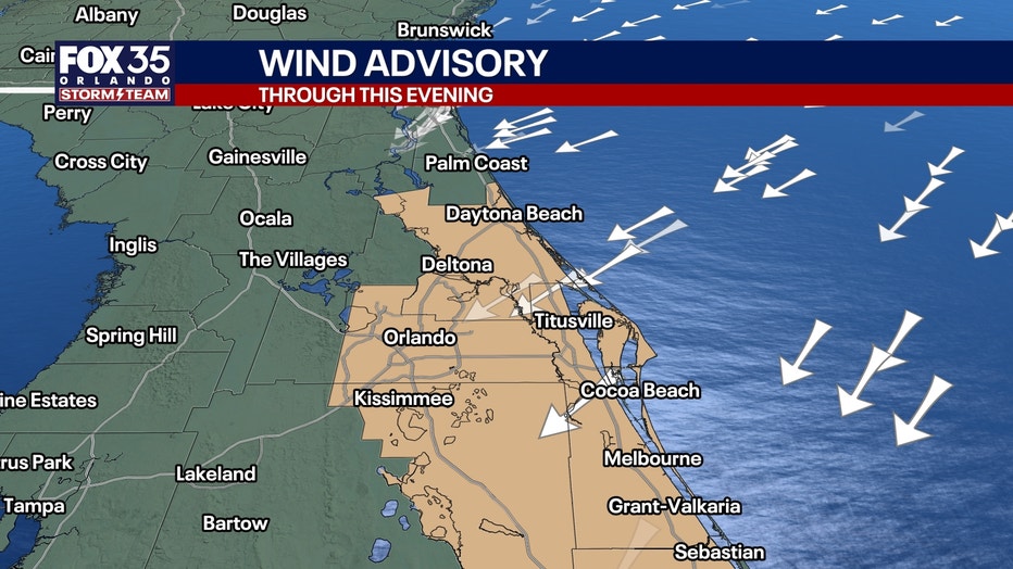
Farther south, scattered Atlantic showers will affect the Treasure Coast, where rain chances increase to 50-70%. A few heavier squalls could produce gusts of 35-45 mph.
Moisture will begin spreading northward again late today and tonight, increasing shower chances toward Cape Canaveral. Locally heavy rainfall will be possible along the Treasure Coast.
Highs near 80°. Overnight lows in the upper 60s northwest of I-4 and lower 70s elsewhere, with some middle 70s along the barrier islands.
Wednesday and Thursday: A fresh surge of Atlantic moisture will bring a more widespread opportunity for showers across Central Florida, including Orlando and inland communities.
Rain chances increase to around 50-70% across much of the region Wednesday, with isolated lightning storms possible.
Gusty northeast winds will continue, although the pressure gradient will gradually begin relaxing. Highs in the lower to middle 80s, with overnight lows in the upper 60s to lower 70s.
Coastal hazards through late week
A prolonged and significant coastal weather event continues along Florida's Atlantic beaches.
Strong northeast winds, pounding surf, persistent swells and astronomical high tides will combine to produce dangerous ocean conditions, moderate to major beach erosion and minor to moderate coastal flooding.
- Coastal flood warning: Minor to moderate saltwater flooding, particularly around morning high tides. Vulnerable beachfront and Intracoastal communities may experience flooding of low-lying roads, parking lots, docks and yards.
- High surf advisory: Breaking waves of 7-11 feet will continue pounding the beaches. Moderate to major erosion is possible, especially during high tides.
- Rip currents: A high risk of numerous, strong and life-threatening rip currents continues at all local beaches. Entering the ocean is strongly discouraged.
- Wind advisory: Northeast winds of 20-25 mph with frequent gusts of 35-40 mph across most of east central Florida today, excluding Lake County.
- Marine hazards: Gale Warnings will gradually transition to Small Craft Advisories later today and tonight. Dangerous seas will persist through at least late Thursday, with only slow improvement expected afterward.
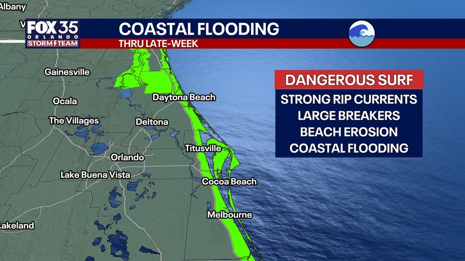
Beachgoers should stay out of the ocean, and recreational boaters should avoid heading offshore. Even as winds gradually diminish, dangerous surf, erosion, coastal flooding and hazardous boating conditions will continue through much of the week.
Friday into Halloween weekend
High pressure over the eastern United States will gradually weaken and shift offshore as another low-pressure system approaches.
This will allow northeast winds to slowly ease, although breezy onshore flow may continue through Saturday.
Rain chances should generally decrease from the wetter Wednesday-Thursday period, but some Atlantic showers will remain possible. Coastal and marine conditions will improve only gradually.
Highs remain in the lower to middle 80s, with overnight lows in the 60s to lower 70s, running above seasonal averages.
Halloween:
For trick-or-treating and Making Strides Against Breast Cancer events, the overall trend favors gradually improving weather compared to midweek. '
Breezy conditions and isolated showers remain possible, but confidence in the timing and coverage of any Saturday rain is still limited.
We'll continue refining the forecast as Halloween approaches.
Tracking the tropics
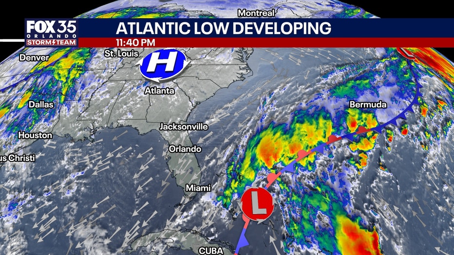
No tropical cyclone development is currently expected across the Atlantic, Caribbean or Gulf over the next seven days.
The weak low-pressure area near the Bahamas is contributing to the prolonged northeast wind pattern, but tropical development is not currently anticipated.
The Source: The information in this story was provided by the FOX 35 Storm Team.