

Orlando weather: Wet start to the weekend, beautiful weather ahead
Orlando Weather Forecast: Cold front brings rain, wind, more refreshing feel
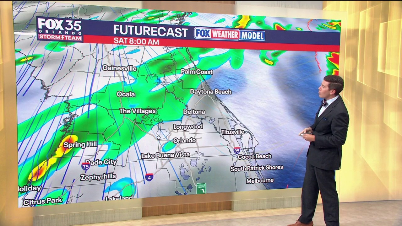
A storm system is moving in, bringing showers and storms as we kick-off the weekend. Meterologist T.J. Springer lets us know how long the rain sticks around and how cool our temps get behind this cold front.
ORLANDO, Fla. - The Storm Team is tracking a cold front that brings rain and eventually much more refreshing conditions. The wind has started to increase as well, making for a high rip current risk and rough boating conditions at area beaches.
FALL FRONT BRINGS RAIN TODAY, BEAUTIFUL DRYING TREND AHEAD
A fall cold front is sweeping across Central Florida today, bringing a damp start to the weekend before leading us into a much quieter pattern.
Rain chances sit around 60% today as the front pushes through, bringing scattered showers and a few storms. Overcast conditions prevail through the afternoon with a bit of clearing expected later in the evening.
Winds will turn out of the north and pick up noticeably, becoming blustery tonight into Sunday. That'll make for rough beach and boating conditions as gusts top out around 30–40 mph.
High Surf Advisories are in effect at all of our East Coast Beaches through early Tuesday AM. The silver lining? As high pressure builds in behind the boundary, rain chances drop off starting tomorrow, setting us up for a dry, sunny stretch through most of next week.
A few coastal showers are expected Sunday into Monday and a couple could make it into the Orlando Metro, but chances are only around 20%.
HAZARDOUS BEACH AND BOATING CONDITIONS THIS WEEKEND
Between the tightening pressure gradient behind our cold front and the nor'easter spinning off the Mid-Atlantic coast, winds will be cranking across Central Florida! Expect gusty breezy conditions inland, but the real impact will be felt along our east coast beaches and local waters.
A Small Craft Advisory is in effect with strong north-east winds sustained at 20–30 mph and gusts topping 35 mph.
A Gale Warning is in play out into the ocean. That's where wind gusts could rise to near 45 mph. Waves will build rapidly to 8–10 feet (occasionally higher offshore), making boating conditions extremely hazardous.
Along the coast, expect rough surf, large breaking waves, and a high risk of dangerous, life-threatening rip currents. Beachgoers and mariners should use extreme caution and consider staying out of the water through the weekend.
COOLER TEMPS AND NOTICEABLY LOWER HUMIDITY
This cold front will pull in some of the crispest, most fall-like air we've seen so far this season. High temperatures today will top out in the upper 70s and lower 80s, with afternoon temps actually falling slightly into the low to mid-70s behind the boundary.
Overnight lows tonight will drop into the mid-to-upper 60s, with even cooler temps in the upper 50s to lower 60s arriving for north-west communities (like Marion and Lake counties) and interior spots by early next week. Daytime highs through midweek will comfortably hold in the upper 70s to around 80° with low humidity.
TRACKING THE TROPICS
The Atlantic basin remains remarkably tranquil for mid-October. The National Hurricane Center expects no tropical cyclone formation across the Atlantic, Caribbean Sea, or Gulf over the next 7 days.
With high pressure firmly in control, there are zero tropical threats to Florida or the U.S. coast. The Storm Team will continue to keep a close eye on the basin.
The Source: This story was written based on information provided by FOX 35 meteorologist T.J. Springer on Octobre 17, 2026.