

Orlando weather: Drier, warmer conditions for Central Florida
Orlando AM Weather Forecast: Lower rain chances
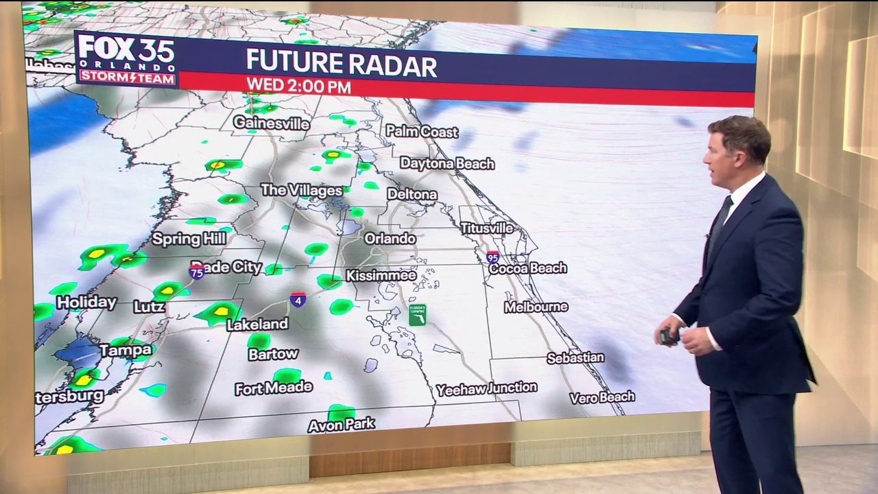
After starting the week with heavy rain, Central Florida is starting to dry out. Lower rain chances are expected for the rest of the week. FOX 35 Storm Team meteorologist Brooks Garner takes a look at the forecast.
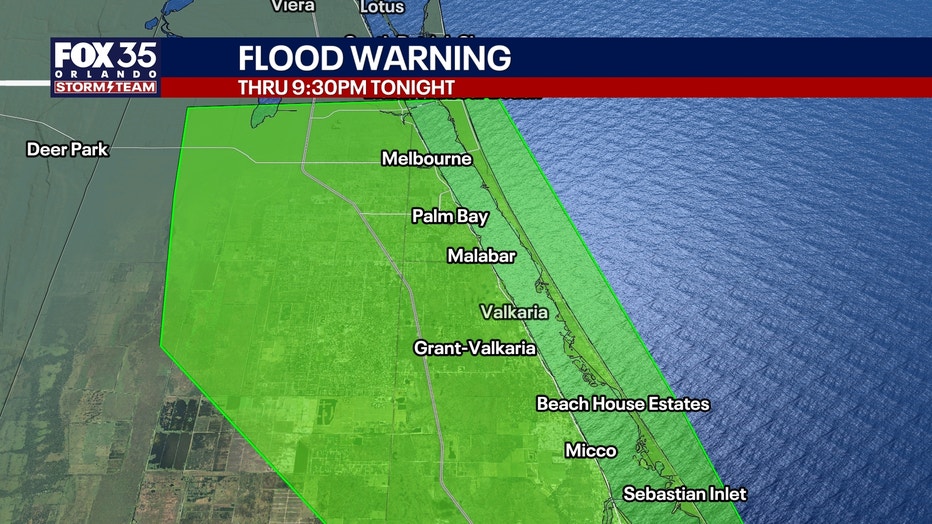
ORLANDO, Fla. - We are finally turning the corner after Monday's catastrophic flooding across southern Brevard County and the Treasure Coast.
High pressure building north of Florida will gradually bring drier conditions, although a lingering easterly breeze could still push a few Atlantic showers inland.
Rain chances are down to 20-30%, meaning most neighborhoods will stay dry today.
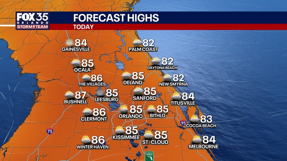
Expect more sunshine with highs reaching the middle 80s. Humidity remains elevated, with heat indices climbing into the upper 80s to near 90°.
More sunshine, very little rain
Thursday looks even better as drier air settles over Central Florida and easterly winds continue to relax. Rain chances drop to 10% or less, with most areas remaining completely dry.
Warmer temps:
Highs will again reach the middle 80s, several degrees above normal for early November. Friday looks similar, with warm temperatures, plenty of dry weather, and light winds.
Weak cold front brings change
What to expect:
A weak cold front is expected to move through Central Florida Saturday, but with very little moisture available, widespread rain is not anticipated.
Saturday will still be warm, with highs in the lower to middle 80s. Behind the front, slightly cooler and drier air filters into the region Sunday and early next week.
By Monday and Tuesday, afternoon highs should settle into the middle 70s to around 80°, with overnight lows potentially dipping into the upper 50s near and northwest of I-4. A welcome taste of fall after our recent stretch of muggy weather!
Dangerous conditions remain after flooding
While the widespread heavy rain has ended, areas devastated by Monday's historic flooding across southern Brevard County and the Treasure Coast continue to face dangerous conditions.
Flooded roads, drainage ditches, and low-lying areas may remain hazardous even as water levels recede. Never drive, walk, or wade through floodwater.
Roads and shoulders may be damaged or washed out beneath the surface. The improving weather will provide several much-needed dry days for recovery and cleanup.
Coastal hazards: High rip current risk
Beach and boating conditions are gradually improving, but the Atlantic remains dangerous. A HIGH risk of life-threatening rip currents continues at all Central Florida Atlantic beaches today, and entering the ocean is strongly discouraged.
Offshore seas of 4-6 feet today should subside to 3-5 feet Thursday as easterly winds decrease from 10-15 knots today to around 10 knots Thursday.
However, another round of long-period swells from developing low pressure south of Bermuda could arrive this weekend, creating renewed hazards near inlets despite relatively light winds.
Watching another possible weather system
Forecast confidence decreases early next week as the major models disagree on the evolution of a developing storm system across the Deep South.
The recently unreliable GFS suggests a stronger upper-level low could help generate Gulf low pressure and push another cold front through Florida Tuesday with rain. The more reliable European model is slower and weaker, keeping conditions dry longer.
For now, rain chances remain low at just 30% Monday and Tuesday, with more seasonable temperatures expected.
Tracking the tropics
Broad low pressure over the western Atlantic remains an area to monitor as we move deeper into November. There's a "medium" 40% chance of development in the next 7-days. Subtropical Storm Kyle could develop.
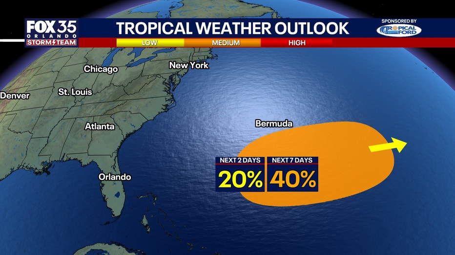
Regardless of whether this system acquires tropical or subtropical characteristics, it is expected to remain well away from Central Florida.
Its main potential influence locally will be renewed long-period Atlantic swells this weekend, which could prolong hazardous surf and boating conditions. The latest National Hurricane Center outlook will determine whether development probabilities need updating.
The Source: The information in this story was provided by the FOX 35 Storm Team.