

Nearly 25 inches of rain reported in Brevard County as historic rainfall floods Central Florida
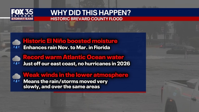
ORLANDO, Fla. - A slow-moving weather system dumped more than two feet of rain in parts of Brevard County over several days, triggering widespread flooding and flash flood emergencies across Central Florida and the Treasure Coast, according to preliminary National Weather Service reports.
Brevard County records highest rainfall totals
By the numbers:
The heaviest rainfall occurred Sunday, Nov. 1, and Monday, Nov. 2, with southern Brevard County bearing the brunt of the storm. Preliminary measurements released by the National Weather Service showed rainfall totals exceeding 20 inches in several communities, including Grant-Valkaria, Malabar and Palm Bay.
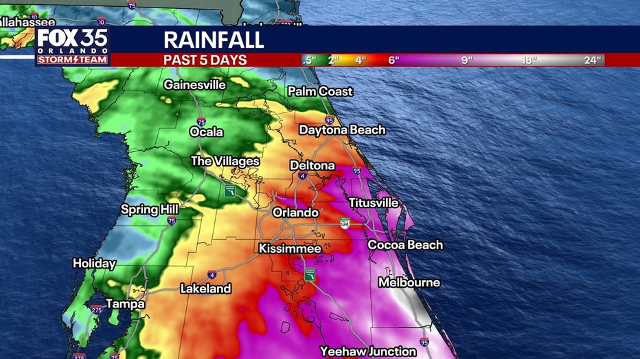
The National Weather Service in Melbourne described widespread flooding from the Melbourne area south to Grant-Valkaria, with rainfall estimates reaching 16 to 22 inches across southern Brevard County by Monday afternoon.
The rainfall event also contributed to prolonged flooding concerns along the St. Johns River, as runoff from the upper river basin continued moving northward.
Brevard County experienced the most significant rainfall in the region, with several reporting locations recording more than a foot of rain.
According to the National Weather Service's preliminary precipitation report issued Nov. 3, the highest totals included:
- Grant-Valkaria: 24.69 inches
- Malabar: 24.52 inches
- Palm Bay: 22 inches
- Melbourne Beach: 20.87 inches
- Melbourne: 13.70 inches
Additional rainfall reports showed significant accumulation throughout the county, including more than 16 inches near Indian Harbour Beach and Indialantic.
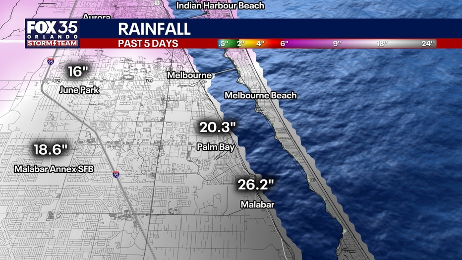
The measurements represent preliminary reports collected from automated gauges, weather networks and volunteer observers. Totals varied by reporting location and observation time.
Heavy rainfall spreads across neighboring counties
Although Brevard County experienced the heaviest rainfall, surrounding communities also received substantial amounts.
Preliminary National Weather Service measurements for the storm period included:
Indian River County
- Sebastian Inlet: 14.48 inches
- Vero Beach South: 14.27 inches
- Pine Tree Park: 13.16 inches
- Roseland: 13.05 inches
- Wabasso: 9.67 inches
Seminole County
- Lake Harney: 8.53 inches
- Oviedo: 7.69 inches
- Chuluota: 7.47 inches
- Geneva: 7.01 inches
- Winter Springs: 6.53 inches
Orange County
- Eatonville: 7.73 inches
- Azalea Park: 6.88 inches
- Fairvilla: 6.12 inches
- Orlando Executive Airport area: 6.09 inches
Lake County
- Clermont: 6.83 inches
Osceola County
- Lake Marian area: 6.66 inches
- Alligator Lake area: 6.45 inches
- Kenansville: 6.42 inches
The National Weather Service also reported significant rainfall in St. Lucie County, where one location west of the Port St. Lucie River recorded 16.70 inches.
Flash flood emergencies issued as water overwhelmed communities
Big picture view:
As rainfall intensified Monday, the National Weather Service issued multiple flash flood warnings for Brevard and Indian River counties.
At one point Monday morning, the agency issued a flash flood emergency for West Melbourne, Palm Bay and Grant-Valkaria, reporting that 15 to 20 inches of rain had fallen in the affected area, with additional rainfall possible.
The warnings described life-threatening flash flooding affecting roads, highways, underpasses, urban areas and locations with poor drainage.
Forecasters urged residents to avoid flooded roadways, warning that driving through floodwater can be deadly.
St. Johns River flooding expected to continue
The impact of the rainfall has extended beyond immediate street and neighborhood flooding.
The National Weather Service reported that excessive rainfall in the upper St. Johns River basin was sending a considerable volume of water north through the river system, creating a prolonged flooding event.
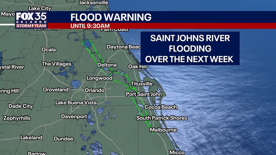
As of Thursday, Nov. 5, flood warnings remained in effect at multiple river forecast locations, including Cocoa, Geneva, Sanford, DeLand and Astor.
Forecasters warned that river levels would continue rising over the following days, with some locations expected to reach moderate or major flood stage before conditions improve.
Near DeLand, the river reached 4 feet Thursday afternoon, its established flood stage, with a forecast rise to approximately 4.6 feet early next week.
Near Cocoa, approximately nine miles west of the city, the river was measured at 16.9 feet on Thursday morning, with major flooding forecast.
Drier weather expected, but flooding risks remain
What's next:
Despite the extensive rainfall, additional significant precipitation was not expected across most of the region in the immediate days following the storm.
The National Weather Service said rain chances would remain relatively low, generally between 10% and 20% over the next several days.
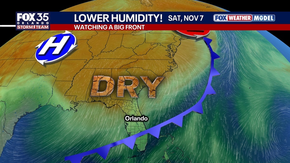
Reduced rainfall does not mean flooding will end immediately. Water levels along the St. Johns River are expected to remain elevated as runoff continues moving through the basin.
The NWS urged residents in flood-affected communities to avoid flooded roads and never walk or wade through floodwater.
Updated river forecasts and weather statements are available through the National Weather Service and the National Oceanic and Atmospheric Administration's National Water Prediction Service at water.noaa.gov.
The Source: This story was written based on National Weather Service gauge readings and forecasts on Nov. 5, 2026.