

Orlando weather: Cooler temps, lower humidity in Central Florida this week
Orlando AM Weather Forecast: Some showers across Central Florida
A fall-like week in store for Central Florida. Temperatures and rain chances will be a little below normal all week. FOX 35 Storm Team Meteorologist Brooks Garner takes a look at the forecast.
ORLANDO, Fla. - We're looking forward to a true fall week across Central Florida!
Temperatures will stay a little below normal, humidity remains comfortable, and rain chances will be below normal all week.
However, strong northeast winds will make for dangerous beach and boating conditions, with another potentially windy stretch arriving this weekend.
Breezy Monday - Dangerous surf
A strong low pressure system off the Carolina coast, combined with high pressure to our north, will keep northeast winds gusty today.
Expect sustained winds of 15–20 mph inland and 20–25 mph along the coast, with gusts reaching 25–35 mph, especially near the beaches.
These winds will also push scattered, fast-moving Atlantic showers onshore throughout the day. Rain chances are around 20–35%, but showers should move through quickly. Most rain should end before afternoon.
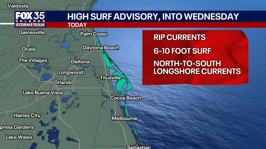
Beach danger: Large breaking waves of 6–10 feet, life-threatening rip currents and possible beach erosion will make swimming extremely dangerous. A High Surf Advisory remains in effect through early Wednesday. Officials urge vacationers to stay out of the ocean.
Cooler temperatures, lower humidity
Despite the gusty winds, temperatures will feel noticeably more comfortable this week.
Slightly below normal temps:
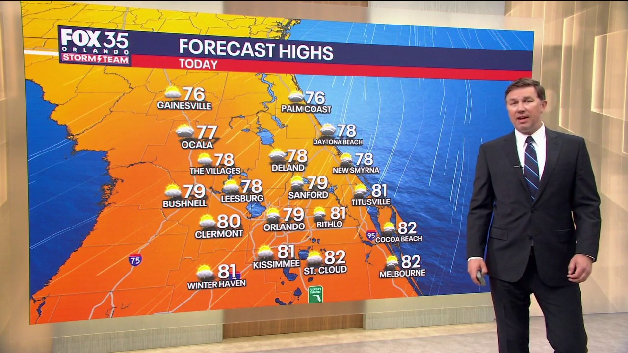
Highs today will range from the upper 70s north of Orlando to the lower 80s across much of Central Florida.
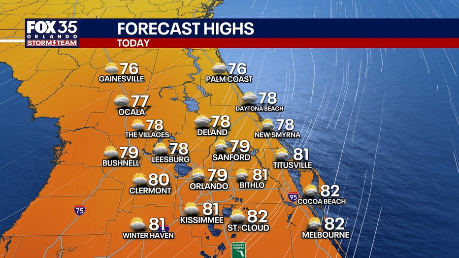
Today: Orlando reaches around 81° today, with an overnight low near 63°. Some inland communities could dip into the upper 50s tonight!
Tuesday and Wednesday: Dry, with comfortable fall weather. Highs in the upper 70s to around 80°, with overnight lows in the 60s inland and upper 60s to near 70° along the coast. Winds will remain breezy through midweek, especially near the beaches, although not quite as strong as today.
Tracking the tropics – Subtropical storm possible
The National Hurricane Center is monitoring a powerful non-tropical low pressure system sitting over the warm Gulf Stream, several hundred miles off the Southeast coast. Interestingly, this system already has storm-force winds (55+MPH) , but it isn't considered tropical or subtropical yet because of how it gets its energy.
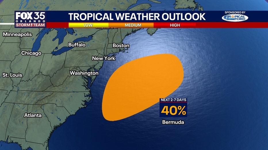
If it develops subtropical characteristics later this week, it could become Subtropical Storm Josephine, the 10th named storm of the season.
- Next 48 hours: Near 0% chance of development.
- Next 7 days: 40% chance of development.
The system is expected to drift slowly before eventually moving northeastward into the open Atlantic. No direct tropical impacts are expected in Florida, but the larger weather pattern is already contributing to dangerous surf, strong winds and coastal flooding along portions of the East Coast.
Another windy, rainy weekend
Weather changes:
Our stretch of drier weather may not last into the weekend.
Another area of low pressure could develop near the Bahamas and Florida Straits as high pressure strengthens to our north.
We'd see another round of strong northeast winds, dangerous surf and increasing rain chances beginning Friday night.
Rain chances may climb to 40% this weekend, especially from Cape Canaveral southward.
Temperatures will remain seasonably comfortable, with highs in the upper 70s and lower 80s.
The Source: The information in this story was provided by the FOX 35 Storm Team.